|
|
Featured Products |
|

Click on image for more information |
|
Search our Site |
|
|
|
 |
|
|
|
|
|
|
|
GeoMart
516 Villanova Court
Ft Collins, CO 80525
800-248-6277
800-321-6277 Fax |
| |
|
Back Roads Explorer 3D

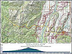 |
Take the road less
traveled with our CD-ROM set, and span the terrain
stretching from the Atlantic to the Pacific Ocean.
Functioning as a digital road atlas of the U.S. that
allows you to zoom in on regions of interest, it is
created from nationwide seamless, USGS topographic maps
with an up-to-date overlay of streets and roads. Search
for more than a million points of interest, and
customize and print photo-quality maps. Plus, now you
can view any map in 3-D or do a 3-D fly-through.
- GPS-compatible with Garmin, Magellan,
Lowrance, and Eagle
- 1:100,000 scale (1:250,000 in Hawaii
and Alaska)
For 1:24,000-scale maps, see the
TOPO! State Series.
- 18 CD-ROMs
- PC and Mac compatible
|
|
Create your own waterproof maps on
Adventure Paper
(sold separately).
|
|
|
|
|
|

