|
NOAA
Nautical Charts
 The Navigational Chart is one of the most fundamental tools available to the mariner. In the very early days of the
United States, commerce between the states was mostly waterborne
and foreign trade, necessary for survival and expansion of our
national economy, was entirely by sea. This still holds true
today with over 98% of the nation's cargo carried by waterborne
transportation -- a good portion consisting of hazardous cargo
posing a continuous threat to the environment. The Navigational Chart is one of the most fundamental tools available to the mariner. In the very early days of the
United States, commerce between the states was mostly waterborne
and foreign trade, necessary for survival and expansion of our
national economy, was entirely by sea. This still holds true
today with over 98% of the nation's cargo carried by waterborne
transportation -- a good portion consisting of hazardous cargo
posing a continuous threat to the environment.
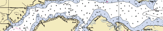
What is a Nautical Chart? A Nautical Chart is a graphic
portrayal of the marine environment. In addition to providing
the most *basic elements (a schematic layout of a Coast Survey
chart), a chart is a working document used by the mariner both
as a "road map" and worksheet and is essential for safe
navigation. In conjunction with supplemental navigational aids,
it is used to lay out courses and navigate ships by the shortest
and most economically safe route. A chart shows the nature and
form of the coast, the depths of the water and general character
and configuration of the sea bottom, locations of dangers to
navigation, the rise and fall of the tides, locations of
man-made aids to navigation, and the characteristics of the
Earth's magnetism.
|