|
Digital Raster Graphics - DRG

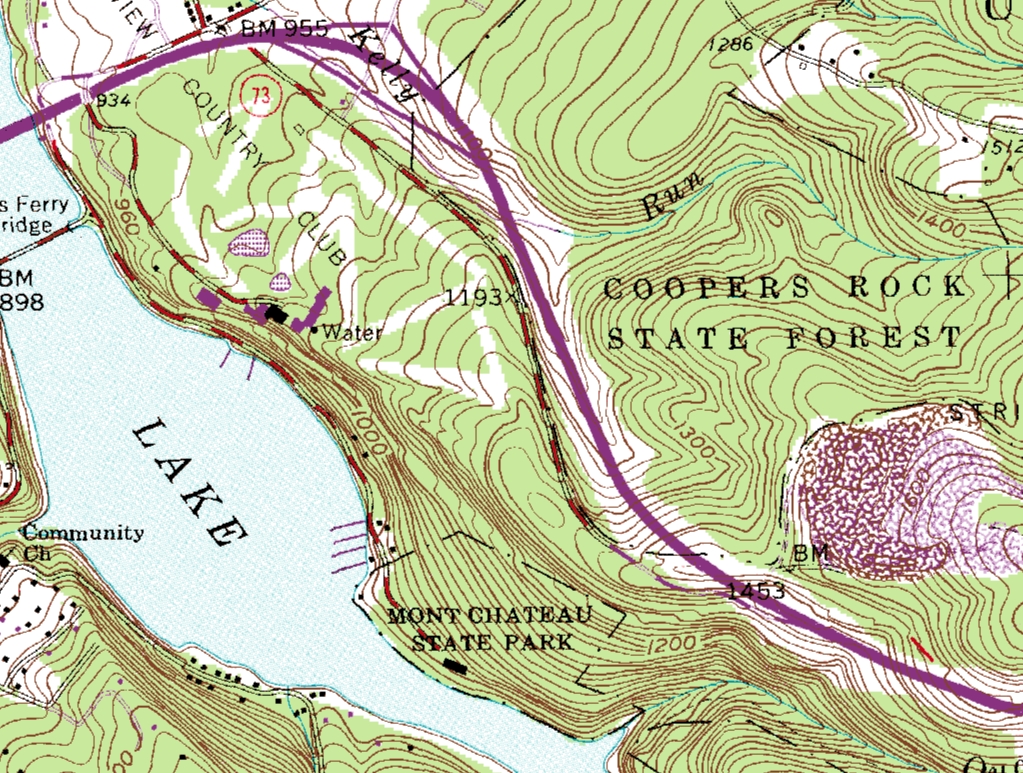
A digital raster graphic (DRG) is a scanned
image of a U.S. Geological Survey (USGS) topographic map. The
scanned image includes all map collar information or can be
ordered "clipped" without the collar information. The image
inside the map neatline is georeferenced to the surface of the
Earth.
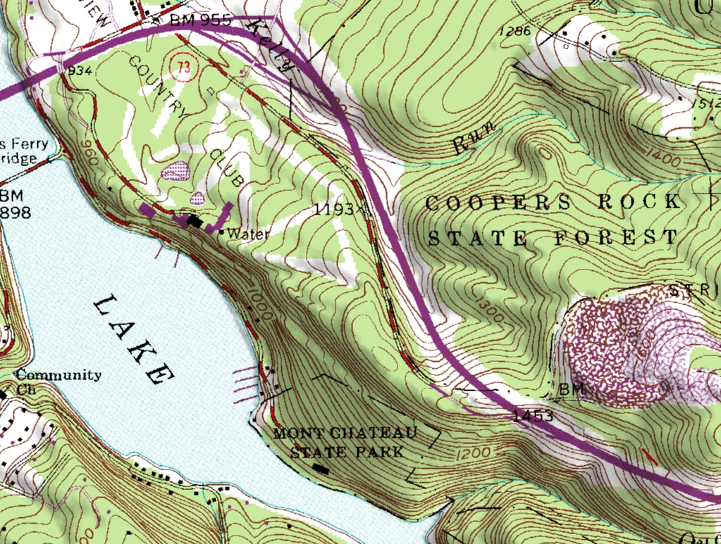
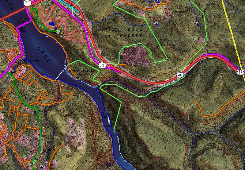
DRGs are useful as backdrops onto which other digital data can be
overlaid. At the USGS, DRGs are used for collecting and validating
vector data. The DRG can help assess the completeness of digital data from
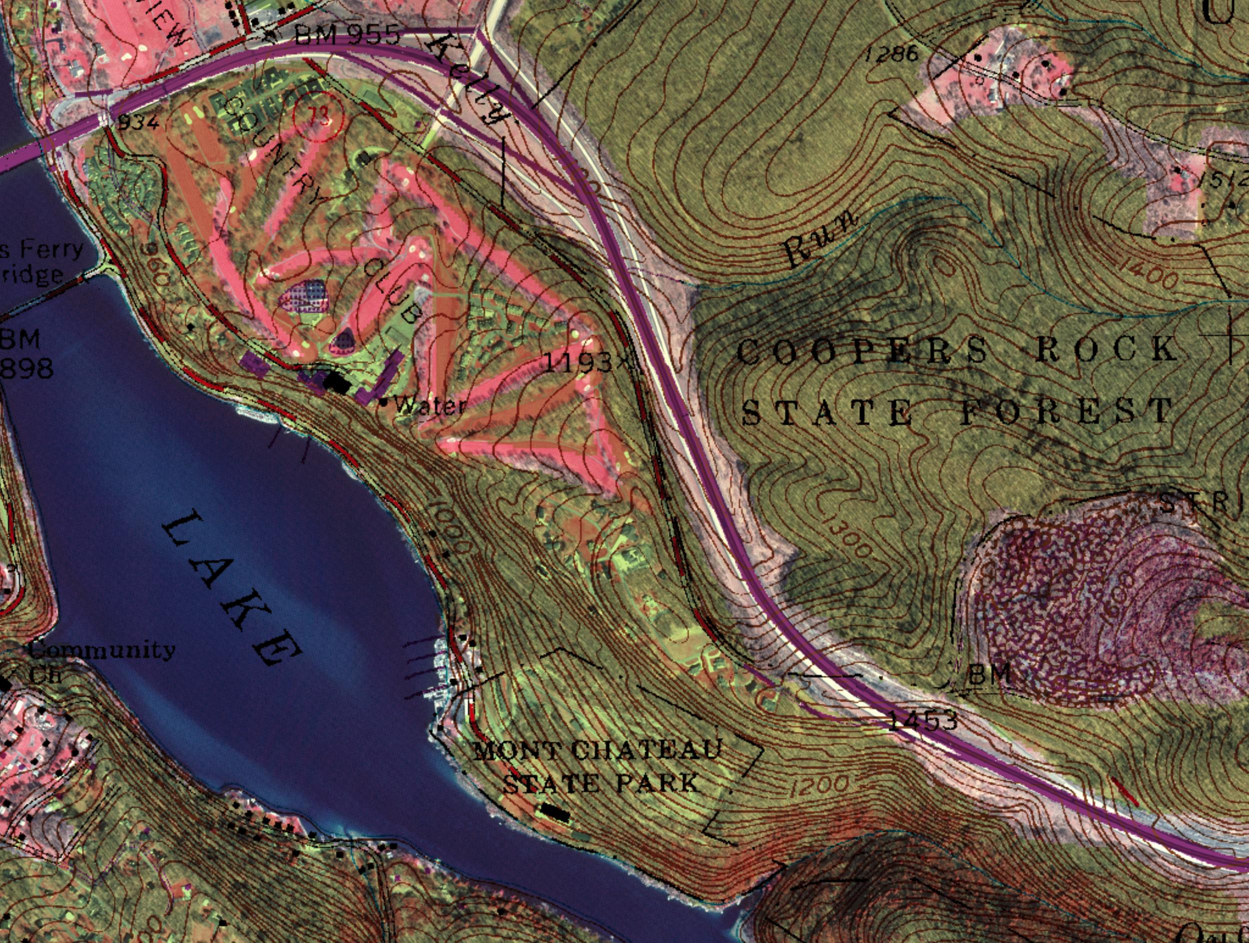
other mapping agencies. It can also be used to produce "hybrid"
products. These include combined DRGs and DOQs for revising and
collecting digital data and combined DRGs and digital elevation
models for creating shaded-relief maps.
See samples.
|
Specifications
Most USGS 7.5-minute DRGs produced between 1995 and 1998 have the
following specifications:
- The source material for a DRG is a USGS topographic paper map.
- USGS DRGs are in TIFF 6.0 format, with GeoTIFF 0.2 or 1.0
extensions to define georeferencing.
- The map is scanned at a minimum resolution of 250 dots per
inch (dpi). If scanned at a finer resolution, the image is
resampled to 250 dpi.
- The digital image is georeferenced to the true ground
coordinates of the 2.5-minute grid ticks and projected to the
Universal Transverse Mercator (UTM) for projection consistency
with USGS digital orthophoto quadrangles (DOQ) and digital line
graphs (DLG).
- Color values are standard between DRG quadrangles. The USGS
uses up to 13 colors on each DRG. The image is an 8-bit
palette-color image in a compressed TIFF file.
- The digital image is accompanied by a metadata file that
complies with the Federal Geographic Data committee's "Content
Standards for Digital Geospatial Metadata" (June 8, 1994).
To be consistent with other USGS digital data, the image is cast
on the UTM projection. The digital image will, therefore, usually
not be consistent with the credit note on the image collar. Only the
area inside the map standard cell boundary is georeferenced. Minor
distortion of the text may occur in the map collar. Overedge areas
and inset maps are not georeferenced.
In most cases, the datum of the source map is preserved in the
DRG. That is, if a map is published on the 1927 North American
Datum, the DRG is also on this datum.
The horizontal positional accuracy of a DRG is approximately the
same as the accuracy of the published source map. The DRG
georeferencing process removes errors caused by material stretching
and shrinking, but human pointing mistakes may introduce other small
errors. In most cases, errors in the DRG are small compared with
sources of error in the original map graphic.
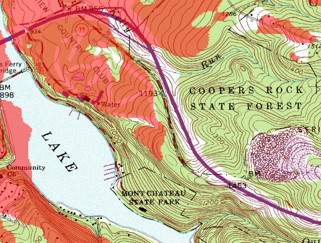
A USGS DRG has a standard color palette of 13 colors, intended to
model the line-drawing nature of the source graphic. The colors are
indexed according to the TIFF standard, with the additional
requirement that the TIFF color look-up table be exactly the same
for every DRG. The colors are always indexed in the same order, with
the same red-green-blue values. Variations in paper map colors
caused by different brands of ink, different printing presses, the
age of the map, and other factors lead to misclassification of pixel
colors in the DRG. Most DRGs made by scanning paper maps contain
significant amounts of color noise, especially in areas filled by
lithographic screen tints.
|