|
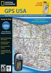
GPS USA
The software of choice for those who want an easy-to-use GPS
waypoint manager and trip planning tool without all of the
detailed maps included in the TOPO! State Series and Back Roads
Explorer software. GPS USA includes three levels of overview
atlas-level maps for the entire U.S.
Features:
* Seamless atlas maps for the entire U.S.
* GPS users can upload and download waypoints and routes
* Unlimited waypoint storage
* GPS Route Wizard
* Elevation profiling - draw a route and TOPO! generates a chart
showing distance and elevation
* Enhanced shaded relief that can be toggled on or off
* Add your own notes, symbols, photos, and web links to the maps
* Select the exact area you need and print in landscape or
portrait on any inkjet, laser printer, or plotter
* Choose from lat/lon or UTM grids
* Use the USA Place Finder to search over 1 million campsites,
lakes, summits, and campgrounds
Available for Windows & Mac operating systems.
System Requirements
Windows: 95, 98, ME, 2000, XP, NT 4.0 and higher. Works
with all color and black & white printers supported by these
operating systems.
Macintosh: OS 9.0 or above, or OS 10.2 or above. Works
with all color and black & white printers supported by Mac OS 9
or Mac OS 10.
|


