|
Wall Maps
- State, County & Cities - Arkansas
GeoMart
is rapidly expanding its on-line selection of wall maps. If you
don't find what you are looking for here, please give us a call at
800-248-6277. One of our customer service representative will be
happy to assist you in finding the right map for you.
Most Maps Usually Ship within 48 hours.
Laminated maps with the option of hanging
rails usually ship in 5 days
 |
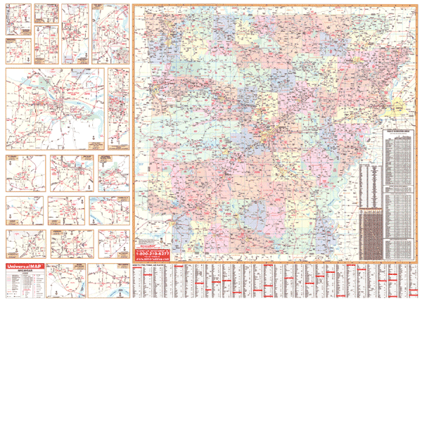
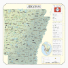
ARKANSAS WALL MAP
2004
2nd edition The Arkansas Wall Map by Universal Map measures 50" x 66". Laminated for durability with a markable surface, it is indexed provides color coded counties. Inset maps cover Blytheville, Camden, Conway, El Dorado, Fayetteville, Fort Smith, Helena, Hot Springs, Jacksonville, Jonesboro, Little Rock, Paragould, Pine Bluff, Rogers, Russellville, Springdale, Texarkana, and West Memphis. Other features shown are all state and federal highways, major waterways, state universities, military installations, airports, hospitals, state and national parks, points of interest, cities and towns complete with populations, wildlife areas, and rest areas. Framing rails are included on top and bottom for easy wall mounting. | |
 |
Raven Arkansas Map
From the forested valleys and hills of the
spectacular Ozark Plateau through the Arkansas Valley with its
exquisite river, to the lowlands along the Mississippi, this map
reflects the diverse beauty of the state. Elevations are
represented by color, and this, in combination with our relief
shading technique, gives the map a 3-dimensional look.
Raven Arkansas Map Dimensions: 38" x
42" (approx.)
Raven Arkansas Map Scale: 1:500,000 or 1" equals about 8 miles |
|
 |
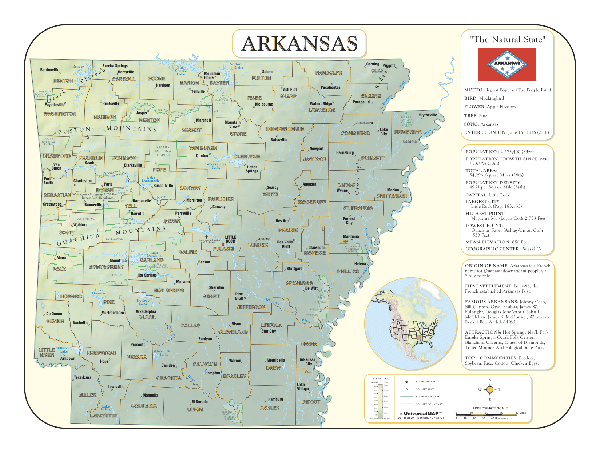
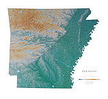
ARKANSAS SHADED RELIEF MAP
The Arkansas Shaded Relief Wall Map by Universal Map is a full-color, topographical wall map. Statistical information on this map includes historical, anecdotal, and geographical. There is also an elevation scale measured in meters and feet and a distance scale measured in miles and kilometers. Identifies county boundaries. Shows state flag. Lists state motto, bird, flower, and tree, plus total area, population and origin of name. Its heavy laminated surface can be used with
water based pens.
45"x36" |
Click Price to Add to Cart | | Laminated |
$31.95 |
|
 |
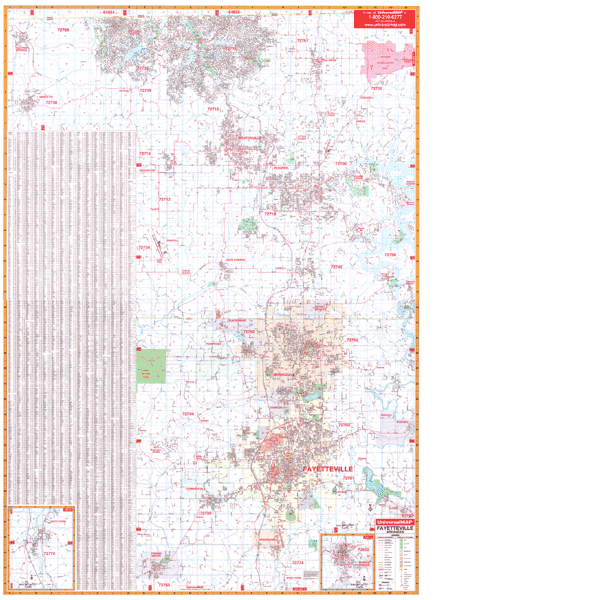
FAYETTEVILLE/BENTONVILLE WALL MAP
2008
2nd edition The Fayetteville and Bentonville, AR Wall Map by Universal Map measures 54" W x 77" H. Providing complete street detail with up-to-date cartography, this full-color map features a laminated finish which is both markable and washable. Streets are indexed on the face of the map. The area of coverage ranges North to the Missouri State line; South to include
Prairie Grove and Greenland; East to include the Pea Ridge National Military Park; and West to include Gravette and Centerton. Also included are insets of Eureka Springs and West Fork. Points of interest include water features, government buildings, airports, golf courses and country clubs, railroads, longitude and latitude lines, zip codes and zip code boundaries, shopping centers, recreational parks, mileage circles, cemeteries, educational facilities, hospitals, post offices, city limits and annexations, fire and police stations, section/township/range lines, mileage circles, longitude and latitude lines, and miscellaneous points of interest. Framing rails are included on top and bottom for easy wall mounting. | |
 |
LITTLE ROCK WALL MAP
2008
4th edition The Little Rock, AR Wall Map by Universal Map measures 60" W x 70" H and provides complete street detail, including up-to-date cartography. The map is printed in color with a markable, washable, laminated surface. Streets are indexed in a separate book. Coverage ranges North to the Faulkner County line, including Little Rock Air Force Base; South to include Woodson and Sardis; East to the Lonoke County line; West to include Pinnacle Mountain State Park and the town of Bryant. Details provided include airports, cemeteries, hospitals, railroads, post offices, all streets and highways, shopping centers, water features, recreational parks, mileage circles, city limits and annexations, government buildings, fire and police stations, educational facilities, golf courses and country clubs, zip codes and boundaries, section/twp/range lines, and points of interest. Framing rails are included on top and bottom for easy wall mounting. | |
"
|