|
Wall Maps
- State, County & Cities - Arizona
GeoMart
is rapidly expanding its on-line selection of wall maps. If you
don't find what you are looking for here, please give us a call at
800-248-6277. One of our customer service representative will be
happy to assist you in finding the right map for you.
Most Maps Usually Ship within 48 hours.
Laminated maps with the option of hanging
rails usually ship in 5 days
"
'
 |
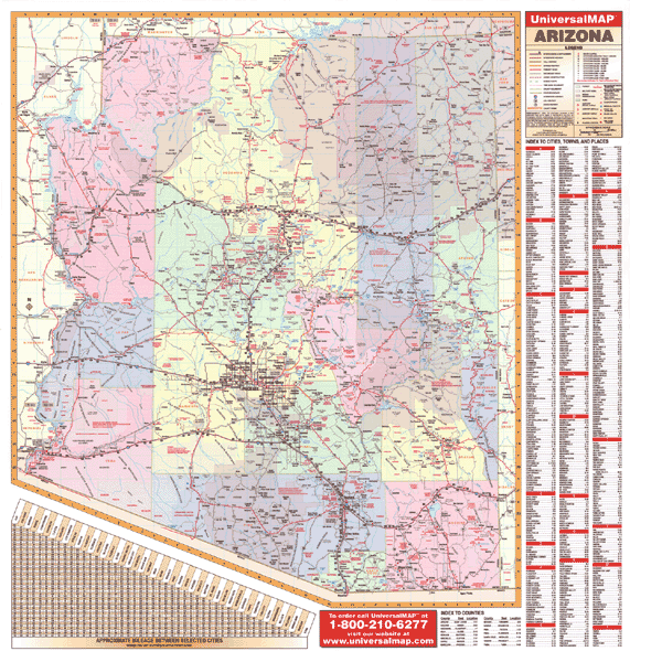
ARIZONA WALL MAP
2006 3rd edition
This Arizona Wall Map by Universal Map measures 54" x 56" and includes all
state/federal highways, major waterways, towns, military installations, major
airports, state universities, points of interest, cities, state parks, and
wildlife areas. Other features include color coded counties and a mileage chart
between major cities. Provides up-to-date cartography. Printed in color with a
markable/washable/laminated surface. Indexed on the face of the map. Contains
hanging rails. Protected with durable, markable surface. Framing rails on
top and bottom for convenient mounting available. | |
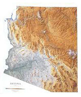 |
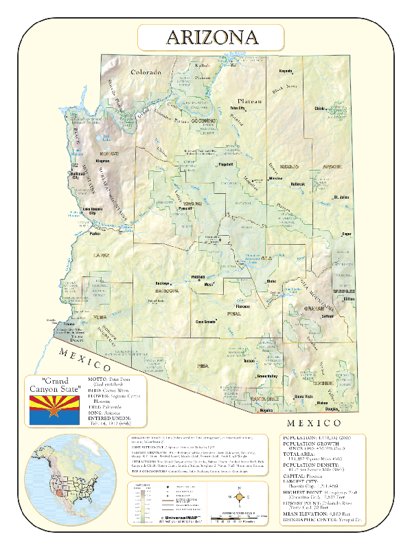
Raven Arizona Map
The Grand Canyon, Petrified Forest, Painted
Desert, and Monument Valley are all part of the spectacular
Colorado Plateau in the north. Rugged mountain ranges run along
just south of the plateau, and a series of fertile valleys lie
between mountain ranges like Santa Catalina, Superstition,
Chiricahua, and Gila. Elevations are represented by color, and
this, in combination with our relief shading technique, gives
the map a 3-dimensional look.
Raven Arizona Map Dimensions: 42" x 51" (approx.)
Raven Arizona Map Scale: 1:550,000 or 1" equals about 8 1/2
miles |
|
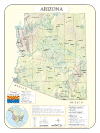 |
ARIZONA SHADED RELIEF MAP
The Arizona Shaded Relief Wall Map by Universal Map measures 36" x 48" and is a full-color, topographical wall map. Statistical information on this map includes historical, anecdotal, and geographical. There is also an elevation scale measured in meters and feet and a distance scale measured in miles and kilometers. Identifies county boundaries. Shows state flag. Lists state motto, bird, flower, and tree, plus total area, population and origin of name. Its heavy laminated surface can be used with waterbased pens. |
Click Price to Add to Cart | | Laminated |
$31.95 |
|
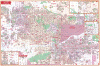 |
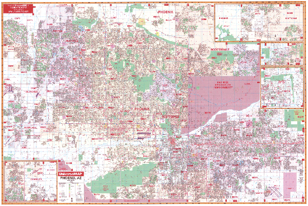
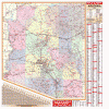
PHOENIX WALL MAP
2008 2nd edition The Phoenix, AZ Wall Map by Universal Map measures 77" W x 54" H. The map is markable and washable and printed in color. This map offers complete street detail and up-to-date-cartography with new streets and changes. Streets are indexed in a separate book. This map's area of coverage ranges North to include all of Scottsdale; South to include Chandler and Sun Lakes; East to the Maricopa-Pinal County line; and West to include Litchfield Park and Phoenix goodyear Airport. There are inset maps of Apache Junction and Carefree. The special features and data contained on this map are as follows: all streets and highways, government buildings, airports, golf courses and country clubs, railroads, zip codes and zip code boundaries, shopping centers, water features, recreational parks, cemeteries, educational facilities, hospitals, post offices, city limits and annexations, mileage circles, section/township/range lines, fire and police stations, and miscellaneous points of interest. Framing rails are
available on top and bottom for easy wall mounting. | |
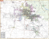 |
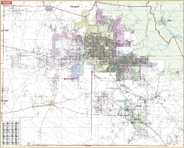
PHOENIX AREA WALL MAP
2006
2nd edition The Phoenix, AZ Vicinity Wall Map by Universal Map measures 66” W x 54” H, with up-to-date cartography at a scale of 1”=2.10 miles. Printed in color with a markable and washable laminated surface. Cities are indexed on the map’s face. Framing rails
are available on top and bottom to complete this quality reference. | |
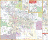 |
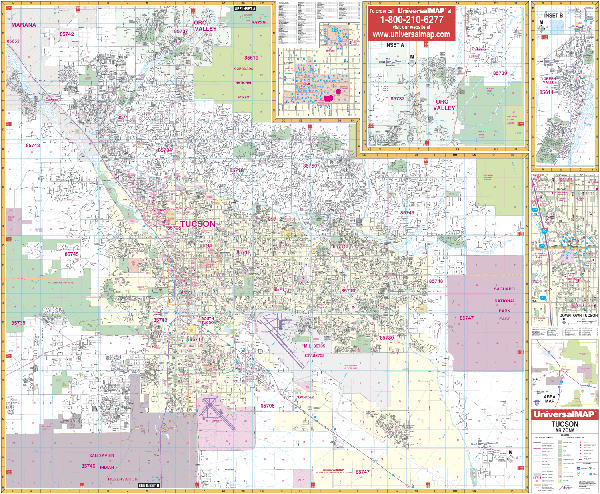
TUCSON WALL MAP
2008 4th edition The Tucson, AZ Wall Map by Universal Map measures 54" x 64" and has added approximately 750 new streets and changes. This commercial wall map shows all of Tucson, AZ in complete street detail with the boundaries as follows: North Cortaro & Oro Valley; South to San Xavier Indian Reservation and Arizona State Prison; East to Saguaro National Park (East); and West to Saguaro National Park (West). Map Insets include University of Arizona and continuation of Oro Valley to include Catalina to the Pima County Line. The special features and data contained on this map are as follows: all streets, all highways, educational institutions, government buildings, post offices, hospitals, zip codes and boundaries, shopping centers, airports, cemeteries, recreational parks, mobile home parks, golf and country clubs, points of interest, water features, mileage circles, longitude/latitude lines, subdivision names, section, township and range lines, railroads, city limits and annexations. Framing rails are
available on top and bottom for easy wall mounting. | |
|