|
Wall Maps
- State, County & Cities - Colorado
GeoMart
is rapidly expanding its on-line selection of wall maps. If you
don't find what you are looking for here, please give us a call at
800-248-6277. One of our customer service representative will be
happy to assist you in finding the right map for you.
Most Maps Usually Ship within 48 hours.
Laminated maps with the option of hanging
rails usually ship in 5 days
 |
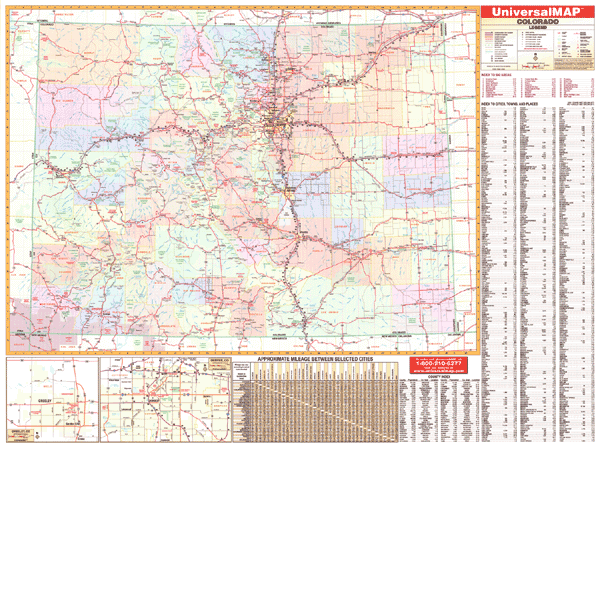
COLORADO WALL MAP
2005
3rd edition The
3rd edition of the Colorado Wall Map by Universal Map features color-coded counties. Details include all state/federal highways, secondary roads, major waterways, state universities, military installations, major airports, state/national parks, county populations, cities/towns, hospitals, wildlife areas, ski areas, and points of interest. The durable laminated surface protects the map, making it both markable and washable. Indexing is on the face of the wall map.
68"x50" | |
 |
Raven Colorado Map
Colorado extends from the Colorado Plateau
through the massive Rocky Mountains and out to the Great Plains
in the east. It also has 54 mountains which are at least
14,000'. Elevations are represented by color, and this, in
combination with our relief shading technique, gives the map a
3-dimensional appearance.
Raven Colorado Map Dimensions: 43" x
54" (approx.)
Raven Colorado Map Scale: 1:500,000 or 1" equals about 8 miles |
|
 |
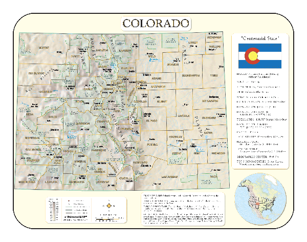
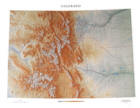
COLORADO SHADED RELIEF MAP
The Colorado Shaded Relief Wall Map by Universal Map is a full-color, topographical wall map. Statistical information on this map includes historical, anecdotal, and geographical. Identifies county boundaries. Shows state flag. Lists state motto, bird, flower, and tree, plus total area, population and origin of name. Its heavy laminated surface can be used with waterbased pens. This map measures
28" x 38". |
Click Price to Add to Cart | | Laminated |
$31.95 |
|
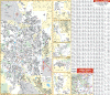 |
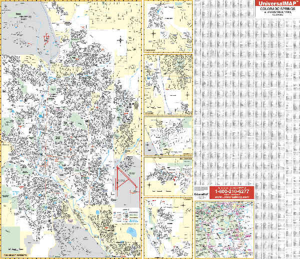
COLORADO SPRINGS WALL MAP
2006
2nd edition The Colorado Springs, CO Wall Map by Universal Map measures 60” x 54”. Covers North: to the Black Forest Park and Shoup Rd. South: includes Fort Carson: East: includes the city of Winterville and Preston Air Base. West: includes Garden of the Gods. Insets Fountain, Manitou Springs, Gleneagle, Monument, Palmer Lake. With complete street detail, this oversized reference offers up-to-date cartography in full color, and a markable and washable laminated surface that may be used with waterbased pens. Convenient framing rails are
available on top and bottom for easy wall mounting. The index appears on the face of the map. | |
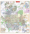 |
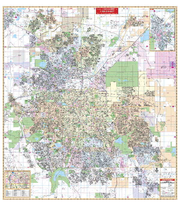
DENVER WALL MAP
2009
4th edition The Denver, CO Wall Map by Universal Map provides complete street detail, up-to-date cartography with new streets and changes. Protected by a laminated surface, the wall map markable and washable. Coverage: North: to the Weld Co. line, including the city of Boulder; So: to Lonetree and Parker in Douglas Co; East: to include all of Denver International Airport and E-470 Highway; West: to include the city of Golden. Includes inset of Downtown Denver. Framing rails
are available on top and bottom make wall mounting easy. A separate street index book is also included. | |
 |
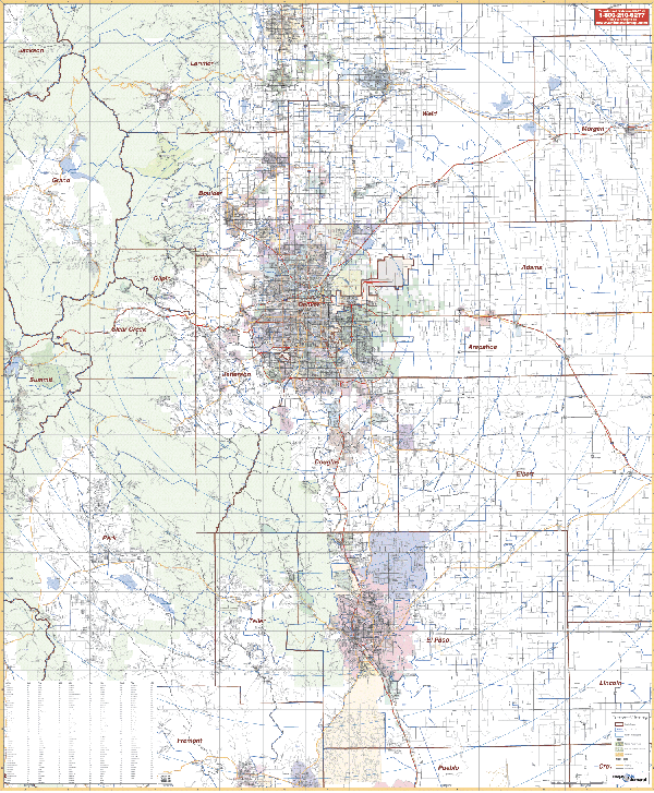
DENVER/VICINITY COLORADO WALL MAP
2005
2nd edition The Denver and Colorado Springs, CO Vicinity Wall Map includes portions of 20 counties and measures 54” x 66.” The area of coverage includes the counties of Adams, Teller, El Paso, Douglass, Denver, Jefferson, Arapahoe, Clear Creek, Gilpin and Boulder; and portions of Fremont, Jackson, grand, Morgan, Weld, Larimer, Park, Lincoln, and Pueblo Counties. Provides up-to-date cartography, printed in color with a markable/washable laminated surface. Hanging rails mounted top and bottom
are available; published by Universal Map. | |
 |
FT COLLINS/GREELEY WALL MAP
2001 1st edition Coverage for the Fort Collins and Greeley, CO Wall Map by Universal Map is divided into two sections. Coverage for Fort Collins ranges North to the Laporte and Trent Lake area; South to the Fossil Creek Reservoir; East to Interstate 25; and West to Hughes Stadium C.S.U. The area of coverage for Greeley ranges North to Cache La Paudre River; South to Southmoor Park; East to Fern Avenue; and West to the Boomerang Golf Course. Details include airports, cemeteries, hospitals, railroads, post offices, city limits and annexations, all streets and highways, shopping centers, water features,
recreational parks, zip codes and boundaries, government buildings, fire and police stations, educational facilities, golf courses and country clubs, and other points of interest. This map offers up-to-date cartography plotted in complete street detail. It is printed in color and is laminated making the surface both markable and washable. Indexing for this 60"" x 42"" map appears on its face; framing rails are
available on top and bottom for easy wall mounting. | |
|