|
Wall Maps
- State, County & Cities - Florida
GeoMart
is rapidly expanding its on-line selection of wall maps. If you
don't find what you are looking for here, please give us a call at
800-248-6277. One of our customer service representative will be
happy to assist you in finding the right map for you.
Most Maps Usually Ship within 48 hours.
Laminated maps with the option of hanging
rails usually ship in 5 days
 |
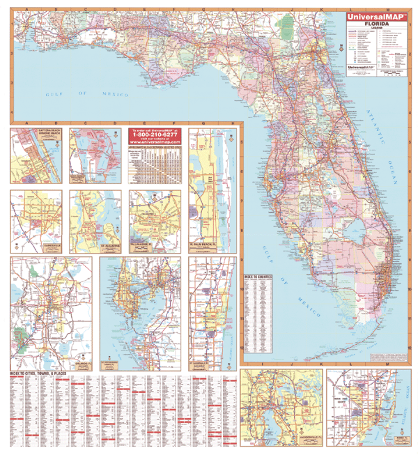
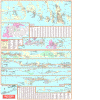
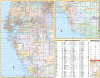
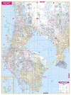
FLORIDA WALL MAP
2007 7th edition The
6th edition of the Florida Wall Map by Universal Map measures 54 x 60 and has cities and counties indexed on the face of the
map. Includes: Miami-Dade County and insets of major cities in more detail: Daytona Beach, St. Petersburg, Orlando, Tampa, Gainesville, Tallahassee, Jacksonville, Ft. Lauderdale, St. Augustine, Miami, and the Kennedy Space Center. Printed in color, the map also provides a markable and washable laminated surface, mileage chart, and places of interest. | |
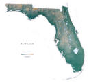 |
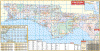
Raven Florida Map
The Florida Uplands, running through the
Panhandle in the northwest, give way to the meeting of the East
Gulf and Atlantic Coastal Plains. The subtle variations in the
elevation (the highest point in the state is 345') are shown in
shades of green. The Big Cypress Swamp, The Everglades, and The
Florida Keys mark this state as one of the most unique in the
nation. Elevations are represented by color, and this, in
combination with our relief shading technique, gives the map a
3-dimensional look.
Raven Florida Map Dimensions: 44" x
48" (approx.)
Raven Florida Map Scale: 1:700,000 or 1" equals about 11 miles |
|
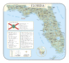 |
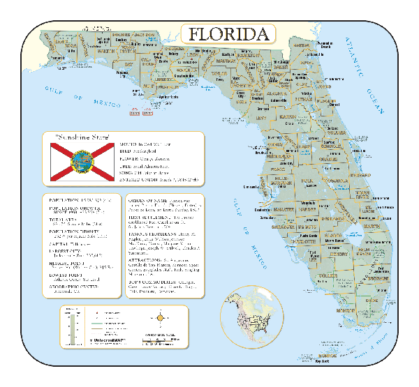
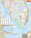
FLORIDA SHADED RELIEF MAP
2000 1st edition The Florida Shaded Relief Wall Map published by Universal Map measures 39 x 36 and is a full-color, topographical wall map. Statistical information on this map includes historical, anecdotal, and geographical. There is also an elevation scale measured in meters and feet and a distance scale measured in miles and kilometers. Identifies county boundaries. Shows state flag. Lists state motto, bird, flower, and tree, plus total area, population and origin of name. Its heavy laminated surface can be used with
water based pens. |
Click Price to Add to Cart | |
Laminated |
$31.95 |
|
 |
FLORIDA CENTRAL WALL MAP
2008 5th edition
This commercial Wall Map
published by Universal Map shows all of Central Florida which includes the
following counties: Brevard, Citrus, Flagler, Hernando, Hillsborough, Indian
River, Lake, Levy, Marion, Orange, Osceola, Pasco, Pinellas, Polk, Seminole,
Sumter, and Volusia.
Details are as follows: state and county roads, US Highways, Interstate
Highways, mileage circles, zip codes and boundaries, longitude and latitude
lines, new and old exit numbers, and an index on the face of the map.
A special feature is a hurricane charting map. Measures 54" H x 56" W and
contains up-to-date cartography with new streets and changes. The laminated
surface is both markable, washable and in color. Framing rails are included on
top and bottom for easy wall mounting. | |
 |
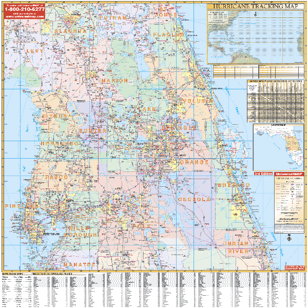
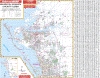
FLORIDA NORTHEAST WALL MAP
2006
3rd edition
The Florida Northeast Region Wall Map measures 60 W x 54 H and is protected by markable/washable laminated surface. Northeast FL: Alachua, Baker, Bradford, Clay, Columbia, Dixie, Duval, Flagler, Gilchrist, Hamilton, Jefferson, Lafayette, Leon, Levy, Madison, Marion, Nassau, Putnam, St. Johns, Suwannee, Taylor, Union, and portions of Volusia, Lake, Sumter, and Citrus. Includes map indexing, mileage chart, and hurricane tracking chart. Published by Universal Map.
Framing rails available | |
 |
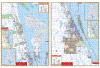
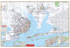
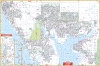
FLORIDA KEYS WALL MAP
2005
3rd edition Florida's St. Johns River North Wall Map illustrates the area from Jacksonville to Crescent Lake. It is excellent for fishing, boating, camping, hunting, and water sports. Featured are
zip codes, water depths, buoy markers,
channels, channel markers, marina facilities--including a complete marina index--bridge clearances, and helpful information. There are two distance scales--one is in nautical miles and the other is in feet.
64"x46" | |
 |
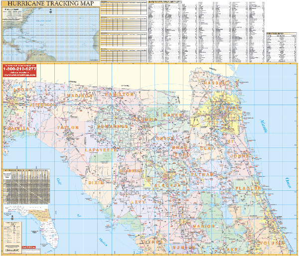
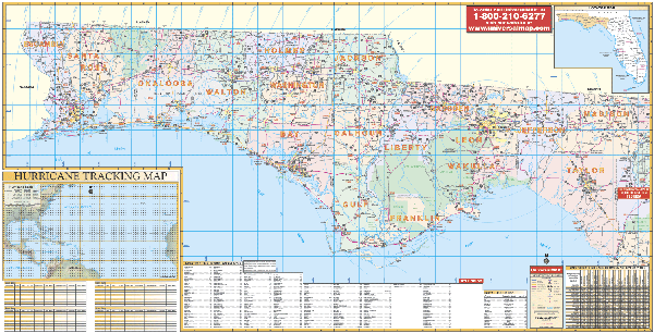
FLORIDA NORTHWEST WALL MAP
2006
3rd edition The Florida Northwest Region Wall Map published by Universal Map measures 66 x 35 and includes up-to-date cartography. Protected by a durable lamination, it can be used with waterbased pens. This commercial wall map shows all of Northwest Florida with the following counties: Escambia, Santa Rosa, Madison, Leon, Gadsen, Franklin, Holmes, Washington, Okaloosa, Taylor, Wakulla, Gulf, Liberty, Claxon, Bay, Walton, Jefferson, and Jackson. Other features provided include mileage circles, a mileage chart, zip codes, longitude and latitude lines, an index of cities and counties on the face of the map. A hurricane charting map is a special feature with this wall map.
Framing rails available on top and bottom for easy wall mounting. | |
 |
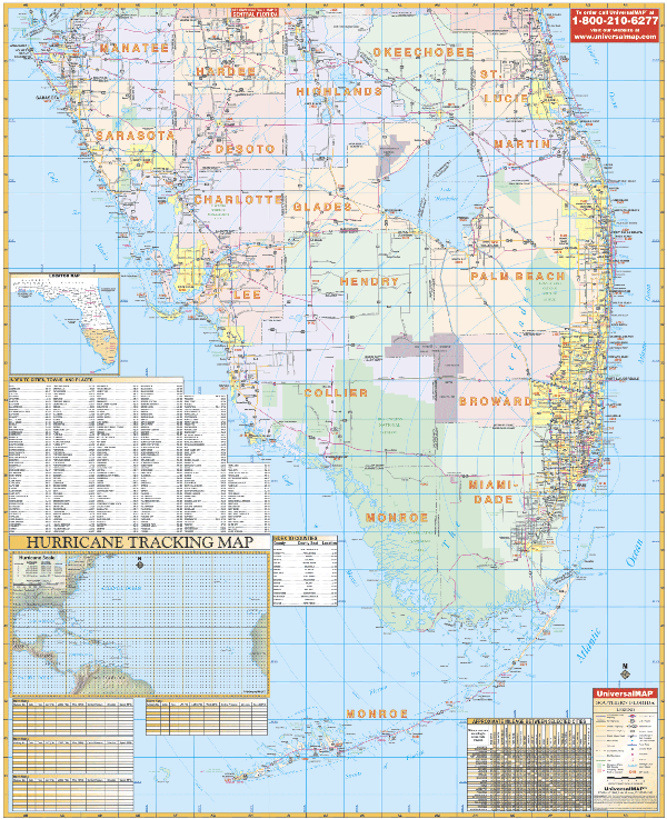
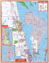
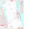
FLORIDA SOUTH REGION WALL MAP
2009
4th edition The Florida South Region Wall Map by Universal Map measures 68 x 54 and shows all of the counties in Southern Florida: Broward, Henry, Monroe, Charlotte, Highlands, Okeechobee, Collier, Lee, Palm Beach, Desoto, Manatee, Sarasota, Glades, Martin, St. Lucie, Hardee, and Miami/Dade. Additional features include mileage circles, longitude/latitude lines, mileage chart, zip code numbers, and an index on face of map, plus a special hurricane charting map. The full-color reference is protected with a durable laminate finish, which is both markable and washable.
Framing rails available on top and bottom for easy wall mounting. | |
 |
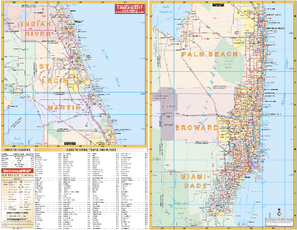
FLORIDA SOUTHEAST REGION WALL MAP
2006
2nd edition The Southeastern Florida Wall Map by Universal map measures 66” W x 53” H and provides up-to-date cartography at a scale of 1” = approx. 2.16 miles.
Framing rails available on top and bottom for easy wall mounting. Covers: Indian River, St. Lucie, Martin, Palm Beach, Broward, and Miami-Dade. Details include mileage circles, new and old exit numbers, long. and lat. lines, zip code nos and boundaries. Printed in color with a markable and washable laminated surface. Indexing on face of map. | |
 |
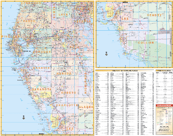
FLORIDA SOUTHWEST WALL MAP
2006
2nd edition Measuring 66” x 53”, The Florida Southwestern Region Wall Map offers a broader view than our city series. Cities and towns are indexed on the map's face. Universal Map wall maps offer full-color cartography, protected by a markable and washable laminated surface.
Framing rails available on top and bottom for easy wall mounting. Boundaries: North: to Brooksville in Hernando Co; South: to Marco Island, Collier Co; East: to Orlando in Orange Co., St. Cloud in Osceola Co., Sebring in Highlands Co., and La Belle in Hendry Co. West: to the Gulf of Mexico. | |
 |
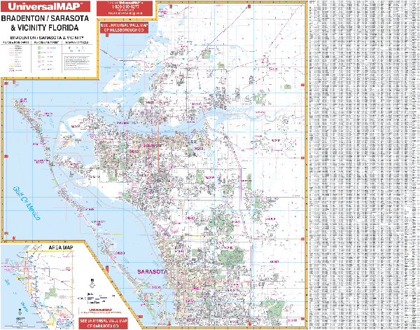
BRADENTON WALL MAP
2009 6th edition The Bradenton, Sarasota & Vicinity FL Area Wall Map by Universal Map measures 66 W x 54 H and provides complete street detail. The map uses up-to-date cartography with new streets and changes. This Wall Map is printed in color with a markable and washable laminated surface. Streets are indexed on the face of the map and in a separate book. The map includes most of Manatee County and ranges North to Hillsborough County; South to 1 mile south of SR 758 and Bee Ridge Rd. in Sarasota Co.; East to include Camp Flying Eagle and Lorraine; and West to the Gulf of Mexico, including Anna Maria, Bradenton Beach, and Longboat Key. Also included are government buildings, airports, golf courses and country clubs, railroads, zip codes and zip code boundaries, shopping centers, water features, recreational parks, cemeteries, educational facilities, hospitals, post offices, city limits and annexations, fire and police stations, mobile home parks, mileage circles, section/township/range lines, and miscellaneous points of interest.
Framing rails available on top and bottom for easy wall mounting. | |
 |
BREVARD COUNTY WALL MAP
2008 6th edition Measuring 76.50 W x 50 H, the Brevard County, FL Wall Map by Universal Map includes its own separate index book. The area of coverage: North-to the Volusia/Brevard Co. line; South-to the Indian River/Brevard Co. line; East-to the Atlantic Ocean; West- to the Orange/Brevard Co. line. Insets include Cape Canaveral Air Force Station and a vicinity area map. Has up-to-date cartography with new streets and changes and provides complete street detail. Printed in color with a laminated surface. | |
 |
BREVARD COUNTY NORTH WALL MAP
2008 6th edition Printed in color with a washable, markable, and laminated surface, this wall map of Northern Brevard County, FL by Universal Map provides up-to-date cartography with new streets and changes. This wall map measures 53 x 70 inches. Streets are indexed in a separate book. The area of coverage for this map runs North to the Volusia/Brevard County line; South to Rockledge and Cocoa Beach; East to the Atlantic Ocean; and West to the Volusia and Orange County lines. There are two insets for this map: Cape Canaveral Air Force Station and a vicinity map. Details on this map include all streets and highways, mileage circles, shopping centers, water features, recreational parks, section/range/township lines, government buildings, fire and police stations, educational facilities, golf courses and
country clubs, zip codes and boundaries, airports, post offices, hospitals, railroads, cemeteries, and latitude and longitude lines.
Framing rails available on top and bottom for easy wall mounting. | |
 |
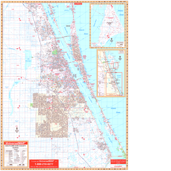
SOUTH BREVARD COUNTY WALL MAP
2008 6th edition The Southern Brevard County, FL Wall Map by Universal Map features up-to-date cartography with new streets and changes. This color map with markable and washable lamination presents complete street detail and measures 53 x 70 inches. This map is printed in color with a markable and washable laminated surface. Streets are indexed in a separate book. This map's area of coverage ranges North: to Rockledge; Cocoa Beach; South to Indian River/Brevard County line; East to the Atlantic Ocean; West to approximately 1 1/2 miles before the Osceola County line with insets of Cape Canaveral Air Force Station and a vicinity map. The special features and data contained on this map are as follows: all streets, all highways, educational institutions, government buildings, shopping centers, hospitals, airports, recreational parks, post offices, golf and country clubs, points of interest, city limits and annexations, railroads, mileage circles, water features, longitude and latitude lines, cemeteries, fire and police stations, zip codes and boundaries.
Framing rails available on top and bottom for easy wall mounting. | |
 |
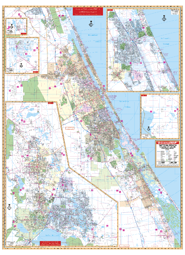
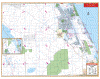
DAYTONA BEACH/ VOLUSIA/ FLAGLER COUNTY WALL MAP
2008 6th edition The Daytona Beach, Metro Volusia, and Flagler Counties, FL Wall Map by Universal Map measures 54 x 64. Coverage includes three distinct sections; East Volusia County, West Volusia County, and Flagler County.
Framing rails available on top and bottom for easy wall mounting. Details include airports, zips, boundaries, hospitals, and points of interest. Includes: up-to-date cartography, new streets, complete detail, and three sections with grid systems, index, and lamination. | |
 |
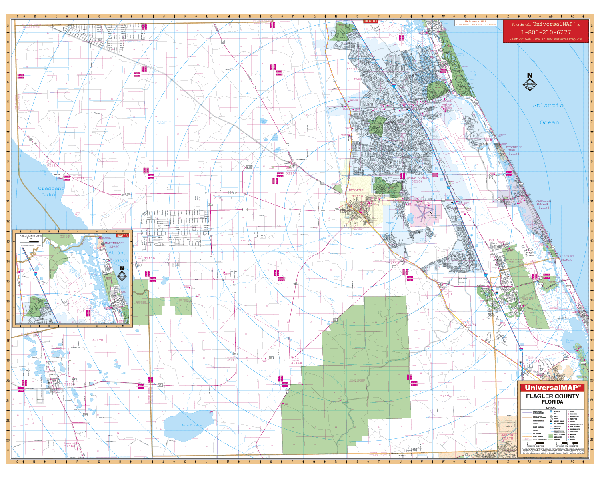
FLAGLER WALL MAP
2008
4th edition The 2nd edition of the Flagler County, FL Wall Map by Universal Map offers up-to-date cartography with new streets and changes. Measuring 70” W x 51” H, this oversized reference is laminated with a markable surface, and indexed on the face of the map. There is one inset map of Marineland. Coverage ranges North to the St. John's/Flagler County line; South to the Volusia/Flagler County line; East to the Atlantic Ocean; and West to the Volusia/Flagler, and Putnam/Flagler County lines. Included: points of interest.
Framing rails available. | |
 |
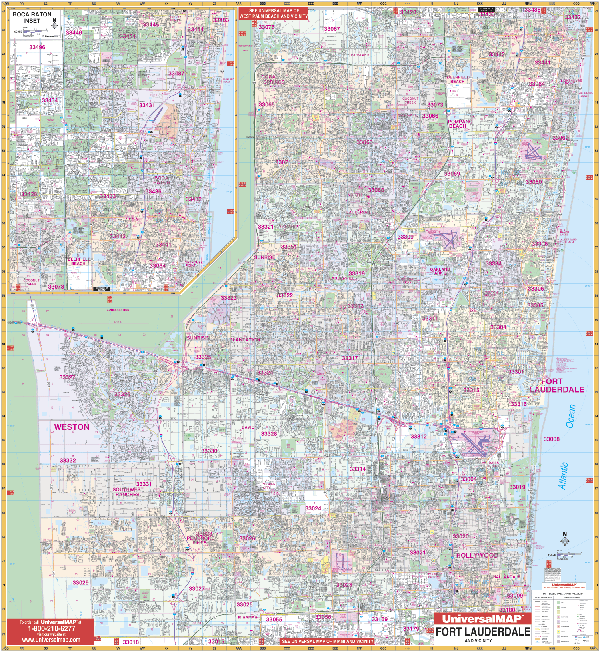
FT LAUDERDALE WALL MAP
2007
5th edition The Ft. Lauderdale/Broward County, FL Wall Map by Universal Map has up-to-date cartography with new streets and changes. Besides complete street detail, the map also has a laminated surface making it markable and washable.
Framing rails available on top and bottom for easy wall mounting. Street indexing for this map appears in a separate book. The map's area of coverage runs: North: to the Palm Beach County line; South: to the Dade County line; East: to the Atlantic Ocean; West: to Interchange at I-75 and US-27. The map has an inset map of Boca Raton. Data, details, and information included with this wall map include all streets, post offices, hospitals, railroads, mileage circles, section/township/and range lines, airports, cemeteries, shopping centers, water features, recreational parks, city limits, annexations, government buildings, fire and police stations, educational facilities, golf courses and country clubs, zip codes, zip code boundaries, and points of interest.
54"x58" | |
 |
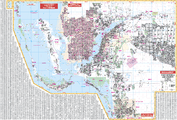
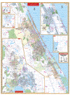
FT MYERS WALL MAP
2009 8th edition The Ft. Myers, FL Wall Map by Universal Map contains up-to-date cartography in complete street detail with over 750 new streets. The map has been printed in color on a laminated surface that is both markable and washable. Street indexing appears on the face of the map and in a separate book. The area of coverage for this map includes all of Lee County with the following boundaries: North to the Charlotte County line, South to the Collier County line, East to the Hendry County line, and West to the Gulf of Mexico, including Sanibel Island, Captiva Island, Boca Grande, N. Captiva Island, and Pine Island. The map is detailed with airports, post offices, hospitals, railroads, mileage circles, block numbers, section/township/range numbers, streets and highways, cemeteries, shopping centers, water features, recreational parks, points of interest, government buildings, fire and police stations, educational institutions, golf courses and country clubs, zip codes and boundaries, city limits and annexations, and lines of longitude and latitude.
Framing rails available on top and bottom for easy wall mounting. 77"x54" | |
 |
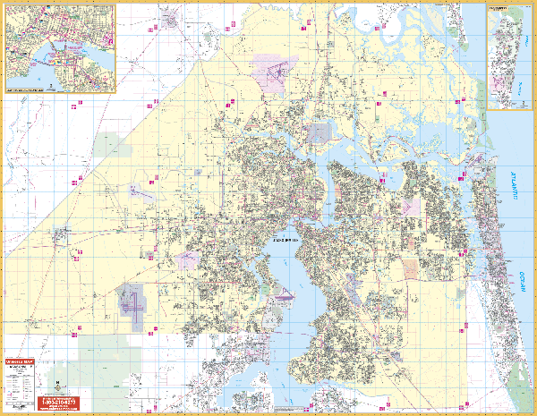
JACKSONVILLE WALL MAP
2007 5th edition The Jacksonville, FL Wall Map, published by Universal map, measures 76 W x 60 H. Complete street detail and up-to-date cartography are provided along with new streets and changes. In addition to a separate street index book, the product is printed in color with a laminated markable and washable surface. Coverage includes all of Duval County with the following boundaries: North to the Nassau/Duval County line; South including Orange Park, community of Doctor's Inlet, Fruit Cove and Ponte Vedra in St. John's County; East to the Atlantic Ocean; and West to the Baker County line. Also included are government buildings, airports, golf courses and country clubs, railroads, zip codes and zip code boundaries, shopping centers, recreational parks, mileage circles, cemeteries, educational facilities, hospitals, post offices, city limits and annexations, fire and police stations, section/township/range lines, new interstate exit numbers, and miscellaneous points of interest. Also included are inset maps of Fernandina Beach and Downtown Jacksonville.
Framing rails available on top and bottom for easy wall mounting. | |
 |
KISSIMMEE/OSCEOLA COUNTY WALL MAP
2009 7th edition The Osceola County/Kissimmee, FL Wall Map by Universal Map measures 64 W x 53 H and offers up-to-date cartography plotted in complete street detail with new streets and changes. This map is printed in color and on a laminated surface which is both markable and washable. Streets are indexed in a separate book. The area of coverage for this map ranges: North to Sand Lake Rd. including the Bee Line Expressway, all of Walt Disney World, and Orlando International Airport; South to include all of Poinciana (Including Polk County Area); East to include Bay Lake Subdivision and Pine Grove; and West to Osceola County line with a portion of Polk County which includes Loughman and Exit #23 of I-4. Inset maps are as follows: Holopaw, Lake Marian Highlands, YeeHaw Junction, plus an area map showing the remainder of Osceola County in detail. Also included are government buildings, airports, golf courses and country clubs, railroads, zip codes and zip code boundaries, shopping centers, recreational parks, mileage circles, cemeteries, educational facilities, hospitals, post offices, city limits and annexations, fire and police stations, section/township/range lines, longitude and latitude lines, and miscellaneous points of interest.
Framing rails available on top and bottom for easy wall mounting. | |
 |
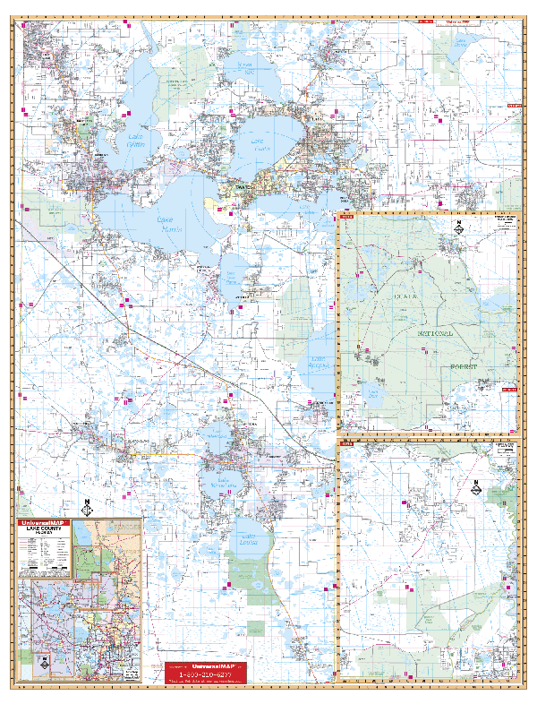
LAKE COUNTY WALL MAP
2008
6th edition The Lake County, FL Wall Map by Universal Map Wall Map measures 54 W x 71 H, and provides complete street detail and up-to-date cartography with new streets and changes. Printed in color with a markable and washable laminated surface.
Framing rails available on top and bottom for easy wall mounting. Streets are indexed in a separate book. The area of coverage ranges North to the Marion County line; South to the Polk County line: East to the Orange County line, Mt. Plymouth area; and West to the Sumter County line. Insets include Eastern Lake County from Mt. Plymouth to the county line: Northern Lake County from Altoona to Lake George: vicinity map. Details covered: airports, cemeteries, hospitals, railroads, post offices, points of interest, all streets and highways, shopping centers, water features, recreational parks, mileage circles, city limits and annexations, government buildings, fire and police stations, educational facilities, golf courses and country clubs, and zip codes and their boundaries. | |
 |
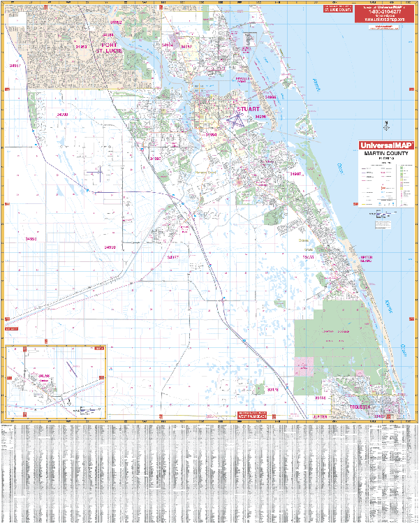
MARTIN COUNTY WALL MAP
2008 5th edition The
Martin County, FL Wall Map by Universal Map offers up-to-date cartography and complete street detail. Covers: North: to the Martin/St. Lucie boundary; South: to the Martin/Palm Beach County boundary; East: to the Atlantic Ocean; West: to the Cobblestone Country Club, I95. Map inset of Indiantown. Features streets, post offices, hospitals, and more. Lamination makes the map markable
and washable. Street indexing appears on the face of the map. Framing rails
available. 54"x64" | |
 |
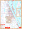
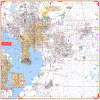
MIAMI DADE WALL MAP
2007
2nd edition The Miami and Dade County, FL Wall Map by Universal Map has added approximately 850 new streets and changes. This commercial wall map shows all of Miami/Dade County, FL in complete street detail with the boundaries as follows: North to the Broward County Line; South to all of Florida City and Homestead; East to the Atlantic Ocean; and West to the Homestead Airport. There is a map inset of Downtown Miami scale 1 =1080, North to 44th St., West to 22nd Ave., South to Viscaya Museum and Gardens. Also included are educational institutions, government buildings, shopping centers, hospitals, zip codes and boundaries, post offices, fire and police stations, airports, cemeteries, recreational parks, golf and country clubs, points of interest, city limits and annexations, railroads, water features, mileage circles, township section and range Lines. The map is protected with a laminate finish allowing the map to be marked on and wiped off.
Framing rails available on top and bottom for easy wall mounting. 54"x74" | |
 |
NAPLES WALL MAP
2009 8th edition The
Naples, FL Wall Map by Universal Map has added approximately 650 new streets and changes. Measuring 54 x 60, it illustrates all of Naples in complete street detail with the boundaries as follows: North file miles into Lee County, including Bonita Springs up to Bonita Bill Street; South to Marco Island Airport & Boyne USA South Golf Course; East to the Fakahatchee Strand State Preserve (14 miles east of 951, to include the Orangetree subdivision and Golden Gate Estates, as well as 3 miles east of DeSoto Blvd..); West to the Gulf of Mexico. Map insets are of Everglades City, Marco Island, and Immokalee. Also featured are government buildings, zip codes and boundaries, cemeteries, golf courses and country clubs, water features, post offices, shopping centers, recreational parks, points of interest, subdivision names, educational institutions, fire and police stations, hospitals, railroads, township, section and range lines, city limits, and annexations. Printed in color with a markable and washable laminated surface making the map both markable and washable. Indexing has been provided in a separate book.
Framing rails available on top and bottom for easy wall mounting. | |
 |
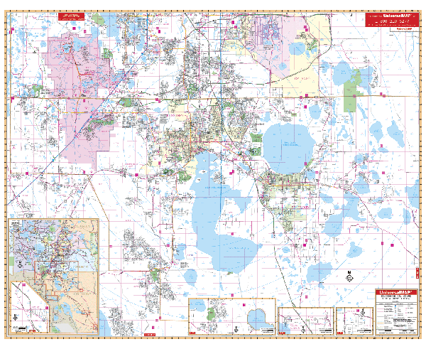
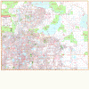
ORLANDO WALL MAP
2009 7th edition This colorful wall map of Metro Orlando and Orange/Seminole Counties, FL by Universal Map measures 77 W x 66 H. With up-to-date cartography, this map provides complete street detail. The map has a laminated surface which is markable and washable and is indexed in a separate book. The area of coverage for this map ranges North to the Volusia-Seminole County lines including Lake Monroe; South to the Osceola County line; East to include Christmas; and West to the Lake County line. Details on this map include all streets and highways, mileage circles, shopping centers, water features, recreational parks, section/range/township lines, government buildings, fire and police stations, educational facilities, golf courses and contry clubs, zip codes and boundaries, airports, post offices, hospitals, railroads, cemeteries, realtor refverence numbers, and latitude and longitude lines.
Framing rails available on top and bottom for easy wall mounting. | |
 |
PENSACOLA WALL MAP
2009
4th edition The Pensacola/Milton, FL Wall Map by Universal Map measures 77” x 54”. With complete street detail, it offers colorful, up-to-date cartography which is protected by a durable laminated surface. Map Coverage: North: East Black-Water River State Park. South: Gulf of Mexico, including Pensacola Beach, Navarre Beach, and the Pensacola NAS. East: Okaloosa Co. line. West: Alabama State line. Northwest: Cottage Hill and Cantonment.
Framing rails available on top and bottom for easy hanging. Indexed in a separate book. | |
 |
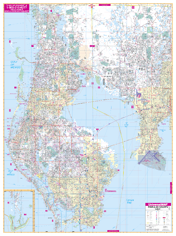
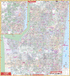
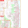
PINELLAS WALL MAP
2007 5th edition The Pinellas County, FL Wall Map by Universal Map shows all of Pinellas County in complete street detail with boundaries as follows: North to the Pasco County line; South to the Gulf of Mexico; East includes Hillsborough County to US41 with McDill Air Force Base and Tampa International Airport; West to the Gulf of Mexico. Special features include government buildings, zip codes and zip code boundaries, airports, golf courses and country clubs, water features, city limits and annexations, township-section-and range lines, post offices, shopping centers, cemeteries, points of interest, mileage circles, block numbers, educational facilities, fire and police stations, hospitals, recreational parks, subdivision names on map, railroads, and realty reference numbers. The map measures 54 x 73 and is protected with a laminate surface which is markable and washable. This map provides complete street detail with up-to-date cartography showing new streets and changes; streets are indexed in a separate book.
Framing rails available on top and bottom for easy wall mounting. | |
 |
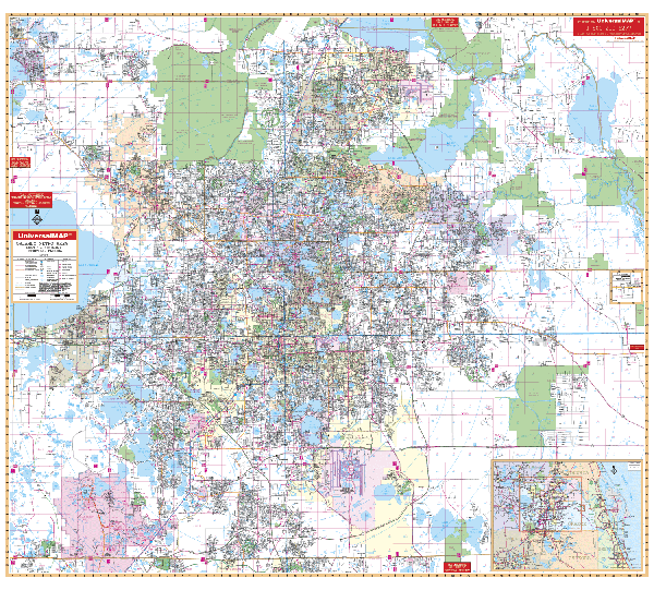
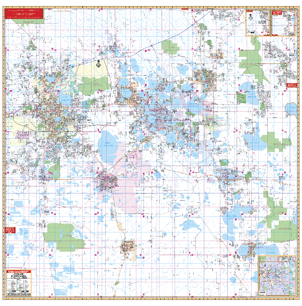
POLK COUNTY WALL MAP
2009 5th edition
Measuring 72 x 72, the 3rd edition of the Polk County, FL Wall Map from Universal Map contains up-to-date cartography with new streets and changes. Coverage: N: to the Osceola Co Line (Exit 58 on I-4); S: to the Highlands and Hardee Co lines; E: includes Poiciana, and Lake Hatchineha; W: to the Hillsborough Co line. Insets: vicinity map of Polk Co; northern Polk Co, along US27 to the Lake Co Line. Street indexing is provided in a separate book. Its protective laminate surface can be used with waterbased
pens. Framing rails available. | |
 |
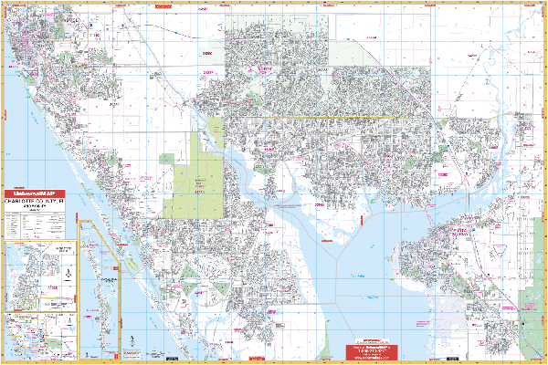
PORT CHARLOTTE WALL MAP
2009 6th edition The full-color Port Charlotte and Charlotte County, FL Wall Map by Universal Map is protected with a markable and washable laminated surface. This wall map offers up-to-date cartography with new streets and changes providing complete street detail. Streets are indexed in a separate book on this 77 x 54 wall map. The area of coverage includes all of western Charlotte County with the following boundaries: North to include all North Port and Venice in Sarasota County; South to the Tropical Gulf Acres at the intersection of CR 777 and 771, and the Boca Grande Causeway; East to US Route 17, including Peace River Shores, Ridge Harbor and Cecil M. Webb Wildlife; and West to the Gulf of Mexico. Insets include Charlotte County and Burnt Stores. Also featured are post offices, hospitals, railroads, mileage circles, airports, cemeteries, shopping centers, water features, recreational parks, government buildings, fire and police stations, educational facilities, mobile home parks, longitude and latitude lines, range/township/section lines, city limits/annexations, golf courses and country clubs, zip codes, and zip code boundaries.
Framing rails available on top and bottom for easy wall mounting. | |
 |
SARASOTA WALL MAP
2009 5th edition The Sarasota County, FL Wall Map by Universal Map measures 46 x 64 and is in complete street detail. Up-to-date cartography shows over 450 new streets and changes. This map has been printed in color with a markable and washable laminated surface. Streets are indexed in a separate book. The map's area of coverage includes all of Sarasota County with the following boundaries: North to the Manatee County line: South to the Charlotte County line; East to the DeSoto County line--including Myakka river State Park; and West to the Gulf of Mexico. The map includes an inset of Northport. Details on this map include all streets and highways, mileage circles, shopping centers, water features, recreational parks, section/range/township lines, government buildings, fire and police stations, educational facilities, golf courses and contry clubs, zip codes and boundaries, airports, post offices, hospitals, railroads, and cemeteries.
Framing rails available on top and bottom for easy wall mounting. | |
 |
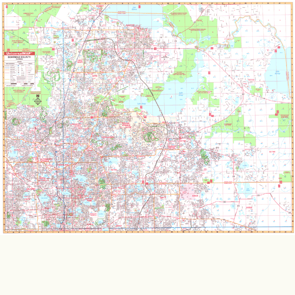
SEMINOLE COUNTY WALL MAP-
2009 7th edition Measuring 66 W x 54 H, the newest edition of the Seminole County, FL Wall Map by Universal Map offers up-to-date cartography in complete street detail with over 800 new streets and changes. This full-color map is protected by laminated surface that is both markable and washable. A street index appears in a separate book. Coverage for this map ranges North to the Volusia County line; South to SR 50 in Orange County; East to the Volusia County line; and West to the Orange County line. Details included with this wall map area as follows: all streets, post offices, hospitals, railroads, mileage circles, block numbers, airports, cemeteries, shopping centers, water features, recreational parks, section/township/and range lines, government buildings, fire and police stations, educational facilities, golf courses and country clubs, zip codes, and zip code boundaries.
Framing rails available on top and bottom for easy wall mounting. | |
 |
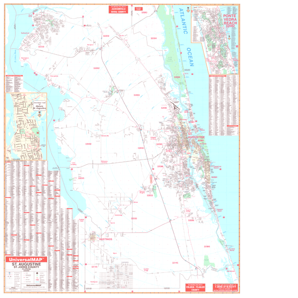
ST AUGUSTINE WALL MAP
2006
4th edition The St. Johns County, FL Wall Map by Universal Map measures 54 x 68 and has up-to-date cartography and complete street detail. The map has been printed in color on a laminated surface that is both markable and washable. The map's index appears on its face. The area of coverage for the St. Johns map is North to the Duval County Line; South to the Flagler County Line; East to the Atlantic Ocean; and West to the St. Johns River. There is an inset of the Historic St. Augustine. Details included with this map are: all streets, post offices, hospitals, railroads, mileage circles, airports, cemeteries, shopping centers, water features, recreational parks, government buildings, fire and police stations, educational facilities, golf courses and country clubs, zip codes, and zip code boundaries.
Framing rails available on top and bottom for easy wall mounting. | |
 |
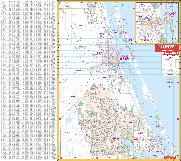
ST LUCIE WALL MAP
2007 5th edition
The St. Lucie County, FL Wall Map by Universal Map measures
56 W x 54 H and includes up-to-date cartography and complete street detail.
Coverage ranges from North to Indian County line; South to the Martin County
boundary; East to the Atlantic Ocean; and West to CR 609, 609A (approx 10 mi
from Ft. Pierce). There is an inset map of Vero Beach. Printed in color,
laminated, indexed on the map, and framing rails available. | |
 |
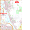
TAMPA WALL MAP
2006
6th edition The Metro Tampa/Hillsborough County, FL Wall Map by Universal Map measures 72 x 72 and features complete street detail at a scale of 1” = 2,816 feet. Streets indexed in a separate book. Boundaries: North: To the Pasco County Line; South: To the Manatee County Line; East: To the Polk County Line; West: To the Pinellas County Line. Includes a detailed inset of Downtown Tampa. Contains up-to-date cartography with new streets and changes. Protected with a markable
laminate finish. Framing rails available. | |
 |
WEST PALM BEACH WALL MAP
2008 7th edition The West Palm Beach/Palm Beach County, FL Wall Map by Universal Map features full-color cartography with streets indexed in a separate book. Coverage includes Palm Beach Co. with the following boundaries: No. to the Martin Co. line; So. to the Broward Co. line; E. to the Atlantic; W. to 3 miles west of Lion Co. Safari. Insets: Belle Glade, Canal Point, Pohokee and South Bay, and Okeechobee. Details on this map include all streets and highways, mileage circles, shopping centers, and more.
54"x74" | |
 |
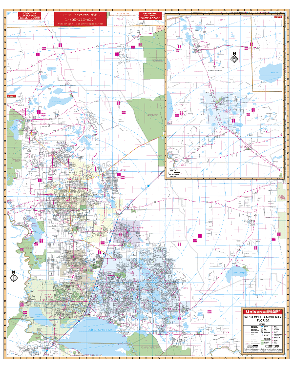
WEST VOLUSIA WALL MAP
2008
4th edition The
3rd edition of the West Volusia County, FL Wall Map by Universal Map measures 54 x 64. Area of coverage: continuous coverage of Peirson, Barberville, DeLeon Springs, Connersville, Eldridge, and Seville: To Seminole County Line, including Debary and Osteen; Deltona; DeLand; Lake Helen; Cassadaga,
and Orange City. Includes: up-to-date cartography, new streets and changes,
complete street detail, and laminated surface. Framing rails available. | |
|