|
Wall Maps
- State, County & Cities
GeoMart
is rapidly expanding its on-line selection of wall maps. If you
don't find what you are looking for here, please give us a call at
800-248-6277. One of our customer service representative will be
happy to assist you in finding the right map for you.
Most Maps Usually Ship within 48 hours.
Laminated maps with the option of hanging
rails usually ship in 5 days
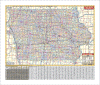 |
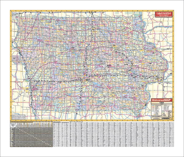
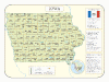
IOWA WALL MAP
2005
3rd edition The Iowa Wall Map by Universal Map includes all state and federal highways, major waterways, towns, military installations, major airports, state universities, cities, state parks, wildlife areas, and various points of interest. This wall map measures 69 W x 54 H and is lithographed in 8 colors. This laminated map is both markable and washable. The map is indexed on the face of the map.
Framing rails are available on top and bottom for easy wall mounting. | |
 |
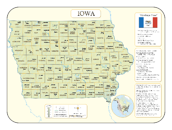
Raven Iowa Map
Situated between the Missouri River on the west
and the Mississippi River on the east, Iowa has some of the most
fertile soil in the country. Elevations are represented by
color, and this, in combination with our relief shading
technique, gives the map a 3-dimensional look.
Raven Iowa Map Dimensions: 34" x 49"
(approx.)
Raven Iowa Map Scale: 1:500,000 or 1" equals about 8 miles |
|
 |
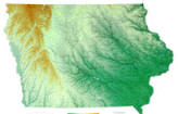
IOWA SHADED RELIEF MAP
The Iowa Shaded Relief Wall Map by Universal Map is a full-color, topographical wall map. Statistical information on this map includes historical, anecdotal, and geographical. There is also an an elevation scale measured in meters and feet and a distance scale measured in miles and kilometers. Identifies county boundaries. Shows state flag. Lists state motto, bird, flower, and tree, plus total area, population and origin of name. Its heavy laminated surface can be used with waterbased pens. |
Click Price to Add to Cart | | Laminated |
$31.95 |
|
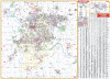 |
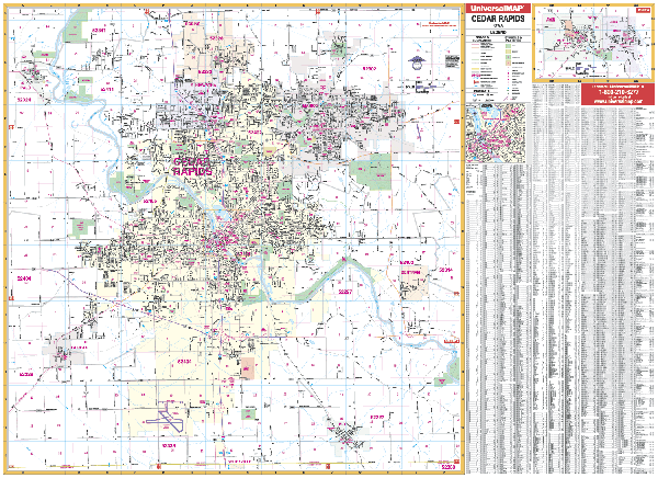
CEDAR RAPIDS WALL MAP
2003 1st edition The Cedar Rapids, IA Wall Map by Universal Map measures 72” x 55”. Features up-to-date cartography with new streets and changes in complete street detail. Printed in color with a markable and washable laminated surface. Coverage: N: includes Robins to Co. Home Road; S: includes Shueyville & Ely to Johnson Co. line; E: includes Bertram to Palisades Kepler State Park; W: includes Palo, Fairfax, to Sisley Grove Road. Includes inset maps of Mount Vernon and Lisbon.
Framing rails are available on top and bottom for easy wall mounting. | |
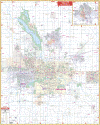 |
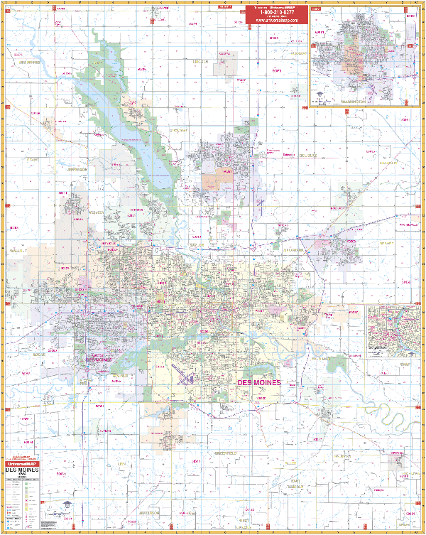
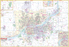
DES MOINES WALL MAP
2008
3rd edition The Des Moines, IA Wall Map by Universal Map measures 54 W x 69 H and provides complete street detail with up-to-date cartography. The map is printed in color with a markable and washable laminated surface. Streets are indexed in a separate book. The area of coverage includes North to the Polk/Boone County lines; South to Spring Hill--5 miles south of Norwalk; East to Hartford, Altoona, and Bondurant; West to Waukee. Insets feature Ames and downtown Des Moines. Also highlighted are government buildings, airports, golf courses and country clubs, railroads, longitude and latitude lines, block numbers, shopping centers, recreation parks, mileage circles, cemeteries, educational facilities, hospitals, post offices, city limits and annexations, block numbers, longitude and latitude lines, municipal township boundaries and names, section/township/and range numbers, water features, fire and police stations, fire district lines, zip codes and boundaries, and assorted points of interest.
Framing rails are available on top and bottom for easy wall mounting. | |
 |
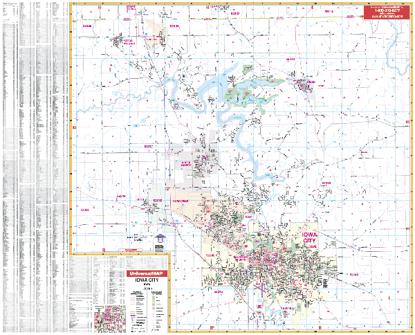
IOWA CITY WALL MAP
2003 1st edition The Iowa City, IA Wall Map by Universal Map measures 65” x 55.” Provides complete street detail with up-to-date cartography showing new streets and changes. Covers all of Iowa City with the following boundaries: North: to the Linn County line; South: to Osage Street, Pleasant Valley Golf Course; East: includes Morse and Solon to Wapsi Avenue; West: includes Swisher to Green Castle Avenue. Printed in color with a markable
/washable laminated surface. Framing rails are available on top and bottom for easy wall mounting. | |
 |
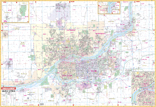
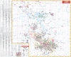
QUAD CITIES WALL MAP
2009
3rd edition The Quad Cities Wall Map by Universal Map measures 77 W x 54 H and includes the cities of Davenport, Bettendorf, Rock Island, and Moline. This wall map provides up-to-date cartography in complete street detail, full color, lamination making the map markable and washable, and indexing in a separate book. The map's area of coverage ranges from North to include the city of Eldridge, South to include the city of Oak Grove, East to include the city of Cleveland, IL, and West to the Scott/Muscatine County Line. Insets found on this map are Princeton, IA; Cordova, IL; Long Grove, IA; Downtown Davenport, IA; and Rock Island, IL. Information detailed on this map include all streets, post offices, hospitals, railroads, mileage circles, points of interest, municipal and township boundaries, airports, cemeteries, shopping centers, water features, recreational parks, longitude and latitude lines, government buildings, fire and police stations, educational facilities, golf courses and country clubs, zip codes, and zip code boundaries.
Framing rails are available on top and bottom for easy wall mounting. | |
|