|
Wall Maps
- State, County & Cities - Illinois
GeoMart
is rapidly expanding its on-line selection of wall maps. If you
don't find what you are looking for here, please give us a call at
800-248-6277. One of our customer service representative will be
happy to assist you in finding the right map for you.
Most Maps Usually Ship within 48 hours.
Laminated maps with the option of hanging
rails usually ship in 5 days
 |
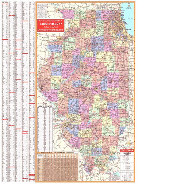
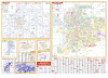
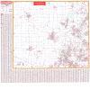
ILLINOIS WALL MAP
2003
2nd edition The Illinois Wall Map by Universal Map includes a laminated surface that is markable and washable. Indexing appears on the 4'2W x 5'7H face of the map, as well as color coded and named counties. Data and details included with this map are as follows: all state highways, all federal highways, cities and towns, major waterways, major airports, state parks, state universities, military installations, wildlife areas, a mileage chart, counties with populations, and points of interest.
Framing rails are available on top and bottom for easy wall mounting. | |
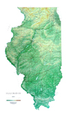 |
Raven Illinois Map
Our Illinois map beautifully displays the
delicate landscape. From Lake Michigan to the Ohio and
Mississippi Rivers, the valleys, plains, rivers, and prairies
are exquisitely mapped in shades of greens and light browns.
Elevations are represented by color, and this, in combination
with our relief shading technique, gives the map a 3-dimensional
look.
Raven Illinois Map Dimensions: 33" x
55" (approx.)
Raven Illinois Map Scale: 1:500,000 or 1" equals about 8 miles |
|
 |
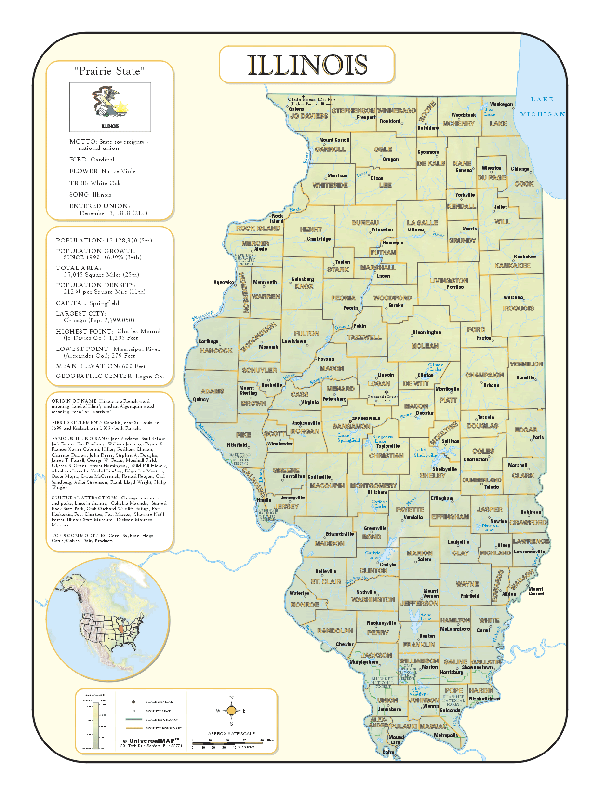
ILLINOIS SHADED RELIEF MAP
The Illinois Shaded Relief Wall Map by Universal Map measures 36 W x 48 H and is a full-color, topographical wall map. Statistical information on this map includes historical, anecdotal, and geographical. There is also an elevation scale measured in meters and feet and a distance scale measured in miles and kilometers. Identifies county boundaries. Shows state flag. Lists state motto, bird, flower, and tree, plus total area, population and origin of name. Its heavy laminated surface can be used with waterbased pens. |
Click Price to Add to Cart | | Laminated |
$31.95 |
|
 |
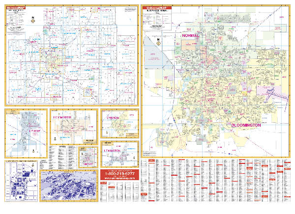
BLOOMINGTON WALL MAP
2008
2nd edition The Bloomington & Normal, IL Wall Map by Universal Map measures 64” x 46,” and features up-to-date cartography. Boundaries: North: to the northern city limits of Normal; South: to the southern city limits of Bloomington; East: includes the Central Illinois Regional Airport; West: includes the Mitsubishi Auto plant. Printed in color with a markable
and washable surface and indexed on the face of the map. Framing rails are
available on top and bottom for easy wall mounting. | |
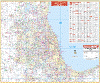 |
CHICAGO 50 MILE VICINITY WALL MAP
The 2006,
2nd. Edition Chicago, Illinois and 50 mile vicinity Wall Map measures 54” W x
48” H, uses up-to-date cartography, color, and lamination making the map
markable and washable. Streets are indexed on the face of the map and framing
rails are used on top and bottom for ease in hanging (Roller available for extra
$30). Area of coverage: All of Cook, Dupage, Kane, and Lake Counties and
portions of McHenry, Will, and Kendall Counties with the following boundaries:
North: to the Wisconsin State line; South: includes Joliet, Frankfort, and Sauk
Village; East: includes Beverly Shores and Valparaiso, IN; West: to Kane/DeKalb
Co, includes city of Harvard. Details covered: airports, cemeteries, hospitals,
railroads, post offices, mileage circles from Chicago City Hall, major roads and
highways, shopping centers, water features, golf courses and country clubs, exit
numbers, government buildings, major fire and police stations, colleges and
universities, trails and recreational parks, city limits, and annexations.
| |
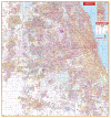 |
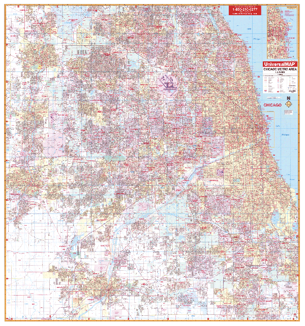
CHICAGO METRO WALL MAP
2007
2nd edition The Chicago, IL Metro Area Wall Map by Universal Map measures 70 W x 76 H. This map provides complete street detail and up-to-date cartography with new streets and changes. The map is printed in color with a markable and washable laminated surface. Streets are indexed in a separate book. The map covers all of Cook and Dupage Counties and portions of Kane and Will Counties with the following boundaries: North: includes Barrington Hills, Wheeling, and Glencoe; South: includes Joliet, New Lenox, Frankfort, and South Chicago Heights; East: to Lake Michigan, includes Calument City and Lynwood; West: includes Aurora, Elgin, and Batavia in Kane County. Also included is an inset map of Downtown chicago. Details provided with the map are as follows: airports, cemeteries, hospitals, railroads, post offices, all streets and highways, shopping centers, water features, recreational parks, mileage circles, city limits and annexations, government buildings, fire and police stations, educational facilities, golf courses and country clubs, zip codes and boundaries, section/twp/range lines, and points of interest.
Framing rails are available on top and bottom for easy wall mounting. | |
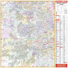 |
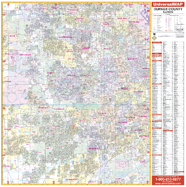
DUPAGE COUNTY WALL MAP
2007
2nd edition The Dupage County, IL Wall Map by Universal Map measures 54 W x 54 H and is protected by a markable and washable laminated surface. Streets are indexed in a separate book. The area of coverage includes all of Dupage County with the following boundaries: North to the Cook County line; South to the Will County line; East to the Cook County line; West to the Kane County line. Information, details, and data: airports, cemeteries, hospitals, railroads, post offices, points of interest, all streets and highways, shopping centers, water features, recreational parks, mileage circles, city limits and annexations, government buildings, fire and police stations, educational facilities, golf and country clubs, zip codes and boundaries, section/township/ and range lines.
Framing rails are available on top and bottom for easy wall mounting. | |
 |
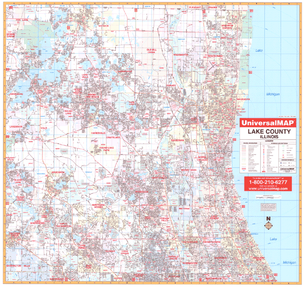
LAKE COUNTY WALL MAP
2007
2nd edition The Lake County, IL Wall Map by Universal Map measures 54 W x 54 H, and provides complete street detail. It is protected by a markable and washable laminated surface. Streets are indexed in a separate book. Details include airports, cemeteries, hospitals, railroads, post offices, all streets and highways, shopping centers, water features, recreational parks, mileage circles, city limits and annexations, government buildings, fire and police stations, educational facilities, golf courses and country clubs, longitude and latitude lines, and points of interest.
Framing rails are available on top and bottom for easy wall mounting. | |
 |
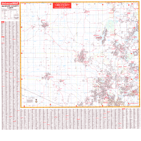
MCHENRY COUNTY WALL MAP
2007
2nd edition The McHenry County, IL Wall Map by Universal Map measures 56 W x 54 H, and provides complete street detail with new streets and changes. Printed in color with a markable and washable finish, with a street index printed on the map.
Framing rails are available on the top and bottom for easy wall mounting. Details include airports, cemeteries, hospitals, railroads, post offices, mileage circles, all streets and highways, shopping centers, water features, recreational parks, municipal township names, longitude and latitude lines, government buildings, fire and police stations, educational facilities, golf courses and country clubs, zip codes and boundaries, and section/township/range lines. | |
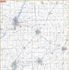 |
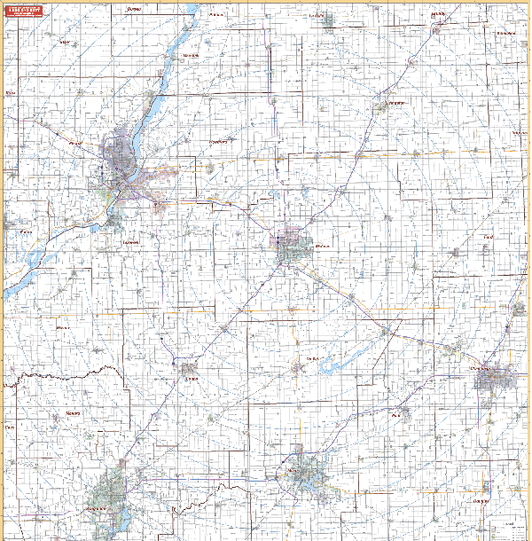
PEORIA/BLOOMINGTON/VICINITY WALL MAP
2005 1st edition The Peoria and Bloomington, IL Vicinity Wall Map by Universal Map includes portions of surrounding counties. Measuring 54” x 64,” it includes up-to-date cartography, as well as a markable and washable laminated surface. Boundaries: North: 45 miles to include Longview, West Longview in Cowlitz County, Washington; South: 65 miles to include Albany and Millersburg in Linn County; East: 50 miles to include Parksdale in Hood River County; West: 40 miles to Tillamook County.
Framing rails are available on top and bottom for easy wall mounting. Excellent source for routing or planning. | |
 |
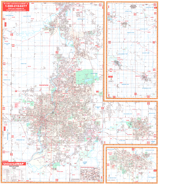
ROCKFORD WALL MAP-2ND EDITION
2008
3rd edition Measuring 54 x 64, the Rockford, IL Wall Map by Universal Map provides complete street detail, with up-to-date cartography. The map has been printed in color with a laminated, markable and washable, surface. Its streets are indexed in a separate book. The map's area of coverage ranges North to the Wisconsin state line, including the city of South Beloit; South to New Milford and Greater Rockford Airport; East to include Belvidere; and West to Meridian Road. Insets for this map are a Greater Rockford area map; Freeport; and western Winnebago County in street detail including the towns of Winnebago, Pecatonica, and Durand. Details found on this map include all streets, post offices, hospitals, railroads, mileage circles, airports, cemeteries, shopping centers, water features, recreational parks, government buildings, fire and police stations, educational facilities, golf courses and country clubs, city limits/annexations, block numbers/townships/ranges, zip codes and boundaries.
Framing rails are available on top and bottom for easy wall mounting. | |
|