|
Wall Maps
- State, County & Cities - Indiana
GeoMart
is rapidly expanding its on-line selection of wall maps. If you
don't find what you are looking for here, please give us a call at
800-248-6277. One of our customer service representative will be
happy to assist you in finding the right map for you.
Most Maps Usually Ship within 48 hours.
Laminated maps with the option of hanging
rails usually ship in 5 days
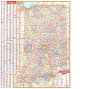 |
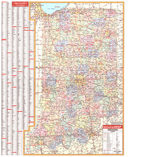
INDIANA WALL MAP
2004
2nd edition The Indiana Wall Map by Universal Map features color-coded counties, a laminated surface that is both markable and washable, and indexing on the face of the map. The wall map measures 4' W x 5' H. Details found with this map include all state and federal highways, cities and towns, major waterways, major airports, time zones, state universities, state parks, wildlife areas, military installations, police and state police posts, county names and boundaries, and points of interest.
Framing rails are available on top and bottom for easy wall mounting. | |
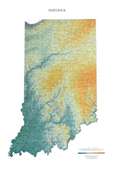 |
Raven Indiana Map
From Lake Michigan in the north to the Ohio
River, Indiana is a state of subtle elevation changes marked by
small lakes, low sandy hills, "knobs" or steeper hills, and
limestone caves in the south created by underground streams.
Elevations are represented by color, and this, in combination
with our relief shading technique, gives the map a 3-dimensional
look.
Raven Indiana Map Dimensions: 29" x
44" (approx.)
Raven Indiana Map Scale: 1:500,000 or 1" equals about 8 miles |
|
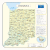 |
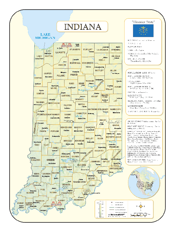
INDIANA SHADED RELIEF MAP
The Indiana Shaded Relief Wall Map by Universal Map measures 36 W x 48 H and is a full-color, topographical wall map. Statistical information on this map includes historical, anecdotal, and geographical. There is also an elevation scale measured in meters and feet and a distance scale measured in miles and kilometers. Identifies county boundaries. Shows state flag. Lists state motto, bird, flower, and tree, plus total area, population and origin of name. Its heavy laminated surface can be used with waterbased pens.
|
Click Price to Add to Cart | | Laminated |
$31.95 |
|
 |
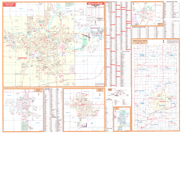
ANDERSON WALL MAP
2002
2nd edition The Anderson, IN Wall Map by Universal Map measures 66 W x 50 H. Using up-to-date cartography showing new streets and changes, this map provides a complete street index. The full-color maps is protected by a laminated surface that is both markable and washable. The area of coverage ranges North to the Madison County line; South to the Madison County line; East to Chesterfield; and West to the Madison County line. Insets for this map are as follows: Elwood, Alexandria, Pendleton, Lapel, Madison County, and Anderson University campus. Also featured are government buildings, airports, golf courses and country clubs, railroads, zip codes and zip code boundaries, shopping centers, water features, recreational parks, cemeteries, educational facilities, hospitals, post offices, city limits and annexations, section/township/range lines, fire and police stations, and miscellaneous points of interest.
Framing rails are available on top and bottom for easy wall mounting. | |
 |
ELKHART WALL MAP
2000 1st edition The Elkhart, IN Wall Map by Universal Map shows complete street detail with the boundaries as follows: North to Elkhart and Bristol and the Michigan State line; South to the town of Nappanee and the Kosciusco County line; East to Middlebury, Millersburg, and the Lagrange County line; and West to Wakarusa and the St. Joseph County line. There is also an inset map of downtown Elkhart. Also shows government buildings, airports, golf courses and country clubs, railroads, longitude and latitude lines, block numbers, shopping centers, recreational parks, mileage circles, cemeteries, educational facilities, hospitals, post offices, city limits and annexations, water features, fire and police stations, and assorted points of interest. This wall map measures 64 W x 54 H and is protected by a laminate surface which is both markable and washable. An index is printed on the map.
Framing rails are available on top and bottom for easy wall mounting. | |
 |
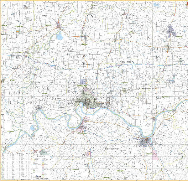
EVANSVILLE/VICINITY WALL MAP
2003 1st edition The Evansville, IN Vicinity Wall Map by Universal Map includes Evansville, IN and Henderson and Owensboro, KY with portions of the surrounding 10 counties. Area of coverage: IN-includes Co of Dubois, Gibson, Pike, Posey, Spencer, Vanderburg, Warrick; and portions of Wabash, Edwards, and White Co. KY-includes Davies, Henderson, and Hancock County; and portions of Ohio, Breckinridge, McLean, and Webster County. Measures 64 x 54 inches and contains up-to-date cartography. It is protected by a heavy laminate coating that can be used with waterbased pens. Framing rails
available on top and bottom. Excellent source for routing or planning. | |
 |
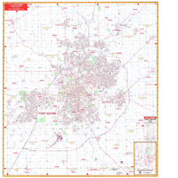
FT WAYNE WALL MAP
2008
2nd edition The Ft. Wayne/Allen County, IN Wall Map by Universal Map includes up-to-date cartography with over 550 new streets. It is protected by a laminated surface that is both markable and washable. Street indexing appears on the map, which measures 54 W x 60 H. The area of coverage ranges North to the DeKalb County line; South to Wells County, including Zanesville; East to Harlan, Five Points, and Hoagland; and West to Whitley County line, including Churbusco. There is also an inset map of Fort Wayne. Other features include airports, shopping centers, railroads, mileage circles, section, township, and range lines, post offices, hospitals, cemeteries, educational facilities, water features, recreational parks, government buildings, fire and police stations, longitude and latitude lines, golf courses and country clubs, zip codes and boundaries, city limits, and annexations.
Framing rails are available on top and bottom for easy wall mounting. | |
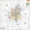 |
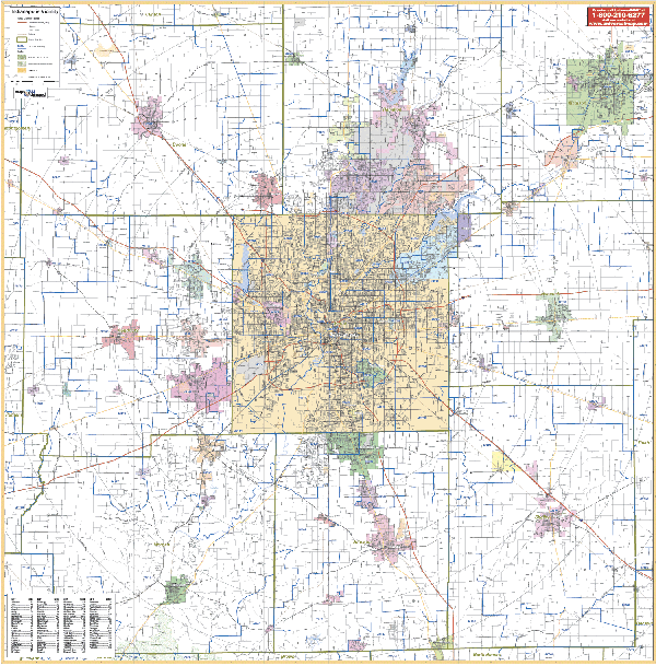
INDIANAPOLIS VICINITY WALL MAP
2007
2nd edition The Indianapolis, IN Vicinity Wall Map measures 63” W. x 64” H. Protected with a markable and washable laminated surface, the cities are indexed on the map’s face. Includes highways, zip codes county lines/names, airports, parks, and more.
Framing rails are available on top and bottom for easy wall mounting. | |
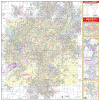 |
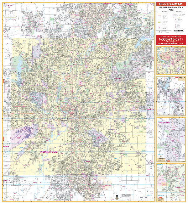
INDIANAPOLIS WALL MAP
2007 6th edition The Indianapolis & Marion County, IN Wall Map by Universal Map shows all of Marion County, Indiana in complete street detail with up-to-date cartography. Printed in color with a markable
and washable laminated surface. Streets indexed in a separate book.
Framing
rails are available on top and bottom for easy wall mounting. 54" x 72"
| |
 |
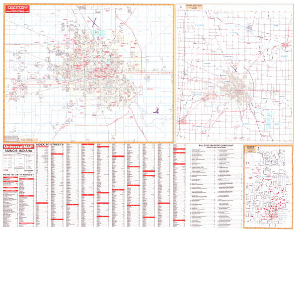
MUNCIE WALL MAP
2004
2nd edition The Muncie, IN Wall Map by Universal Map offers complete street detail and street indexing on the face of the map. Measuring 68 W x 54 H, its laminated surface is both markable and washable. The map's area of coverage ranges from north to Royerton Road and Royerton Elementary School, south to one mile south of State Rt. 67, East to one mile east of Reese Airport, and west to include Yorktown. Inset maps for the Muncie map include Delaware County and Ball State University. Other features found on the map are all streets, post offices, hospitals, railroads, mileage circles, points of interest, block numbers, airports, cemeteries, shopping centers, water features, recreational parks, city limits and annexations, subdivision names, government buildings, fire and police stations, educational institutions, golf courses and country clubs, zip codes, and zip code boundaries.
Framing rails are available on top and bottom for easy wall mounting. | |
|