|
Wall Maps
- State, County & Cities - Kansas
GeoMart
is rapidly expanding its on-line selection of wall maps. If you
don't find what you are looking for here, please give us a call at
800-248-6277. One of our customer service representative will be
happy to assist you in finding the right map for you.
Most Maps Usually Ship within 48 hours.
Laminated maps with the option of hanging
rails usually ship in 5 days
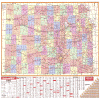 |
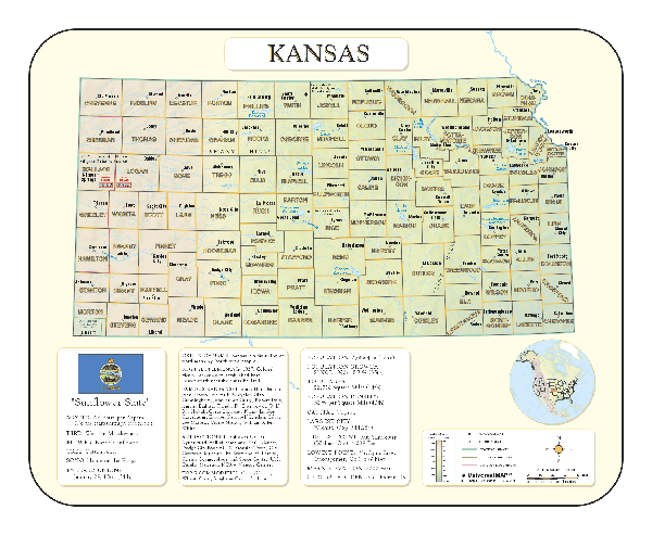
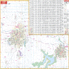
KANSAS WALL MAP
2004
2nd edition The Kansas Wall Map from Universal Map measures 61 x 42 and provides up-to-date cartography. This full-color wall map is protected by a markable and washable laminated surface. Cities and counties are indexed on the face of the map. Special features include color coded counties and a mileage chart between major cities. Details for this map include all state and federal highways, major waterways, state universities, military installations, major airports, state parks and wildlife areas, cities, towns, and points of interest.
Framing rails are available on top and bottom for easy wall mounting. | |
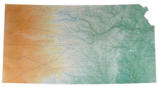 |
Raven Kansas Map
From Mount Sunflower and the Great Plains in the
west, past the historic Arkansas River, to the Missouri River in
the east, Kansas is a state where you'll see gentle rolling
plains falling in elevation from west to east. All the subtle
changes in topography are shown on this beautiful map of the
state. Elevations are represented by color, and this, in
combination with our relief shading technique, gives the map a
3-dimensional look.
Raven Kansas Map Dimensions: 35" x
58" (approx)
Raven Kansas Map Scale: 1:500,000 or 1" equals about 8 miles |
|
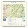 |
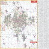
KANSAS SHADED RELIEF MAP
The Kansas Shaded Relief Wall Map by Universal Map measures 36 W x 40 H and is a full-color, topographical wall map. Statistical information on this map includes historical, anecdotal, and geographical. There is also an elevation scale measured in meters and feet and a distance scale measured in miles and kilometers. Identifies county boundaries. Shows state flag. Lists state motto, bird, flower, and tree, plus total area, population and origin of name. Its heavy laminated surface can be used with waterbased pens. |
Click Price to Add to Cart | | Laminated |
$31.95 |
|
 |
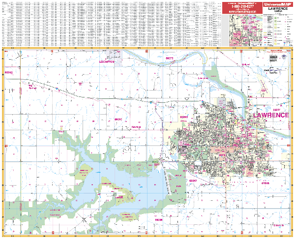
LAWRENCE WALL MAP
2003
2nd edition The Lawrence, KS Wall Map by Universal Map measures 54” x 44” and shows complete street detail at a scale of 1” = 1,850 feet. Provides up-to-date cartography with new streets/changes. Coverage: North: to No. 2100 Rd., including part of Lecompton; South:to No. 950 Rd., including the Rockhaven Recreation Area; East: to the Douglas-Leavenworth County line; West: 1 mile West of the Douglas-Schawnee County line. Inset of Downtown Lawrence. Laminated, printed in color, and indexed on map face. | |
 |
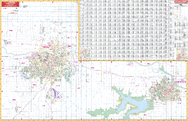
TOPEKA WALL MAP
2003
2nd edition The Topeka, KS Wall Map by Universal Map measures 54” x 56” and provides full-color street detail. Map Coverage: North to the Jackson/Shawnee County line; South to include Auburn and Wakarusa; East to 1 mile east of the Shawnee-Douglas County line; and West to Silver Lake. Includes an inset of Downtown Topeka. Includes inset map of Downtown Topeka. Contains up-to-date cartography with new streets and changes, and is indexed on the face of the map. Mounted on framing rails and protected with a markable lamination. | |
 |
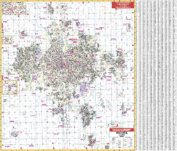
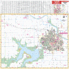
WICHITA WALL MAP
2004
3rd edition The Wichita, KS Wall Map by Universal Map measures 60 x 54. It illustrates the area with full-color street detail, and is protected by a markable and washable laminated surface. Streets are indexed on the face of the map.
Framing rails are available. | |
|