|
Wall Maps
- State, County & Cities - Kentucky
GeoMart
is rapidly expanding its on-line selection of wall maps. If you
don't find what you are looking for here, please give us a call at
800-248-6277. One of our customer service representative will be
happy to assist you in finding the right map for you.
Most Maps Usually Ship within 48 hours.
Laminated maps with the option of hanging
rails usually ship in 5 days
 |
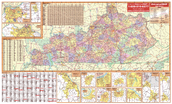
KENTUCKY WALL MAP
2003
3rd edition The Kentucky Wall Map by Universal Map measures 66 W x 42 H. Includes: state highways, federal highways, secondary roads, major waterways, airports, state and national parks, towns, state universities, military installations, and points of interest. Protected by a markable
laminate. Framing rails are available on top and bottom for easy wall mounting. | |
 |
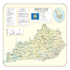
Raven Kentucky Map
From the Ohio River and Bluegrass Region in the
north to the Cumberland Plateau with its Pine and Black
Mountains and west to the rocky ridges tunneled with underground
caves, Kentucky is a state of diverse geography. Elevations are
represented by color, and this, in combination with our relief
shading technique, gives the map a 3-dimensional look.
Raven Kentucky Map Dimensions: 29" x
58" (approx.)
Raven Kentucky Map Scale: 1:500,000 or 1" equals about 8 miles |
|
 |
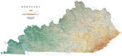
KENTUCKY SHADED RELIEF MAP
The Kentucky Shaded Relief Wall Map by Universal Map measures 48 W x 36 H and is a full-color, topographical wall map. Statistical information on this map includes historical, anecdotal, and geographical. There is also an elevation scale measured in meters and feet and a distance scale measured in miles and kilometers. Identifies county boundaries. Shows state flag. Lists state motto, bird, flower, and tree, plus total area, population and origin of name. Its heavy laminated surface can be used with waterbased pens. |
Click Price to Add to Cart | | Laminated |
$31.95 |
|
 |
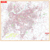
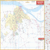
LEXINGTON WALL MAP
2008 5th edition The Lexington, KY Wall Map by Universal Map features complete street detail with the boundaries as follows: North to Kentucky State Horse Park; South to Jessamine County line; East to N. Cleveland Road; West to Bluegrass Airport. An inset of downtown Lexington is included. This map measures 66 W x 54 H and provides up-to-date cartography with new streets and changes. The map is protected by durable lamination that is markable and washable. Streets are indexed on the face of the map. Other features include government buildings, airports, golf courses and country clubs, railroads, water features, zip codes and zip code boundaries, shopping centers, recreational parks, mileage circles, cemeteries, educational facilities, hospitals, post offices, city limits and annexations, fire and police stations, and miscellaneous points of interest.
Framing rails are available on top and bottom for easy wall mounting. | |
 |
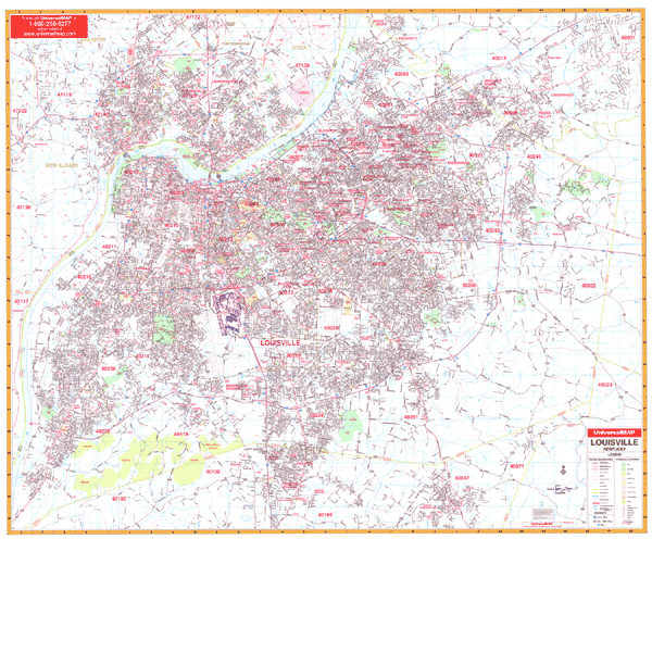
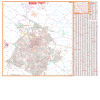
LOUISVILLE WALL MAP
2008
3rd edition The Jefferson County, KY Wall Map by Universal Map includes the city of Louisville and adjacent areas. The map features up-to-date cartography in complete street detail. It has protected with a laminate that is both markable and washable. Street indexing appears in a separate book. The area of coverage ranges North to include New Albany-Clarksville and Jeffersonville, IN, plus a portion of Oldham County including River Bluff, Pewee Valley, Crestwood, and surrounding areas; South to include Hillview, Pioneer Village, and Mount Washington in Bullet County; East to Shelby County line; and West across the Ohio River to show portions of the Indiana side including Edwardsville. Details include post offices, hospitals, railroads, mileage circles, airports, cemeteries, shopping centers, water features, recreational parks, government buildings, fire and police stations, educational facilities, golf course and country clubs, zip code boundaries, and other points of interest.
Framing rails are available on top and bottom for easy wall mounting. 63" x 54" | |
 |
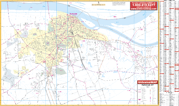
PADUCAH WALL MAP
2006
2nd edition The Paducah, KY Wall Map by Universal Map measures 50 W x 70 H. The map provides complete street detail and up-to-date cartography with new streets and changes. Printed in color, this laminated map is markable and washable. Streets are indexed on the face of the map. All of Paducah is covered with the following boundaries: North to the Ohio River; South to 2 miles south of Lone Oak; East to Exit 16 on I-24; West to 2 miles west of Paducah city limit. Insets for this map include the cities of Benton, Fulton, Mayfield, and Murray. Special features included are government buildings, airports, golf courses and country clubs, railroads, zip codes and zip code boundaries, shopping centers, water features, recreational parks, cemeteries, educational facilities, hospitals, post offices, city limits and annexations, longitude and latitude lines, mileage circles, fire and police stations, and miscellaneous points of interest.
Framing rails are available on top and bottom for easy wall mounting. | |
|