|
Wall Maps
- State, County & Cities - Louisiana
GeoMart
is rapidly expanding its on-line selection of wall maps. If you
don't find what you are looking for here, please give us a call at
800-248-6277. One of our customer service representative will be
happy to assist you in finding the right map for you.
Most Maps Usually Ship within 48 hours.
Laminated maps with the option of hanging
rails usually ship in 5 days
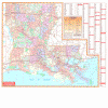 |
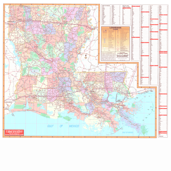
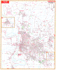
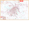
LOUISIANA WALL MAP
2005
3rd edition The Louisiana Wall Map by Universal Map illustrates parishes in different colors along with the parish name. The special features and data contained on this map are as follows: all state and federal highways, major waterways, towns, military installations, major airports, state universities, cities, state parks, wildlife areas, and various points of interest. This wall map measures 59 X 50 and is protected with a non-glare matte finish laminate making the map both markable and washable. Also, the map has been indexed on its face.
Framing rails are available on top and bottom for easy wall mounting. | |
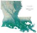 |
Raven Louisiana Map
The gentle rolling landscape of Louisiana is a
result of years of clays and silt being deposited by the
Mississippi River. Remarkable Lake Pontchartrain is the largest
estuary in southern Louisiana. Elevations are represented by
color, and this, in combination with our relief shading
technique, gives the map a 3-dimensional look.
Raven Louisiana Map Dimensions: 41"
x 45" (approx.)
Raven Louisiana Map Scale: 1:500,000 or 1" equals about 8 miles |
|
 |
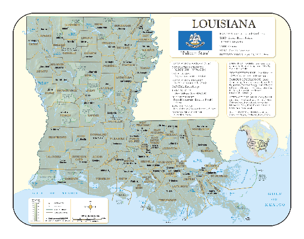
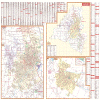
LOUISIANA SHADED RELIEF MAP
The Louisiana Shaded Relief Wall Map by Universal Map measures 46 W x 36 H and is a full-color, topographical wall map. Statistical information on this map includes historical, anecdotal, and geographical. There is also an elevation scale measured in meters and feet and a distance scale measured in miles and kilometers. Identifies county boundaries. Shows state flag. Lists state motto, bird, flower, and tree, plus total area, population and origin of name. Its heavy laminated surface can be used with waterbased pens. |
Click Price to Add to Cart | | Laminated |
$31.95 |
|
 |
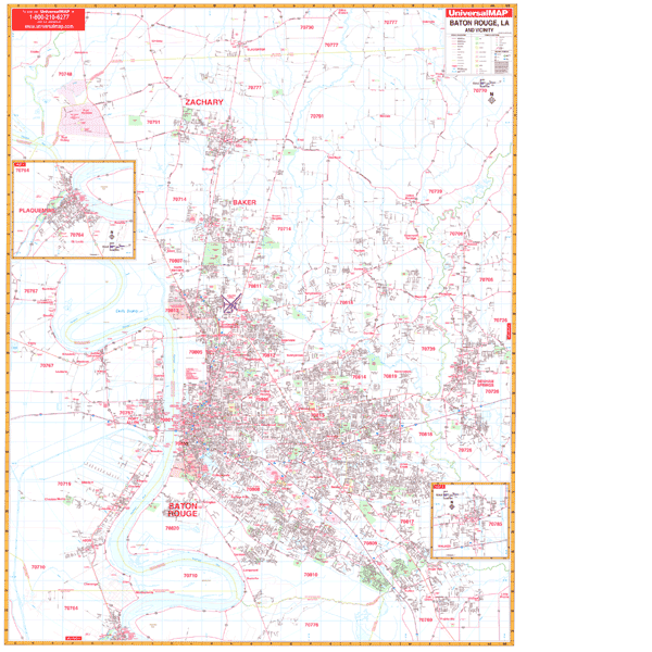
BATON ROUGE WALL MAP
2007 5th edition The Baton Rouge, LA Wall Map by Universal Map features complete street detail and up-to-date cartography. Streets are indexed in a separate book. Boundaries: North: Slaughter and Olive Branch; South: includes Prairieville and to Turnerville; East: Denham Springs: West: Riddle, Carey, Brusley, and Addis. Included are Insets for: Plaquamine and Walker. The full color reference is protected by a markable/washable
laminated surface. Framing rails are available on top and bottom for easy wall mounting.
46" x 64" | |
 |
LAFAYETTE WALL MAP
2006
2nd edition The Lafayette, LA Wall Map by Universal Map features an area of coverage that ranges as follows: North to Gloria Switch Road, SR98; South to Southside Regional Park; East to the Lafayette Regional Airport; and West to Scot. Insets for this map include the New Iberia and Lafayette Parish. The special features include government buildings, airports, golf courses and country clubs, railroads, longitude and latitude lines, zip codes and zip code boundaries, shopping centers, recreational parks, mileage circles, cemeteries, educational facilities, hospitals, post offices, city limits and annexations, fire and police stations, and miscellaneous points of interest. Measuring 64 W x 54 H, the map is protected by a laminate surface which is both markable and washable.
Framing rails are available on top and bottom for easy wall mounting. | |
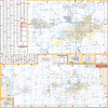 |
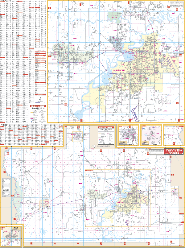
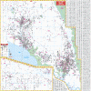
LAKE CHARLES WALL MAP
2008
2nd edition Measuring 50 x 67, the Lake Charles and Calcasieu Parish, LA Wall Map by Universal Map provides complete street detail with new streets and changes. This map has been printed in color with a markable and washable laminated surface. Streets are indexed on the face of the map. The area of coverage is as follows: Section 1--North 1 mile north of Sam Houston State Park; South to Lake Charles Regional Airport; East to Chenault International Airport; and West to the city limits of Sulphur. Section 2--Calcasieu Parish with the balance of streets. Insets for this map include Vinton, Dequincy, and Iowa. Also featured are government buildings, airports, golf courses and country clubs, railroads, longitude and latitude lines, zip codes and zip code boundaries, shopping centers, recreational parks, mileage circles, cemeteries, educational facilities, hospitals, post offices, city limits and annexations, fire and police stations, section/township/range lines, longitude and latitude lines, and miscellaneous points of interest.
Framing rails are available on top and bottom for easy wall mounting. | |
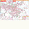 |
NEW ORLEANS WALL MAP-
2002
4th edition Measuring 64” W x 45” H, the New Orleans, LA Wall Map by Universal Map has added numerous new streets and changes in complete street detail at a scale of 1” = 2,080 feet. Protected by a markable
laminate surface. Framing rails are available on top and bottom for easy wall mounting. | |
 |
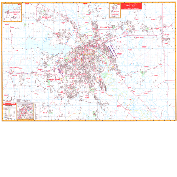
SHREVEPORT WALL MAP
2006
4th edition The Shreveport, LA Wall Map by Universal Map measures 64 x 46 and features complete street detail with the boundaries as follows: North to Blanchard; South to Wallace Lake and North Lake; East to Haughton; and West to Greenwood. Insets include Benton, Moorings and Downtown Area. Special features include educational institutions, government buildings, shopping centers, hospitals, airports, recreational parks, post offices, golf and country clubs, points of interest, city limits and annexations, railroads, mileage circles, water features, longitude and latitude lines, cemeteries, fire and police stations, zip codes and boundaries. Printed in color with a markable and washable laminated surface. Streets are indexed in a separate book.
Framing rails are available on top and bottom for easy wall mounting. | |
 |
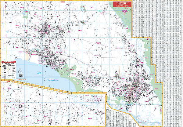
ST TAMMANY WALL MAP
2002
2nd edition The St. Tammany Parish, LA Wall Map by Universal Map has added numerous new streets and changes. Special features include government buildings, airports, golf courses and country clubs, railroads, longitude and latitude lines, zip codes and zip code boundaries, shopping centers, recreational parks, mileage circles, cemeteries, educational facilities, hospitals, post offices, city limits and annexations, fire and police stations, and miscellaneous points of interest. Measuring 54 H x 77 W, it is protected by a laminate surface which is both markable and washable. Also, indexing is on the face of the map.
Framing rails are available on top and bottom for easy wall mounting. | |
|