|
Wall Maps
- State, County & Cities - Massachusetts
GeoMart
is rapidly expanding its on-line selection of wall maps. If you
don't find what you are looking for here, please give us a call at
800-248-6277. One of our customer service representative will be
happy to assist you in finding the right map for you.
Most Maps Usually Ship within 48 hours.
Laminated maps with the option of hanging
rails usually ship in 5 days
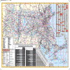 |
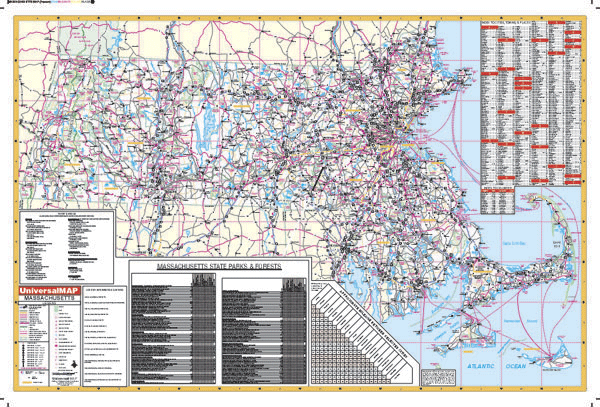
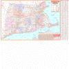
MASSACHUSETTS WALL MAP
2001 1st edition This Massachusetts Wall Map by Universal Map measures 60 W x 42 H and is printed in color. The map has a laminated surface which is both markable and washable. Indexing is provided on the face of the map. This wall map includes all state and federal highways, cities, major waterways, major airports, towns, state parks, wildlife areas, hospitals, military installations, and points of interest.
Framing rails are available on top and bottom for easy wall mounting. | |
 |
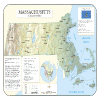
Raven MA, CT & RI Map
Our map of southern New England places three
historic states together. Elevations are represented by color,
and this, in combination with our relief shading technique,
gives the map a 3-dimensional look.
Raven MA, CT & RI Map Dimensions:
32" x 36" (approx.)
Raven MA, CT & RI Map Scale: 1:500,000 or 1" equals about 8
miles |
|
 |
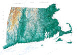
MASSACHUSETTS RELIEF MAP
The Massachusetts Shaded Relief Wall Map by Universal Map measures 48 W x 36 H and is a full-color, topographical wall map. There is an inset map of North America showing the relative position of the state. Included is geographical, historical, and anecdotal information about Maryland. Also provided with this map are the major cities, counties, national capital, state capital, county seats, and state and county boundaries. There is a distance scale calibrated in miles and kilometers, and identifies county boundaries. State facts include flag, motto, bird, flower, and tree, plus total area, population and origin of name. Its heavy laminated surface can be used with waterbased pens. |
Click Price to Add to Cart | | Laminated |
$31.95 |
|
 |
MASSACHUSETTS/ CONNECTICUT/ RHODE ISLAND WALL MAP
2006
2nd edition The Connecticut, Rhode Island, and Massachusetts Tri-state Area Wall Map by Universal Map is durably laminated allowing for a markable and washable surface. The map measures 66" x 42", and features a comprehensive index on its face. Also included are all highways, military installations, major airports, state parks, cities and towns, state universities, wild life areas, and points of interest. Framing rails are
available on top and bottom for easy wall mounting. | |
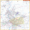 |
SPRINGFIELD WALL MAP
2002 1st edition The Springfield, MA Wall Map by Universal Map measures 68 W x 50 H, and includes complete street detail and up-to-date cartography with new streets and changes. Printed in color with a markable and washable laminated surface, the streets are indexed on the face of the map. The area of coverage includes North to Smith College in Northampton; South to MA-CT line; East to Springfield Reservoir in Ludlow; and West to Westfield State College. Provided insets: Downtown Springfield and Southwick. Includes all streets, airports, government buildings, post offices, cemeteries, fire and police stations, hospitals, shopping centers, educational facilities, railroads, water features, golf courses and country clubs, recreational parks, zip codes and boundaries, longitude and latitude lines, city limits and annexations, and points of interest.
Framing rails are available on top and bottom for easy wall mounting. | |
9
|