|
Wall Maps
- State, County & Cities- Maryland
GeoMart
is rapidly expanding its on-line selection of wall maps. If you
don't find what you are looking for here, please give us a call at
800-248-6277. One of our customer service representative will be
happy to assist you in finding the right map for you.
Most Maps Usually Ship within 48 hours.
Laminated maps with the option of hanging
rails usually ship in 5 days
 |
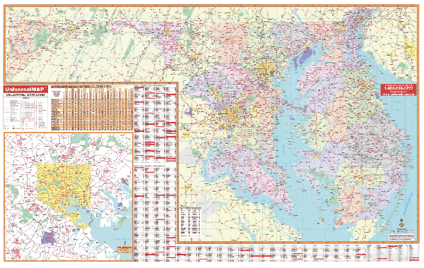
MARYLAND/DELAWARE WALL MAP
2005
2nd edition The Maryland and Delaware Wall Map by Universal Map measures 77 W x 50 H. This map provides a laminated surface making the map both markable and washable. Indexing is on the face of the map. Special features include a mileage chart between cities, indexing of counties and cities, and an inset of Baltimore. Other details provided are state and federal highways, major waterways, military installations, state universities, various points of interest, major airports, cities and towns, and state parks.
Framing rails are available on top and bottom for easy wall mounting. | |
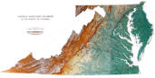 |
Raven VA, MD, DE & D.C. Map
This regional map is centered on the Chesapeake
Bay area. Elevations are represented by color, and this, in
combination with our relief shading technique, gives the map a
3-dimensional look.
Raven VA, MD, DE & D.C. Map
Dimensions: 34" x 65" (approx.)
Raven VA, MD, DE & D.C. Map Scale: 1:500,000 or 1" equals
about 8 miles |
|
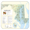 |
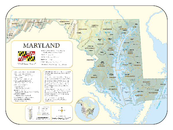
MARYLAND SHADED RELIEF MAP
The Maryland Shaded Relief Map by Universal Map illustrates the state full-color shaded relief map measuring 48 W x 36 H. There is an inset map of North America showing the relative position of the state. Included is geographical, historical, and anecdotal information about Maryland. Also provided with this map are the major cities, counties, national capital, state capital, county seats, and state and county boundaries. There is a distance scale calibrated in miles and kilometers, and identifies county boundaries. State facts include flag, motto, bird, flower, and tree, plus total area, population and origin of name. Its heavy laminated surface can be used with waterbased pens. |
Click Price to Add to Cart | | Laminated |
$31.95 |
|
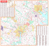 |
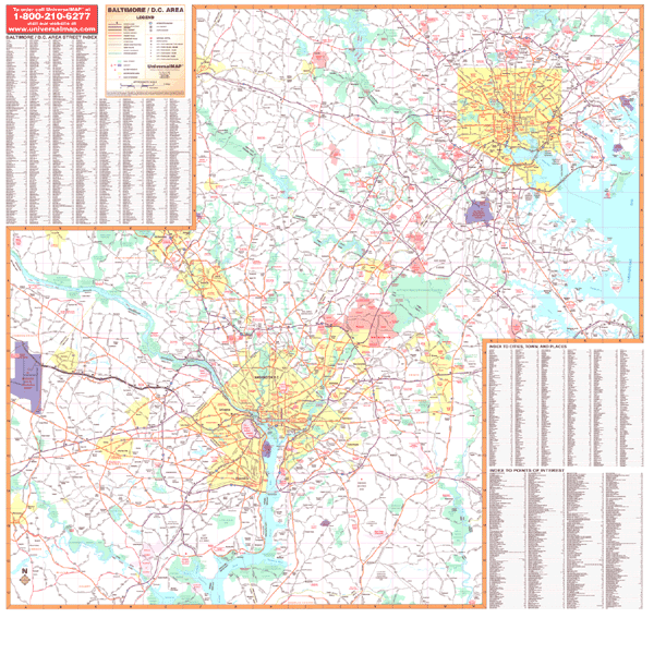
BALTIMORE AREA/WASHINGTON DC WALL MAP
2009
3rd edition The laminated surface of the Baltimore, MD and Washington, DC Wall Map by Universal Map allows the map to be marked on and wiped off. Special features included are all state and federal highways, major waterways, towns, military, and more.
Framing rails are available on top and bottom for easy wall mounting. | |
|