|
Wall Maps
- State, County & Cities - Michigan
GeoMart
is rapidly expanding its on-line selection of wall maps. If you
don't find what you are looking for here, please give us a call at
800-248-6277. One of our customer service representative will be
happy to assist you in finding the right map for you.
Most Maps Usually Ship within 48 hours.
Laminated maps with the option of hanging
rails usually ship in 5 days
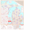 |
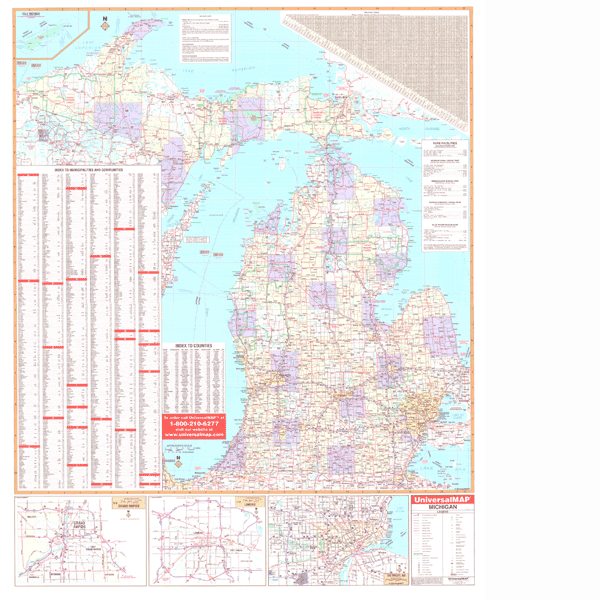
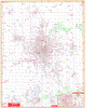
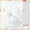
MICHIGAN WALL MAP
2004 3rd edition The Michigan Wall Map by Universal Map features color-coded counties, a mileage chart between major cities, durable lamination that is both markable and washable, indexing on the face of the map, and measurements of 54 W x 68 H. Data, details, and information included with this map are all state and federal highways, major waterways, state universities, military installations, state police posts, major airports, state and national parks, county names and boundaries, cities and towns, hospitals, wild life areas, and points of interest.
Framing rails are available on top and bottom for easy wall mounting. | |
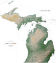 |
Raven Maine Map
The state of Michigan touches on four of the five
Great Lakes, and the Upper and Lower Peninsula are connected by
the five mile long Mackinac Bridge. Its geographic location has
enabled Michigan to become one of the leading industrial states.
Elevations are represented by color, and this, in combination
with our relief shading technique, gives the map a 3-dimensional
look.
Raven Michigan Map Dimensions: 40" x
45" (approx.)
Raven Michigan Map Scale: 1:700,000 or 1" equals about 11 miles |
|
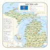 |
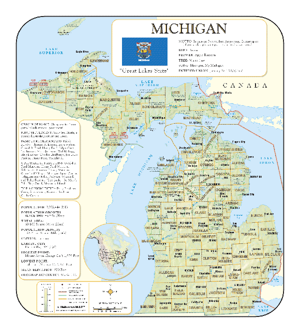
MICHIGAN SHADED RELIEF MAP
The Michigan Shaded Relief Wall Map by Universal Map measures 36 W x 40 H and is a full-color, topographical wall map. There is an inset map of North America showing the relative position of the state. Included is geographical, historical, and anecdotal information about Maryland. Also provided with this map are the major cities, counties, national capital, state capital, county seats, and state and county boundaries. There is a distance scale calibrated in miles and kilometers, and identifies county boundaries. State facts include flag, motto, bird, flower, and tree, plus total area, population and origin of name. Its heavy laminated surface can be used with waterbased pens. |
Click Price to Add to Cart | | Laminated |
$31.95 |
|
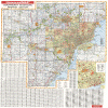 |
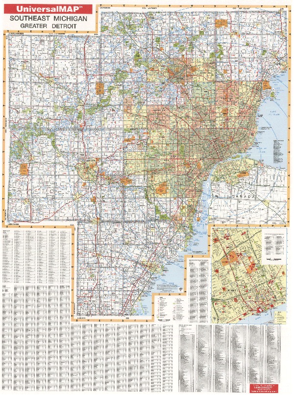
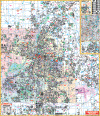
MICHIGAN SOUTHEAST WALL MAP
2009 3rd edition The Southeast Michigan Wall Map by Universal Map shows all six Southeast Michigan counties: Livingston, Macomb, Monroe, Oakland, Washtenaw, and Wayne. Special features include all national interstates, US and state highways as well as all the principal county and municipal roads in detail. Other details found here are airports, government buildings, shopping centers, golf courses and country clubs, mileage circles, city limits and annexations, railroads, fire and police stations, hospitals, block numbers, educational facilities, zip codes and boundaries, recreational parks, water features, longitude and latitude lines, and other assorted points of interest, plus a complete index. Measuring 46 x 64, it is protected by a markable laminate.
Framing rails on top and bottom for easy wall mounting. | |
 |
ANN ARBOR/WASHTENAW COUNTY WALL MAP
2008
4th edition The Ann Arbor & Washtenaw County, MI Wall Map by Universal Map features complete street detail with the boundaries as follows: North to Oakland and Livingston County Line; South to Lenawee County Line including Milan; East
to
Wayne County Line; and West to Jackson County Line. Also included are
educational facilities, government buildings, shopping centers, hospitals, zip
codes and boundaries, post offices, fire and police stations, airports,
cemeteries, recreational parks, golf and country clubs, points of interest, city
limits and annexations, railroads, mileage circles, water features, block
numbers, longitude/latitude lines, school districts, range, township and section
lines. Measuring 64W x 54H, it is protected with a laminate finish which is both
markable and washable. In addition, a separate index book is included. Framing
rails are available on top and bottom for easy wall mounting. | |
 |
BENTON HARBOR/BERRIEN COUNTY WALL MAP
2006
2nd edition The Benton Harbor/Berrien County, MI Wall Map by Universal Map features complete street detail with the boundaries as follows: North to the Van Buren County line; South to the Indiana state line; East to the Cass County line; and West to Lake Michigan. An inset map shows Niles, Benton Harbor, and St. Joseph. Also included are government buildings, airports, golf courses and country clubs, railroads, longitude and latitude lines, zip codes and boundaries, shopping centers, recreational parks, mileage circles, cemeteries, educational facilities, hospitals, post offices, city limits and annexations, fire and police stations, and miscellaneous points of interest, plus a complete index. Measuring 54 W x 60 H, it is protected by a laminate surface which is both markable and washable.
Framing rails are available on top and bottom for easy wall mounting. | |
 |
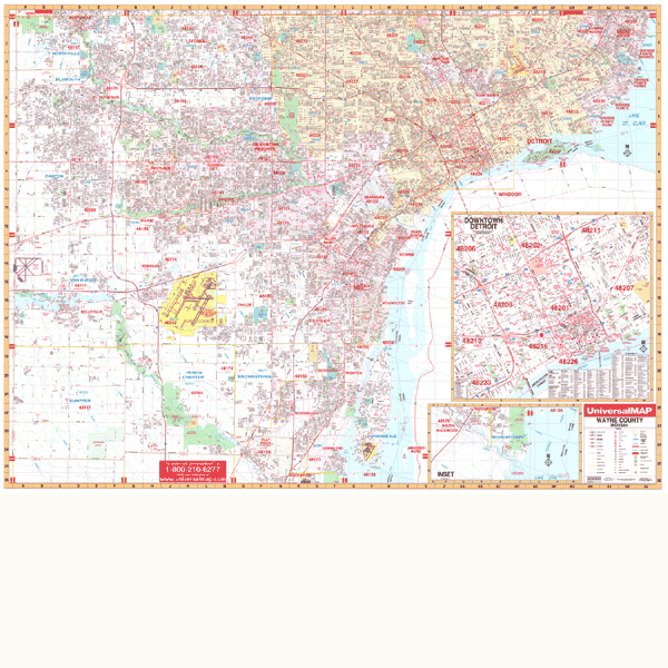
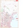
DETROIT WALL MAP
2009 4th edition The Detroit and Wayne County, MI Wall Map by Universal Map measures 70 W x 54 H and provides up-to-date cartography in complete street detail including all new streets and changes. The map has been printed in color with a markable and washable laminated surface. Streets have been indexed in a separate book. The map includes an inset map of downtown Detroit. Also included are government buildings, airports, golf courses and country clubs, railroads, water features, zip codes and zip code boundaries, shopping centers, recreational parks, mileage circles, cemeteries, educational facilities, hospitals, post offices, city limits and annexations, fire and police stations, section/township/range lines, longitude and latitude lines, and miscellaneous points of interest. Special features on the map include a grid to section, township and range is compatible with existing realtor grids, including the Realtor MLS numbers.
Framing rails are available on top and bottom for easy wall mounting. | |
 |
FLINT/GENESEE COUNTY WALL MAP-2008
5th edition The Genessee County, MI Wall Map by Universal Map measuring 54 W x 70 H, complete with a separate index book. Complete street detail and up-to-date cartography are provided with new streets and changes. This map is printed in color with a laminated surface which is both markable and washable. There is also an inset map of Downtown Flint. Also illustrated are government buildings, airports, golf courses and country clubs, railroads, zip codes and zip code boundaries, shopping centers, water features, recreational parks, cemeteries, educational facilities, hospitals, post offices, city limits and annexations, longitude and latitude lines, section/township/range lines, block numbers, mileage circles, fire and police stations, and miscellaneous points of interest.
Framing rails are available on top and bottom for easy wall mounting. | |
 |
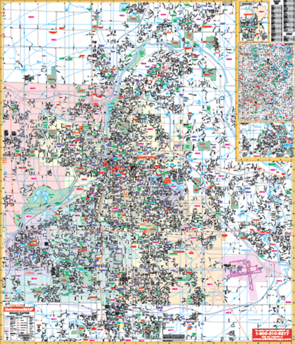
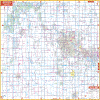
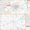
GRAND RAPIDS WALL MAP
2006 3rd edition The Grand Rapids, MI Wall Map by Universal Map shows complete street detail with boundaries as follows: North to 10 Mile Rd including Rockford; South to 76th Street; East to Cannonsburg and Cascade including Kent County International Airport; and West to the Kent County line. Also featured are government buildings, airports, golf courses and country clubs, railroads, longitude and latitude lines, zip codes and zip code boundaries, shopping centers, recreational parks, mileage circles, cemeteries, educational facilities, hospitals, post offices, city limits and annexations, fire and police stations, and miscellaneous points of interest. This wall map measures 46 W x 64 H and is protected by a laminate surface which is both markable and washable. A separate indexed book is provided.
Framing rails are available on top and bottom for easy wall mounting. | |
 |
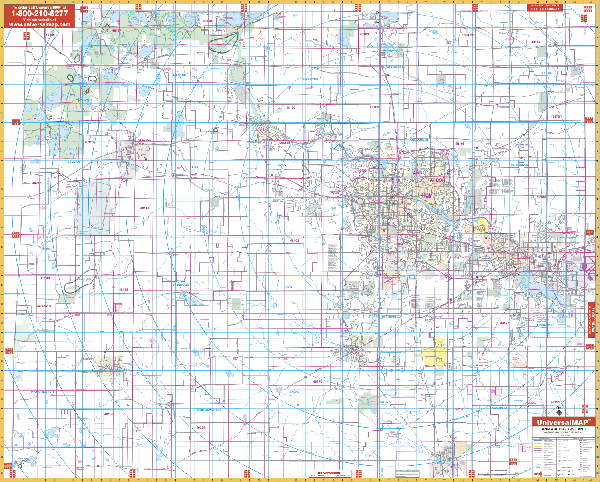
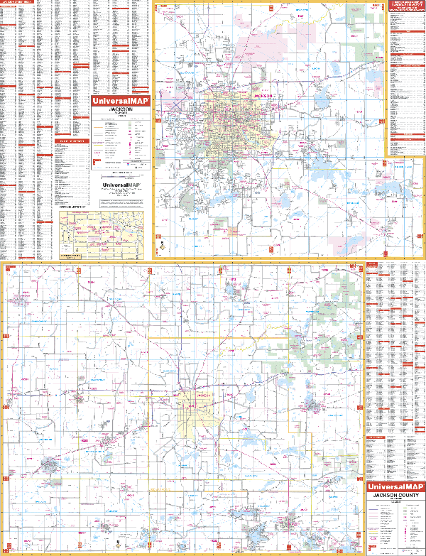
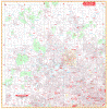
JACKSON/JACKSON COUNTY WALL MAP
2005
2nd edition The Jackson and Jackson County, MI Wall Map by Universal Map measures 50 x 63. Provided with this map is up-to-date cartography with new streets and changes. This map has been printed in color with a markable and washable laminated surface. Streets are indexed on the face of the map. The area of coverage is as follows: Section One which is the city of Jackson ranges North to the State Prison Farm; Root Station Road; South to Jackson Community College; Crouch Road and Stoney Lake Road; East to Grass Lake Township, Waterloo Recreation Area; and West to Reynolds Municipal Airport and Hickory Hills Golf Course. Section Two, which is Jackson County, provides a Jackson County area map in street detail and an inset of the Downtown Jackson traffic pattern. Other details and data found with this map include all streets and highways, post offices, hospitals, water features, recreational parks, mileage circles, city limits and annexations, cemeteries, shopping centers, block numbers, golf courses and country clubs, zip codes and zip code boundaries, airports and railroads, government buildings, fire and police stations, educational facilities, longitude and latitude lines, section/township/range lines, and other points of interest.
Framing rails are available on top and bottom for easy wall mounting. | |
 |
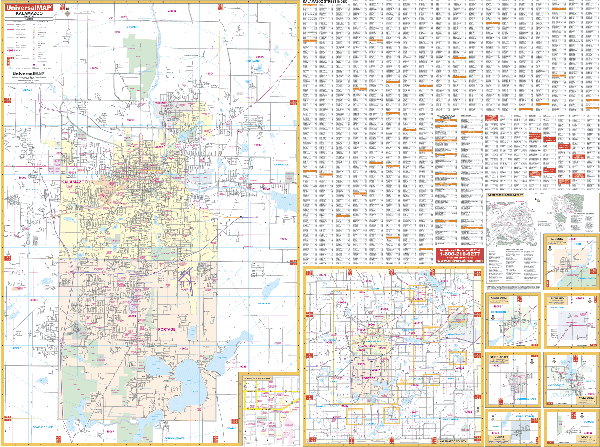
KALAMAZOO WALL MAP
2007
3rd edition The Kalamazoo, MI Wall Map by Universal Map measures 64 x 46, and offers complete street detail and up-to-date cartography with over 350 new streets and changes. The map is printed in color with a markable and washable laminated surface. Indexing for this product is on the face of the map. The map's area of coverage ranges North to Cooper Center; South to Schoolcraft; East to Richland and Comstock; and West to Alamo and Oshtemo and Texas townships. Insets for this map are Augusta, Galesburg, Richland, Schoolcraft, Vicksburg, Climax, Scotts, Kalamazoo County, Downtown Kalamazoo, and Western Michigan University. Other details and data found with this map include all streets and highways, post offices, hospitals, water features, recreational parks, mileage circles, city limits and annexations, cemeteries, shopping centers, block numbers, golf courses and country clubs, zip codes and zip code boundaries, airports and railroads, government buildings, fire and police stations, educational facilities, section/township/range lines, and other points of interest.
Framing rails are available on top and bottom for easy wall mounting. | |
 |
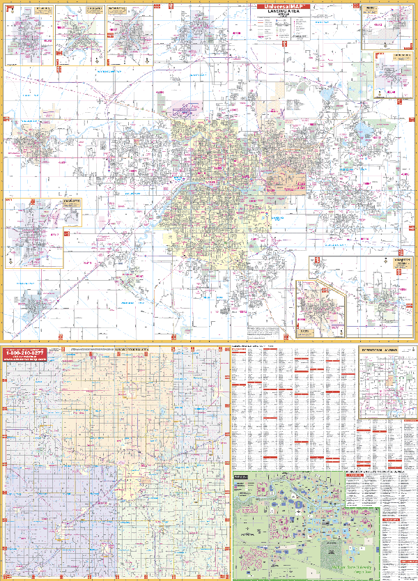
LANSING WALL MAP
2008 5th edition The Lansing, MI Wall Map by Universal Map measures 54 W x 74 H and features complete street detail with the boundaries as follows: North to include DeWitt; South to include Potterville; East to Meridian Road; and West to include Grand Ledge. Map Insets highlight Eaton Rapids, Laingsburg, Grand Ledge, Charlotte, Mason, Perry, Portland, St. Johns, Williamston, Michigan State University, and Downtown Lansing. A new addition for this map is a regional map of Eaton, Ingahm, and Clinton Counties with a portion of Ionia and Shiawassee Counties. Also included are railroads, educational facilities, hospitals, government buildings, golf and country clubs, zip codes and boundaries, post offices, fire and police stations, shopping centers, airports, cemeteries, recreational parks, points of interest, city limits and annexations, water features, railroads, township names, range/twp/section lines, longitude and latitude lines, and block numbers. The map is protected with a durable, laminated finish which is both markable and washable. Indexing is provided in a separate book.
Framing rails are available on top and bottom for easy wall mounting. | |
 |
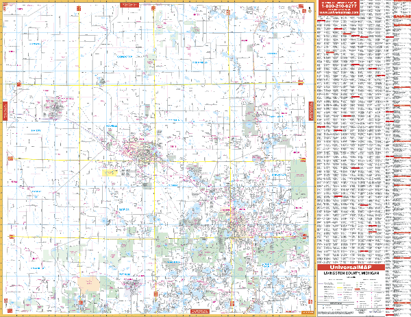
LIVINGSTON COUNTY WALL MAP-
2008 4th edition The Livingston County, MI Wall Map by Universal Map shows complete street detail of the entire county. Also featured are educational facilities, government buildings, shopping centers, hospitals, zip codes and boundaries, post offices, fire and police stations, airports, cemeteries, recreational parks, golf and country clubs, points of interest, city limits and annexations, railroads, mileage circles, water features, range, township and section lines, block numbers, and longitude/ latitude lines, plus a complete street index. Measuring 67 W x 54 H, it is printed in color with a markable and washable laminated surface.
Framing rails are available on top and bottom for easy wall mounting. | |
 |
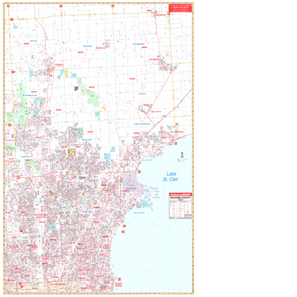
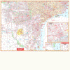
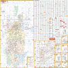
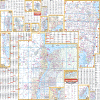
MACOMB COUNTY WALL MAP
2009 5th edition The Macomb County, MI Wall Map by Universal Map includes the cities and towns of Armada, Center Line, East Pointe, Fraser, Memphis, Mt. Clemens, New Baltimore, New Haven, Richmond, Romero, Roseville, St. Clair Shores, Sterling Heights, Utica and Warren. This map has added approximately 900 new streets and changes. An inset map includes SE Michigan, North to Flint, West to Lansing, South to Toledo, and East to Port Huron. Also included are government buildings, shopping centers, airports, golf courses and country clubs, mileage circles, longitude and latitude lines, post offices, hospitals, cemeteries, railroads, block numbers, educational facilities, fire and police stations, zip codes and their boundaries, recreational parks, water features, city limits and annexations, section/township/ranges, and points of interest. Measuring 54 H X 77 W, it is laminated, making it both markable and washable. A separate index book is provided.
Framing rails are available on top and bottom for easy wall mounting. | |
 |
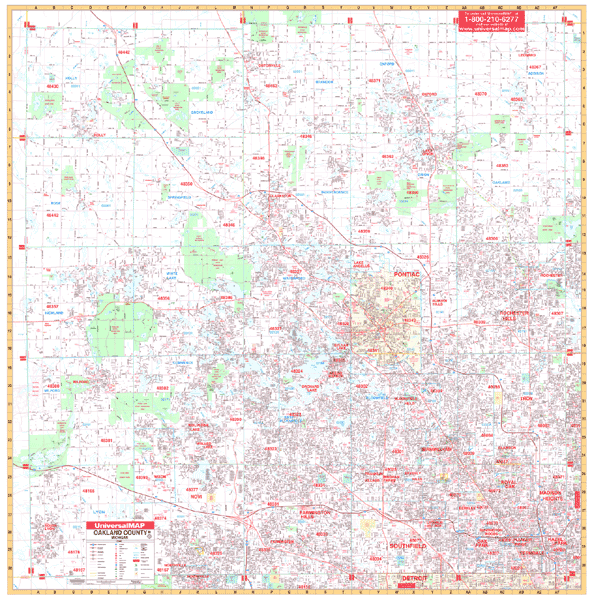
OAKLAND COUNTY WALL MAP
2009 5th edition The Oakland County, MI Wall Map by Universal Map contains up-to-date cartography in complete street detail with over 1,150 new streets and changes. The map is protected with a laminated finish, making it markable and washable. Street indexing for this wall map appears in a separate book, and the map measures 5' 4 x 5' 4. Other highlights are post offices, hospitals, water features, recreational parks, mileage circles, city limits and annexations, cemeteries, shopping centers, block numbers, golf courses and country clubs, zip codes and zip code boundaries, airports and railroads, government buildings, fire and police stations, educational facilities, longitude and latitude lines, section/township/range lines, and other points of interest. As special feature indicates that grid to section, township and range is compatible with existing realtor grids, including realtor area numbers.
Framing rails are available on top and bottom for easy wall mounting. | |
 |
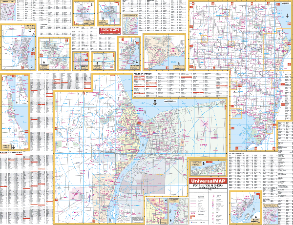
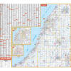
PORT HURON WALL MAP
2007
3rd edition The Port Huron and St. Clair County, MI Wall Map by Universal Map provides up-to-date cartography in complete street detail. Included are post offices, hospitals, water features, recreational parks, mileage circles, city limits and annexations, cemeteries, shopping centers, block numbers, golf courses and country clubs, zip codes and zip code boundaries, airports and railroads, government buildings, fire and police stations, educational facilities, longitude and latitude lines, section/township/range lines, and other points of interest. This map measures 68 x 50 and is indexed on the map itself. The area of coverage has two sections. Section One, Port Huron, includes Port Huron, St. Clair, and Ontario, Canada. The map ranges North to include Ft. Gratiot; South to include Marysville; East to include Sarnia; and West to Crystal Lake, one mile past Wadhams Road. It includes insets of Algonac, Downtown Algonac, Bright's Grove, Capac, Emmett, Lakeport, Marine City, Downtown Marine City, Memphis, New Baltimore, Port Huron/Sarnia, Ontario, Downtwon Port Huron, Downtown Sarnia, Richmond, St. Clair, Downtown St. Clair, Yale, Burtchville, and Worth. Section Two, St. Clair County, includes all of St. Clair County.
Framing rails are available on top and bottom for easy wall mounting. | |
|