|
Wall Maps
- State, County & Cities - Minnesota
GeoMart
is rapidly expanding its on-line selection of wall maps. If you
don't find what you are looking for here, please give us a call at
800-248-6277. One of our customer service representative will be
happy to assist you in finding the right map for you.
Most Maps Usually Ship within 48 hours.
Laminated maps with the option of hanging
rails usually ship in 5 days
 |
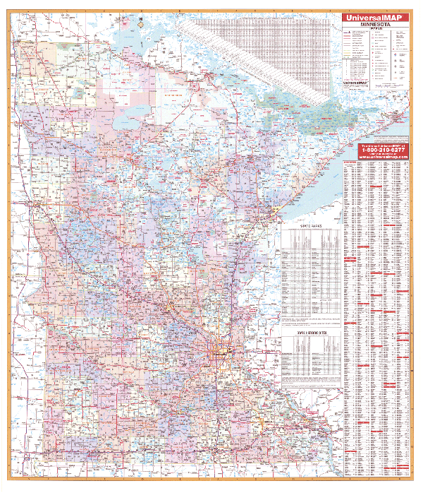
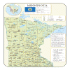
MINNESOTA WALL MAP
2005
2nd edition The Minnesota Wall Map by Universal Map measures 54” x 63” and includes up-to-date cartography at a scale of 1” = 8.2 miles. Printed in color with a markable and washable laminated surface. Hanging rails are
available. Cities and counties are indexed on the face of the map. Special features include color-coded counties and a mileage chart between major cities. Details include all state highways, all federal highways, secondary roads, cities/towns, airports, and more. | |
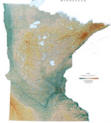 |
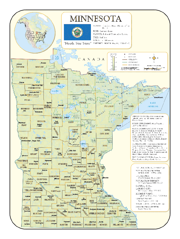
Raven Minnesota Map
Most of the state was formed
into gently rolling plains when glaciers moved over the land
during the last Ice Age. Minnesota is known for being the Land
of 10,000 Lakes. Elevations are represented by color, and this,
in combination with our relief shading technique, gives the map
a 3-dimensional look.Raven
Minnesota Map Dimensions: 41" x 49" (approx.)
Raven Minnesota Map Scale: 1:600,000 or 1" equals about 10 miles |
|
 |
MINNESOTA SHADED RELIEF MAP
The Minnesota Shaded Relief Wall Map by Universal Map measures 36 W x 48 H and is a full-color, topographical wall map. There is an inset map of North America showing the relative position of the state. Included is geographical, historical, and anecdotal information about Maryland. Also provided with this map are the major cities, counties, national capital, state capital, county seats, and state and county boundaries. There is a distance scale calibrated in miles and kilometers, and identifies county boundaries. State facts include flag, motto, bird, flower, and tree, plus total area, population and origin of name. Its heavy laminated surface can be used with waterbased pens. |
Click Price to Add to Cart | | Laminated |
$31.95 |
|
|