|
Wall Maps
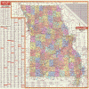
- State, County & Cities - Missouri
GeoMart
is rapidly expanding its on-line selection of wall maps. If you
don't find what you are looking for here, please give us a call at
800-248-6277. One of our customer service representative will be
happy to assist you in finding the right map for you.
Most Maps Usually Ship within 48 hours.
Laminated maps with the option of hanging
rails usually ship in 5 days
 |
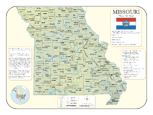
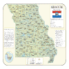
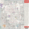
MISSOURI WALL MAP
2004
2nd edition Measuring 66 W x 49 H, the Missouri Wall Map by Universal Map includes color coded counties and a mileage chart. Other date includes all state highways, all federal highways, rest areas, major airports, major waterways, hospitals, state universities, military installations, police stations, schools, toll ferries, golf courses, state and national parks, wildlife areas, cities and towns with their approximate populations, and other points of interest, plus a complete index. Protected by a markable laminated surface;
Framing rails are available on top and bottom for easy wall mounting. | |
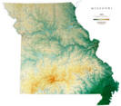 |
Raven Missouri Map
From the Boot Heel in the southeast to the
Missouri River where it enters the state, Missouri is a land of
plains, rich farmland, low mountains, caves, plateaus, and
springs, rivers, and lakes. Elevations are represented by color,
and this, in combination with our relief shading technique,
gives the map a 3-dimensional look.
Raven Missouri Map Dimensions: 42" x
46" (approx.)
Raven Missouri Map Scale: 1:550,000 or 1" equals about 8 1/2
miles |
|
 |
MISSOURI SHADED RELIEF MAP
The Missouri Shaded Relief Wall Map by Universal Map measures 48 W x 36 H and is a full-color, topographical wall map. There is an inset map of North America showing the relative position of the state. Included is geographical, historical, and anecdotal information about Maryland. Also provided with this map are the major cities, counties, national capital, state capital, county seats, and state and county boundaries. There is a distance scale calibrated in miles and kilometers, and identifies county boundaries. State facts include flag, motto, bird, flower, and tree, plus total area, population and origin of name. Its heavy laminated surface can be used with waterbased pens. |
Click Price to Add to Cart | | Laminated |
$31.95 |
|
 |
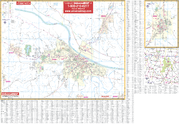
JEFFERSON CITY WALL MAP
2000 1st edition The Jefferson City/Fulton, MO Wall Map by Universal Map provides complete street detail with the boundaries as follows: North to include Mykee; South to (but not including) Wardsville; East to (but not including) Taos; and West to include Lohman. Insets are: Missouri state map, localized area map and city of Fulton. Also featured are educational facilities, government buildings, shopping centers, hospitals, zip codes and boundaries, post offices, fire and police stations, airports, cemeteries, recreational parks golf and country clubs, points of interest, city limits and Annexations, railroads, mileage circles, water features, range markers, township and section lines, block numbers, and longitude/ latitude lines, plus a comprehensive index The map is protected with a laminate finish, which is both markable and washable.
Framing rails are available on top and bottom for easy wall mounting.
54" x 40" | |
 |
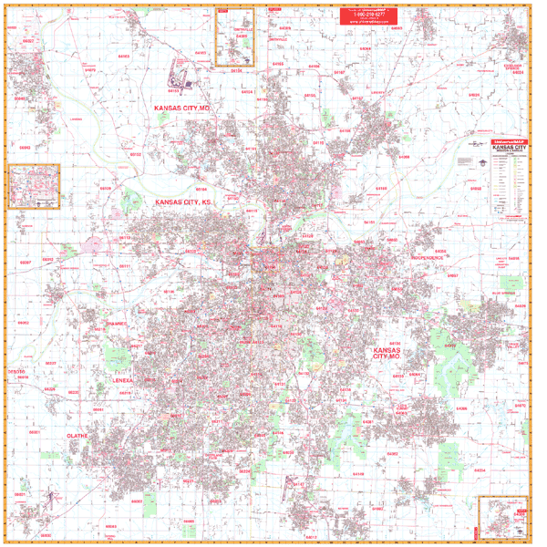
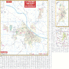
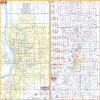
KANSAS CITY WALL MAP
2007
3rd edition The Kansas City, MO/KS Wall Map by Universal Map measures 69 W x 70 H and is indexed in a separate book. The map provides complete street detail and up-to-date cartography with new streets and changes. The map is printed in color with a markable and washable laminated surface. The area of coverage ranges North to include Platte City, MO, and most of Kearney, MO: South to include Gardner, KS; Belton, MO; and Raymore, MO: East to the eastern limit of Independence, MO and the Clay/Ray County lines: West to include Leavenworth, KS; and Gardner, KS. Insets for this map include Pleasant Hill, MO; Smithville, MO; and downtown Kansas City, MO. Other information includes all streets and highways, government buildings, airports, golf courses and country clubs, railroads, zip codes and zip code boundaries, shopping centers, water features, recreational parks, cemeteries, educational facilities, hospitals, post offices, city limits and annexations, longitude and latitude lines, section/township/range lines, mileage circles, fire and police stations, and miscellaneous points of interest.
Framing rails are available on top and bottom for easy wall mounting. | |
 |
KANSAS CITY/VICINITY WALL MAP
2007
2nd edition The Kansas City, KS/MO Vicinity Wall Map features extensive coverage of portions of 15 surrounding counties. Measuring 64” x 54, it includes colorful, up-to-date cartography, and is protected by a markable, washable laminated surface. Coverage includes urban and suburban Kansas City, KS/MO, with all of the following counties: Atchison, Buchanan, Clay, Clinton, Douglas, Jackson, Johnson, Jefferson, Leavenworth, and Platte, with portions of Brown, Shawnee, Doniphan, Caldwell, and Cass.
Framing rails are available on top and bottom. Excellent source for routing or planning. | |
 |
SPRINGFIELD WALL MAP
1999 1st edition The Springfield, MO Wall Map by Universal Map measures 46 x 54 and shows complete street detail with the boundaries as follows: North to two miles north of I-44, including Valley Water Mill; South to James River Road, including Battlefield and Lake Springfield; East to two miles east of State Route 65; and West to include Springfield-Branson Regional Airport and Deer Lake Golf Course. The map inset contains the city of Nixa. Also included are educational facilities, government buildings, shopping centers, hospitals, zip codes and boundaries, post offices, fire and police stations, airports, cemeteries, recreational parks, golf and country clubs.
Framing rails are available on top and bottom for easy wall mounting. | |
 |
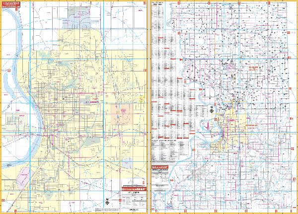
ST JOSEPH WALL MAP
2007
2nd edition The St. Joseph and Andrew & Buchanan Counties, MO Wall Map by Universal Map measures 67 W x 50 H. This map provides up-to-date cartography in complete street detail and is protected with a markable and washable laminated surface. Streets are indexed on the face of the map. The area of coverage ranges for Section I (St. Joseph): North to include Country Club Village; South to the city limits of St. Joseph; East to Riverside Road; and West to the town of Elwood. Section II includes Andrew and Buchanan Counties. Other data includes all streets and highways, government buildings, airports, golf courses and country clubs, railroads, longitude and latitude lines, zip codes and zip code boundaries, shopping centers, recreational parks, mileage circles, cemeteries, educational facilities, hospitals, post offices, city limits and annexations, fire and police stations, section/township/range lines, longitude and latitude lines, and miscellaneous points of interest.
Framing rails are available on top and bottom for easy wall mounting. | |
 |
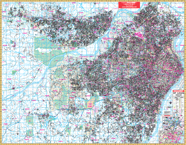
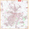
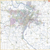
ST LOUIS MISSOURI WALL MAP
2005
2nd edition The
St. Louis, Missouri Wall Map is the 2005 edition publication by Universal Map.
Measures 76" W x 60" H and provides complete street detail with up-to-date
cartography and all new streets and changes. The streets are indexed in a
separate book. Printed in color on a laminated surface which is both markable
and washable. The area of coverage includes all of St. Louis with the following
borders: North to St. Paul and all of St. Charles; South to Arnold; East to the
Mississippi River;
West to Wentzville. There is also an inset map of Downtown St. Louis. Special
features, data, and details: all streets and highways, government buildings,
airports, golf courses and country clubs, railroads, longitude and latitude
lines, block numbers, shopping centers, recreation parks, mileage circles,
cemeteries, educational facilities, hospitals, post offices, city limits and
annexations, block numbers, longitude and latitude lines, township names, water
features, fire and police stations, fire district lines, zip codes and
boundaries, and miscellaneous points of interest.
| |
 |
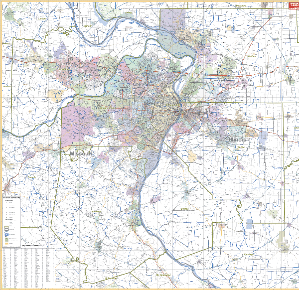
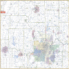
ST LOUIS/VICINITY MISSOURI WALL MAP
2005 1st edition The St. Louis, MO Vicinity Wall Map measures 57” W x 54” H. It contains up-to-date, full-color cartography at a scale of 1”=7,400’, and is indexed on the face of the map. Covers urban/suburban St. Louis with all of St. Louis, Jefferson, and St. Charles Co’s with portions of Franklin and Lincoln Co’s in MO, all of Madison, St. Clair and Monroe Counties, portions of Randolph, Washington, and Clinton Counties in Illinois. Protected with a markable and washable laminated surface, complete with
Framing rails are available on top and bottom. Excellent source for routing or planning. | |
|