|
Wall Maps
- State, County & Cities - Mississippi
GeoMart
is rapidly expanding its on-line selection of wall maps. If you
don't find what you are looking for here, please give us a call at
800-248-6277. One of our customer service representative will be
happy to assist you in finding the right map for you.
Most Maps Usually Ship within 48 hours.
Laminated maps with the option of hanging
rails usually ship in 5 days
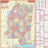 |
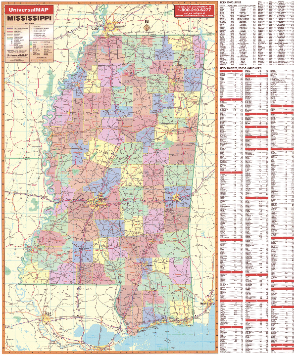
MISSISSIPPI WALL MAP
2006
3rd edition The Mississippi Wall Map by Universal Map offers color coded counties and a durable laminated surface that is both markable and washable. The map is indexed on the face and measures 54 W x 60 H. Other features include all state highways, all federal highways, major waterways, state universities, airports, state and national parks, points of interest, cities and towns, hospitals, wildlife areas, and rest areas.
Framing rails are available on top and bottom for easy wall mounting. | |
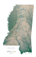 |
Raven Mississippi Map
Between the winding Mississippi and Yazoo rivers
lies a fertile delta, and east of the Yazoo are the Pearl, the
Big Black, and the Pascagoula River drainages. The sandy hills
of the northeast give way to pine woods, prairie, and finally
the Gulf Coast. Elevations are represented by color, and this,
in combination with our relief shading technique, gives the map
a 3-dimensional look.
Raven Mississippi Map Dimensions:
32" x 48" (approx.)
Raven Mississippi Map Scale: 1:500,000 or 1" equals about 8
miles |
|
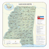 |
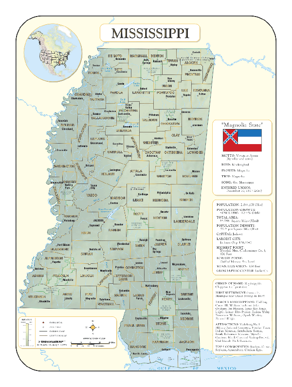
MISSISSIPPI SHADED RELIEF MAP
The Mississippi Shaded Relief Wall Map by Universal Map measures 36 W x 48 H and is a full-color, topographical wall map. There is an inset map of North America showing the relative position of the state. Included is geographical, historical, and anecdotal information about Maryland. Also provided with this map are the major cities, counties, national capital, state capital, county seats, and state and county boundaries. There is a distance scale calibrated in miles and kilometers, and identifies county boundaries. State facts include flag, motto, bird, flower, and tree, plus total area, population and origin of name. Its heavy laminated surface can be used with waterbased pens.
Framing rails are available on top and bottom for easy wall mounting. |
Click Price to Add to Cart | | Laminated |
$31.95 |
|
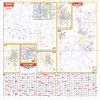 |
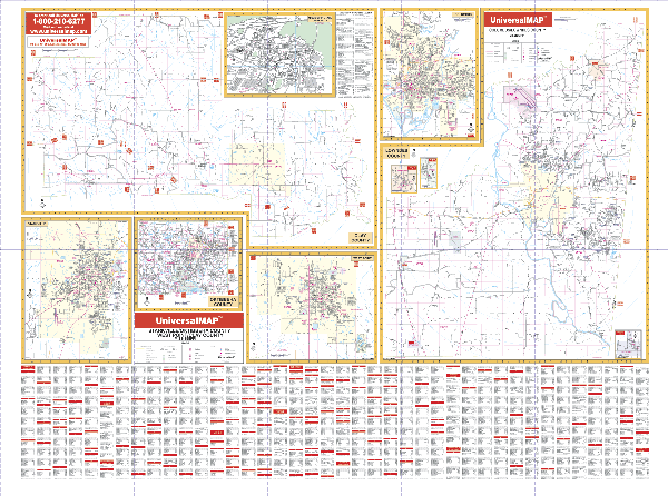
COLUMBUS/STARKSVILLE/WEST POINT WALL MAP
2006
2nd edition The Clay, Lowndes, and Oktibbeha Counties, MS Wall Map by Universal Map is a 50 x 72 inch wall map providing up-to-date cartography in complete street detail. This map is printed in color with a markable and washable laminated surface.
Other details include government buildings, zip codes and boundaries, airports, golf courses and country clubs, railroads, post offices, shopping centers, cemeteries, city limits and annexations, educational facilities, fire and police stations, hospitals, water features, mileage circles, and points of interest. The area of coverage ranges as follows: Section One--Clay County with a city inset of West Point; Section Two--Lowndes County with a city inset of Columbus and insets of Artesia, Crawford, and Caledonia; Section Three--Oktibbeha County and the city of Starksville. It also includes an inset map of Mississippi State University.
Framing rails are available on top and bottom for easy wall mounting. | |
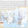 |
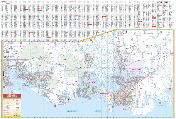
MISSISSIPPI GULF COAST WALL MAP
2007 5th edition The Mississippi Gulf Coast Wall Map by Universal Map has added new streets and changes. This commercial Wall Map will show all of the Mississippi Gulf Coastline in complete street detail with the following boundaries: North to 6 miles north of Interstate 10 including Lyman and Colltown, and Coalville; South to Mississippi Sound; East to the Alabama/Mississippi State line; West to the Stennis International Airport, including Bayside Park, Clermont Harbor, Waveland, and Diamondhead in Hancock County. Inset is a Mississippi state map with index and an Casinos Area Locator map. Other data includes all streets and highways, government buildings, zip codes and boundaries, airports, golf courses and country clubs, railroads, post offices, shopping centers, cemeteries, city limits and annexations, educational facilities, fire and police stations, hospitals, water features, mileage circles, and points of interest. Measuring 76 W x 54 H, the map has been protected with a markable laminate finish. Indexing has been provided in a separate book.
Framing rails are available on top and bottom for easy wall mounting. | |
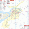 |
VICKSBURG WALL MAP
2001 1st edition The Vicksburg, MS Wall Map by Universal Map ranges North to the intersection of US 61 and Washington St; South to the Redbone, Vicksburg Municipal Airport; East to the Mt. Alban Rd exit of I-20; and West to the Mississippi River. This map measures 42 W x 62 H. Its laminated surface provides the ability to mark on the map and wash it off. The street index appears on the face of the map. The area of coverage for this map ranges as follows: North to the
intersection of US 61 and Washington St.; South to the Redbone, Vicksburg Municipal Airport; East to the Mt. Alban Rd. exit of I-20; and West to the Mississippi River. Other details include government buildings, zip codes and boundaries, airports, golf courses and country clubs, railroads, post offices, shopping centers, cemeteries, city limits and annexations, educational facilities, fire and police stations, hospitals, water features, mileage circles, and points of interest.
Framing rails are available on top and bottom for easy wall mounting. | |
|