|
Wall Maps
- State, County & Cities - North Carolina
GeoMart
is rapidly expanding its on-line selection of wall maps. If you
don't find what you are looking for here, please give us a call at
800-248-6277. One of our customer service representative will be
happy to assist you in finding the right map for you.
Most Maps Usually Ship within 48 hours.
Laminated maps with the option of hanging
rails usually ship in 5 days
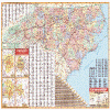 |
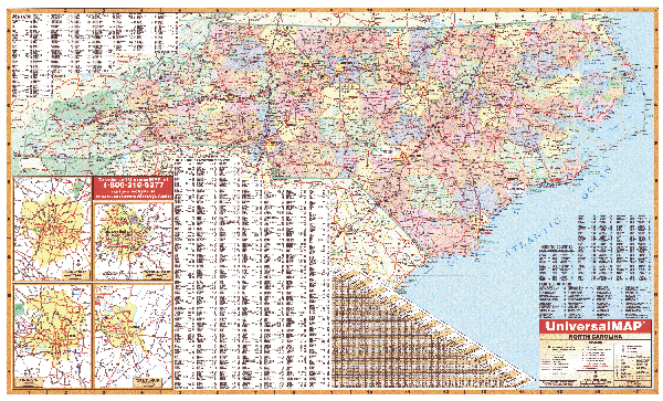
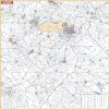
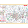
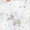
NORTH CAROLINA WALL MAP
2008 4th edition The North Carolina Wall Map by Universal Map measures 67 W x 42 H and includes all state highways, all federal highways, cities and towns, major waterways, major airports, state parks, state universities, military installations, points of interest, and mileage chart. The map is printed in color and protected by a laminated material that is both markable and washable. Special features include color coded counties and a mileage chart between major cities, plus a complete index. There are inset maps of the following: Charlotte, Raleigh, Fayetteville, and Winston-Salem.
Framing rails are available on top and bottom for easy wall mounting. | |
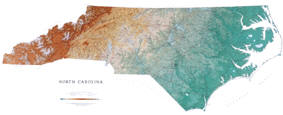 |
Raven North Carolina Map
The Great Smokey and Blue Ridge Mountains in the
west give way to the gentler piedmont plateau and finally the
coastal plain and tidewater of this beautifully diverse state.
Elevations are represented by color, and this, in combination
with our relief shading technique, gives the map a 3-dimensional
look.Raven North
Carolina Map Dimensions: 34" x 68" (approx.)
Raven North Carolina Map Scale: 1:500,000 or 1" equals about 8
miles |
|
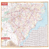 |
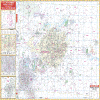
NORTH CAROLINA/SOUTH CAROLINA WALL MAP
2008
4th edition The North Carolina and South Carolina Wall Map by Universal Map measures 42 W x 56 H and includes all state highways, all federal highways, cities, major waterways, major airports, state parks, towns, state universities, wildlife areas, military installations, points of interest, and mileage charts, plus a comprehensive index. The map is protected with a laminate surface, which is both markable and washable.
Framing rails are available on top and bottom for easy wall mounting. | |
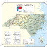 |
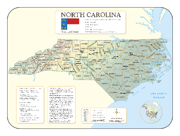
NORTH CAROLINA SHADED RELIEF MAP
The North Carolina Shaded Relief Wall Map by Universal Map is a full-color, topographical wall map. Statistical information on this map includes historical, anecdotal, and geographical. There is also an elevation scale measured in meters and feet and a distance scale measured in miles and kilometers. Identifies county boundaries. Shows state flag. Lists state motto, bird, flower, and tree, plus total area, population and origin of name. Its heavy laminated surface can be used with waterbased pens.
48"x26" |
Click Price to Add to Cart | | Laminated |
$31.95 |
|
 |
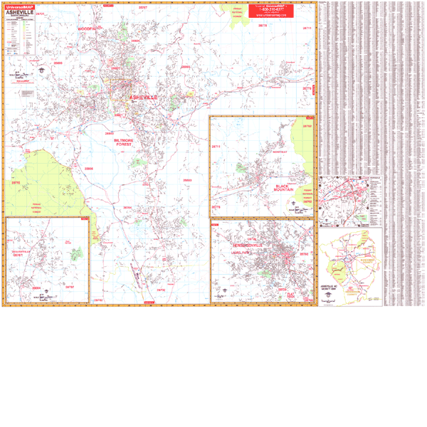
ASHVILLE WALL MAP
2009 5th edition The Asheville, NC Wall Map by Universal Map measures 72 W x 54 H and includes up-to-date cartography in complete street detail. The map is protected by a laminated surface, making it both markable and washable. Street indexing appears on the face of the map. The area of coverage ranges North to the City of Woodfin; South to the Asheville Municipal Airport; East to the edge of Black Mountain City Limits; and West to the Asheville city limit and Enka Lake. Insets for this map include Weaverville, Black Mountain, Hendersonville, and Downtown Asheville and vicinity. Other details include all streets, hospitals, cemeteries, water features, mileage circles, post offices, shopping centers, airports and railroads, golf courses and country clubs, longitude and latitude lines, government buildings, fire and police stations, educational facilities, recreational parks, zip codes and their boundaries.
Framing rails are available on top and bottom for easy wall mounting. | |
 |
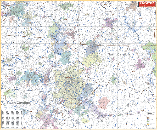
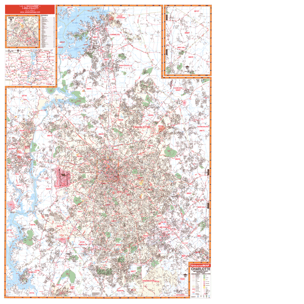
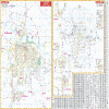
CHARLOTTE NORTH CAROLINA/VICINITY WALL MAP
2006
2nd edition The Charlotte, NC Vicinity Wall Map contains portions of the surrounding 12 counties. Includes the counties of Mecklenburg, Stanly, Cabarrus, Gaston, Lincoln, Catawba & Rowen, and portions of Iredell, Davidson, Union, and Anson Counties including a portion of York County in SC. Measures 65” x 54” and provides up-to-date cartography. Printed in color with a markable and washable laminated surface.
Framing rails are available on top and bottom. | |
 |
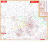
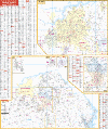
CHARLOTTE WALL MAP
2009 7th edition The Charlotte and Mecklenburg County, NC Wall Map by Universal Map has added new streets and changes. Coverage includes North To Iredell County Line, including Davidson and Cornelius; South to Tega Cay, Fort Mill, and Weddington; East to Mint Hill, Harrisburg, and portions of Concord; and West to Mount Holly and Belmont. There is also an inset Downtown Charlotte Area Map. Other data includes all city streets and highways, government buildings, zip codes and boundaries, airports, golf courses and country clubs, water features, mileage circles, block numbers, post offices, shopping centers, cemeteries, fire districts, fire and police stations, educational institutions, recreational parks, railroads, and city limits and annexations. Measuring 54 W to 77 H, the map markable and washable. In addition, the map has been indexed in a separate book.
Framing rails are available on top and bottom for easy wall mounting. | |
 |
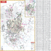
DURHAM/CHAPEL HILL WALL MAP
2008 5th edition The Orange/Durham Counties, NC Wall Map by Universal Map includes up-to-date cartography with over 700 new streets, a laminated surface making the map both markable and washable, street indexing that appears on the front of the map or in a separate book, and measurements of 62 W x 54 H. Map insets include Downtown Durham, Mabane, Duke University, University of North Carolina at Chapel Hill, and NCCU. Features, details, and data found on the map includes all streets, post offices, hospitals, railroads, mileage circles, airports, cemeteries, shopping centers, water features, recreational parks, fire district lines, government buildings, fire and police stations, educational facilities, golf courses and country clubs, zip codes and boundaries, city limits and annexations, and miscellaneous points of interest.
Framing rails are available on top and bottom for easy wall mounting. | |
 |
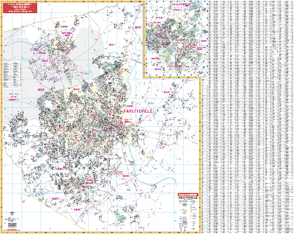
FAYETTEVILLE NORTH CAROLINA VICINITY WALL MAP
2007
2nd edition The Fayetteville, NC Vicinity Wall Map by Universal Map measures 54” x 64” and provides colorful, up-to-date cartography. Protected by a markable, water-washable laminated surface. The special features and data are as follows: all streets and highways, government buildings, airports, golf/country clubs, railroads, longitude and latitude lines, block numbers, shopping centers, recreational parks, mileage circles, points of interest.
Framing rails are available on top and bottom. Excellent source for routing or planning. | |
 |
FAYETTEVILLE WALL MAP
2002
2nd edition The Fayetteville, NC Wall Map by Universal Map measures 64” x 51” and is in complete street detail at a scale of 1” = 2,650 feet. Uses up-to-date cartography with new streets and changes. Covers: North to Harnett-Cumberland Co. line and Exit 58; South includes Cypress Lakes Golf Course, 5 miles so. of Exit 46 on I-95, including Hope Mills; East to 3 ½ miles e. of Exit 52 on I-95; West includes Fort Bragg, Cumberland Co. line crossing US 401. Protected by a markable laminate finish, the map framing rails
are available on top and bottom for convenient wall mounting. | |
 |
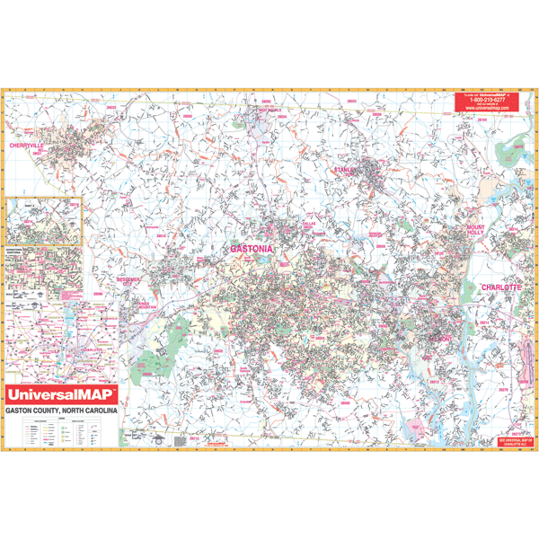
GASTON COUNTY WALL MAP
2009 3rd edition The Gaston County, NC Wall Map by Universal Map shows complete street detail with the boundaries as follows: North to the Gaston/Lincoln County line; South to the South Carolina line; East to the Charlotte-Douglas International Airport; and West to the Cleveland County line. Other data includes government buildings, airports, golf courses and country clubs, railroads, longitude and latitude lines, zip codes and zip code boundaries, shopping centers, recreational parks, mileage circles, cemeteries, educational facilities, hospitals, post offices, city limits and annexations, fire and police stations, and miscellaneous points of interest, plus a downtown area map. Measuring 64 W x 46 H, it is protected by a markable laminate surface. Also, the map is indexed in a separate book.
Framing rails are available on top and bottom for easy wall mounting. | |
 |
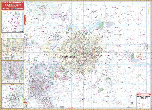
GREENSBORO WALL MAP
2008 4th edition The Greensboro, High Point, and Guilford County, NC Wall Map by Universal Map offers up-to-date cartography with approximately 600 new streets and changes. A markable laminated surface protects the map, which is indexed in a separate book. Measuring 5'11 W x 4'6 H, the area of coverage ranges North to the Guilford/Rockingham County line including all of Stokesdale; South to the Guilford/Rockingham County line including all the city of Archdale in Randolph County; East to the Guilford/Alamance County line including the city of Gibsonville; and West to the Guilford/Forsyth County line including a portion of Kernersville. Insets include Thomasville, Downtown High Point, Downtown Greensboro, and the University of North Carolina at Greensboro. Other details include airports, post offices, hospitals, railroads, mileage circles, points of interest, block numbers, all streets and highways, cemeteries, shopping centers, water features, recreational parks, longitude and latitude lines, city limits and annexations, government buildings, fire and police stations, educational facilities, golf courses and country clubs, zip codes and zip code boundaries, and township names.
Framing rails are available on top and bottom for easy wall mounting. | |
 |
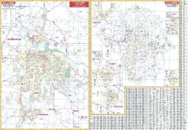
GREENVILLE WALL MAP
2000 1st edition The Greenville/Pitt County, NC Wall Map by Universal Map shows all of Greenville/Pitt County in complete street detail with the boundaries as follows: North to 1/2 mile north of US 13 and State Route 903 junction; South to include all of Winterville; East to two miles beyond Greenville Blvd., and Bradford Creek Golf Course; and West to US 264 and Business US264 junction. Insets for this map provide Greenville and Pitt County plus Grifton, Fountain, Grimesland, Bethel, Farmville, Ayden, and Simpson. Other data includes all streets and highways, government buildings, airports, golf courses and country clubs, railroads, longitude and latitude lines, zip codes and zip code boundaries, shopping centers, recreational parks, mileage circles, cemeteries, educational facilities, hospitals, post offices, city limits and annexations, fire and police stations, and miscellaneous points of interest, plus a comprehensive index. Measuring 75 W x 54 H, it is protected by a markable laminate surface.
Framing rails are available on top and bottom for easy wall mounting. | |
 |
HICKORY WALL MAP
2007
2nd edition The Hickory and Catawba County, NC Wall Map by Universal Map measures 54” x 64”, and provides complete street detail and comprehensive index. Covers Hickory. Boundaries: N: Caldwell Co line; S: includes Brookford; E: Lake Hickory Country Club and portions of Conover; W: to Longview and Hickory Regional Airport. Insets: Catawba (town), Claremont, Newton-Conover, and Maiden; and Catawba Co. Protected by a markable laminated finish.
Framing rails are available on top and bottom for easy wall mounting. | |
 |
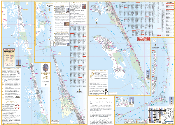
OUTER BANKS WALL MAP
2005
2nd edition The Outer Banks, NC Wall Map by Universal Map measures 68 x 48, and includes all streets, hospitals, cemeteries, water features, mileage circles, shopping centers, recreational parks, zip codes and boundaries, government buildings, fire and police stations, educational facilities, golf courses and country clubs, city limits and annexations, post offices, hospitals, railroads, and points of interest. The map shows all of the Outer Banks of North Carolina in complete street detail ranging North to the Virginia state line and South to Ocracoke Island. Other features include a ferry schedule, an Outer Banks area map, guides to area attractions and bike paths, Outer Banks fishing and bird watching charts, and a beach safety chart (lifeguards, bathhouses, paved, and handicap parking).
Framing rails are available on top and bottom for easy wall mounting. | |
 |
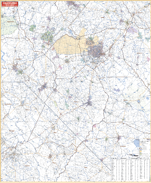
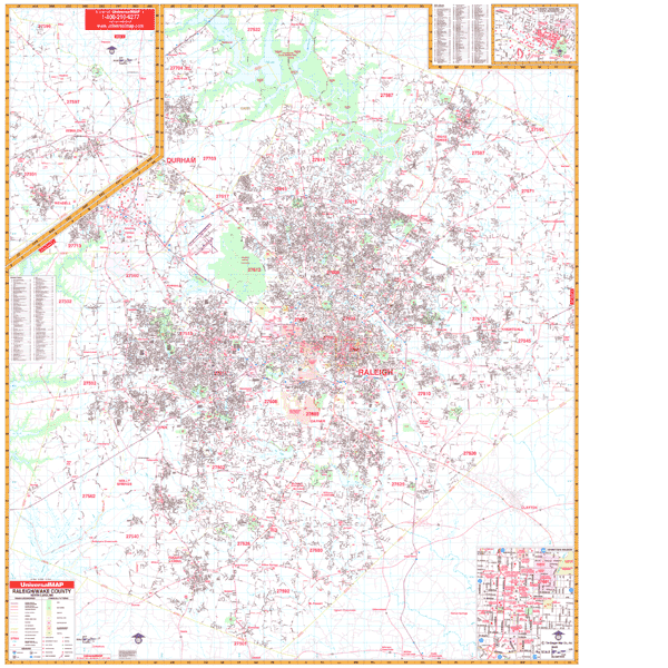
RALEIGH NORTH CAROLINA/VICINITY WALL MAP
2006 1st edition The Raleigh and Durham, NC Vicinity Wall Map measures 54” x 65.” Area of Coverage: North: to the North Carolina/Virginia state line; South: includes Lillington, Coats, Benson, and Sanford; East: includes Middleburg, Zebulon, Smithfield, and Selma; West: includes Mebane, Pittsboro, Haw River, and Saxapahaw. Provides up-to-date cartography and is printed in color with a markable/washable laminated surface. Cities and towns are indexed on the face of the map.
Framing rails are available on top and bottom. | |
 |
RALEIGH WALL MAP
2008
7th edition The Raleigh and Wake County, NC Wall Map by Universal Map has added new streets and changes and measures 60 x 69. This commercial wall map shows all of Wake County in complete street detail at a scale of 1=3,100 feet. Protected by a markable laminate finish. Boundaries range North-to the Durham County Line including the Research Triangle Park; South-to the Harnett County Line; East-to the Johnston County Line; and West-to the Chatham County Line. Provides an inset map of Downtown Raleigh.
Framing rails are available on top and bottom for easy wall mounting. | |
 |
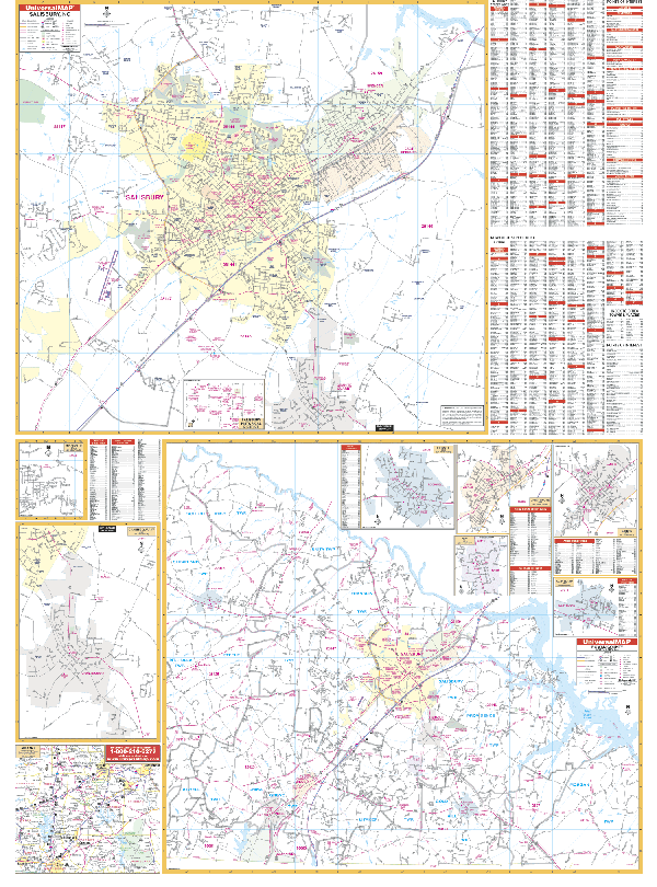
SALISBURY/ROWAN COUNTY WALL MAP
2001 1st edition The Salisbury and Rowan County, NC Wall Map by Universal Map measures 54 x 72 and contains up-to-date cartography with new streets and changes. Detail found on this map include all streets, hospitals, cemeteries, water features, mileage circles, shopping centers, recreational parks, zip codes and boundaries, government buildings, fire and police stations, educational facilities, golf courses and country clubs, city limits and annexations, post offices, hospitals, railroads, and points of interest. The lower half of the map is the entire county while the upper half is the city of Salisbury. Insets include Enochville, Granite Quarry, Rockwell, China Grove, Faith, Landis, Cleveland, and the Salisbury Historical District.
Framing rails are available on top and bottom for easy wall mounting. | |
 |
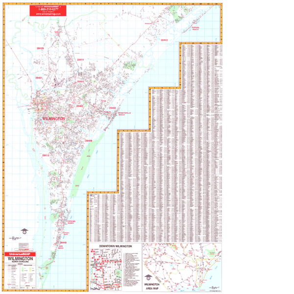
WILMINGTON WALL MAP
2001 1st edition Measuring 46 W x 62 H, the Wilmington, NC Wall Map by Universal Map provides up-to-date cartography with new streets and changes. A durable lamination, which is both markable and washable, protects its surface. The area of coverage ranges North to Northeast Cape Fear River, Ole Point Country Club, Topsail Beach; South to Fort Fisher State Recreation Area; East to the Atlantic Ocean; and West to the Cape Fear River. Insets include Downtown Wilmington and the Wilmington Area. Other details include all streets, post offices, hospitals, water features, mileage circles, airports, railroads, cemeteries, shopping centers, recreational parks, zip codes, boundaries, government buildings, fire and police stations, educational facilities, golf courses and country clubs, and longitude and latitude lines, plus complete index.
Framing rails are available on top and bottom for easy wall mounting. | |
 |
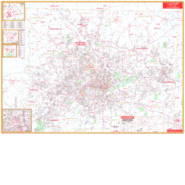
WINSTON-SALEM WALL MAP
2008 4th edition The Winston-Salem & Forsyth County, NC Wall Map from Universal Map features complete street detail and includes over 550 new streets. A laminated surface makes this map both markable and washable. Measuring 71 W x 54 H, it is indexed in a separate book. Insets for this map include Wake Forest University area map, Winston-Salem State University, Salem College, and a detailed Downtown Winston-Salem. The details, data, and information provided with this map include all streets, post offices, hospitals, railroads, mileage circles, points of interest, fire district lines, airports, cemeteries, shopping centers, water features, recreational parks, longitude and latitude lines, city limits, annexations, government buildings, fire and police stations, educational facilities, golf courses, country clubs, zip codes, zip code boundaries, and township names.
Framing rails are available on top and bottom for easy wall mounting. | |
|