|
Wall Maps
- State, County & Cities - Nebraska
GeoMart
is rapidly expanding its on-line selection of wall maps. If you
don't find what you are looking for here, please give us a call at
800-248-6277. One of our customer service representative will be
happy to assist you in finding the right map for you.
Most Maps Usually Ship within 48 hours.
Laminated maps with the option of hanging
rails usually ship in 5 days
 |
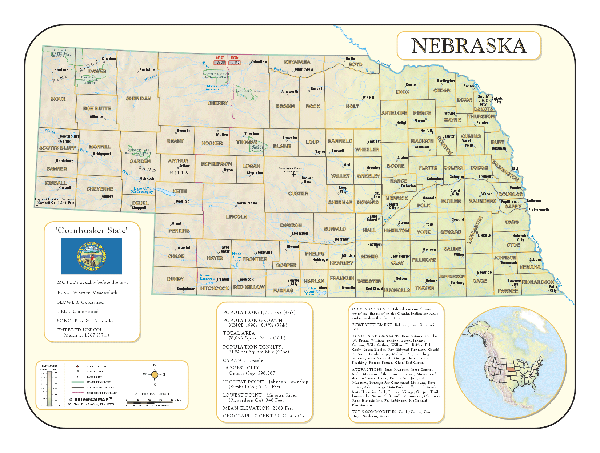
NEBRASKA WALL MAP
2005
2nd edition The Nebraska Wall Map by Universal Map offers color-coded counties and indexing on the face of the map. Measuring 62 W x 42 H, it is protected by a laminated surface that is both markable and washable. Details include highways, major waterways, state universities, military installations, government facilities, state and national parks, cities and towns, airports, wildlife areas, rest areas, and points of interest. Two special features on this wall map are an index of cities and counties and a mileage chart.
Framing rails are available on top and bottom for easy wall mounting. | |
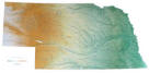 |
Raven Nebraska Map
The land west of the Missouri River is beautiful
farm country, with streams and rivers crossing between rolling
hills. The Platte river runs through the entire state, and just
north of it are the Sand Hills, the largest area of sand dunes
in North America. Elevations are represented by color, and this,
in combination with our relief shading technique, gives the map
a 3-dimensional look.
Raven Nebraska Map Dimensions: 33" x 64" (approx.)
Raven Nebraska Map Scale: 1:500,000 or 1" equals about 8 miles |
|
 |
NEBRASKA SHADED RELIEF MAP
The Nebraska Shaded Relief Wall Map by Universal Map measures 48 W x 36 H and is a full-color, topographical wall map. There is an inset map of North America showing the relative position of the state. Included is geographical, historical, and anecdotal information about Maryland. Also provided with this map are the major cities, counties, national capital, state capital, county seats, and state and county boundaries. There is a distance scale calibrated in miles and kilometers, and identifies county boundaries. State facts include flag, motto, bird, flower, and tree, plus total area, population and origin of name. Its heavy laminated surface can be used with waterbased pens. |
Click Price to Add to Cart | | Laminated |
$31.95 |
|
 |
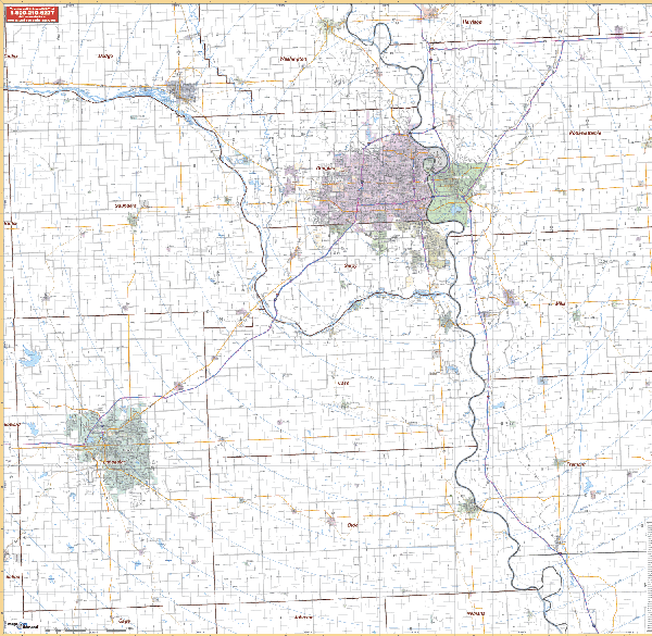
LINCOLN/OMAHA/VICINITY WALL MAP
2005
2nd edition The Lincoln and Omaha, NE Vicinity Wall Map by Universal Map includes portions of the surrounding 9 counties. Measures 64” x 54” with up-to-date cartography. Boundaries are as follows: North: all of Marshall and Livingston Counties; South: all of Sangamon and Macon Counties; East: all of Champaign in Champaign County; West: all of Peoria, Sangamon, and Menard Counties. Printed in color with a markable and washable laminated surface.
Framing rails are available on top and bottom. Excellent source for routing or planning. | |
 |
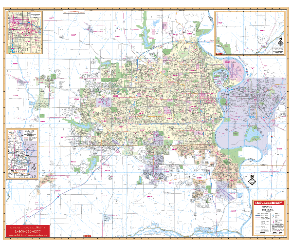
OMAHA WALL MAP-3rd EDITION
2007
4th edition The Omaha, NE Wall Map by Universal Map features up-to-date cartography with over 800 new streets and changes. The area of coverage ranges North to the Douglas/Washington County line; South to the Platte River; East to Council Bluffs, IA; and West to the cities of Waterloo, Elkhorn, and Gretna. Insets for this map cover southern Sarpy County, downtown Omaha, and an area map of eastern Nebraska. Other data includes government buildings, airports, golf courses and country clubs, railroads, longitude and latitude lines, zip codes and zip code boundaries, shopping centers, recreational parks, mileage circles, cemeteries, educational facilities, hospitals, post offices, city limits and annexations, fire and police stations, and miscellaneous points of interest, plus a complete index. Measuring 60 W x 51 H, the map is protected by a laminate surface which is both markable and washable.
Framing rails are available on top and bottom for easy wall mounting. | |
|