|
Wall Maps
- State, County & Cities - New Jersey
GeoMart
is rapidly expanding its on-line selection of wall maps. If you
don't find what you are looking for here, please give us a call at
800-248-6277. One of our customer service representative will be
happy to assist you in finding the right map for you.
Most Maps Usually Ship within 48 hours.
Laminated maps with the option of hanging
rails usually ship in 5 days
 |
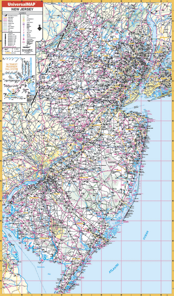
NEW JERSEY WALL MAP
2005 3rd edition The New Jersey Wall Map by Universal Map is protected by a durable, laminated surface allowing the map to be marked on and wiped off. This map is printed in color and measures 42 W x 72 H. Other data includes state and federal highways, major waterways, cities and towns, major airports, military installations, state universities, state and national parks, and miscellaneous points of interest, plus a comprehensive index.
Framing rails are available on top and bottom for easy wall mounting. | |
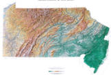 |
Raven Pennsylvania & New Jersey Map
Our map of these two states together
presents the Delaware River plain in context. Elevations are
represented by color, and this, in combination with our relief
shading technique, gives the map a 3-dimensional look.
Raven Pennsylvania & New Jersey Map Dimensions: 36" x 54"
(approx.)
Raven Pennsylvania & New Jersey Map Scale: 1:500,000 or 1"
equals about 8 miles |
|
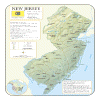 |
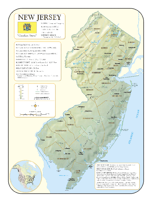
NEW JERSEY SHADED RELIEF MAP The New Jersey Shaded Relief Wall Map by Universal Map measures 36 W x 48 H and is a full-color, topographical wall map. The map's lamination makes the map able to be marked on and wiped off easily. Statistical information on this map includes historical, anecdotal, and geographical. There is also an elevation scale measured in meters and feet and a distance scale measured in miles and kilometers. Identifies county boundaries. Shows state flag. Lists state motto, bird, flower, and tree, plus total area, population and origin of name. Its heavy laminated surface can be used with waterbased pens. |
Click Price to Add to Cart | | Laminated | $31.95 |
|
|