|
Wall Maps
- State, County & Cities - Nevada
GeoMart
is rapidly expanding its on-line selection of wall maps. If you
don't find what you are looking for here, please give us a call at
800-248-6277. One of our customer service representative will be
happy to assist you in finding the right map for you.
Most Maps Usually Ship within 48 hours.
Laminated maps with the option of hanging
rails usually ship in 5 days
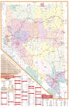 |
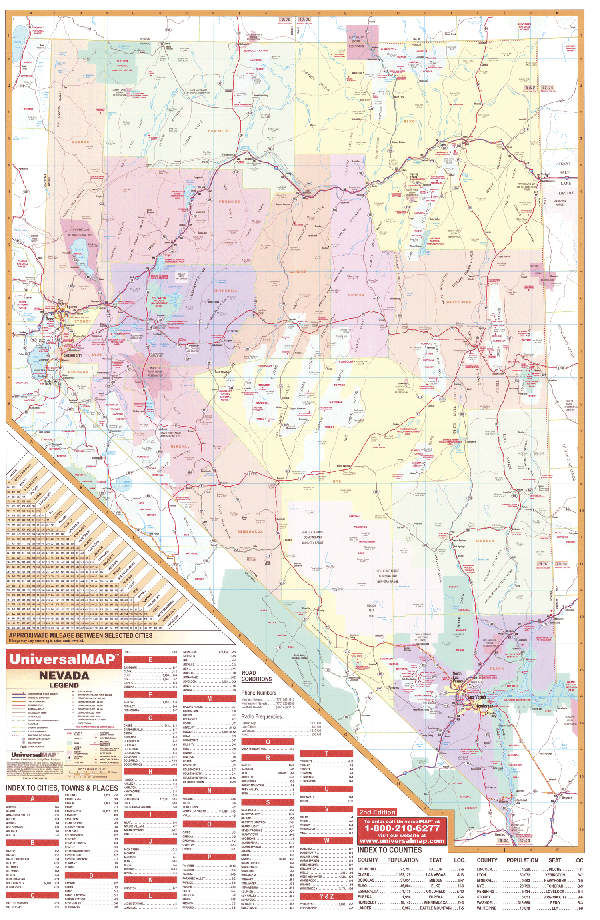
NEVADA WALL MAP
2006
3rd edition The Nevada Wall Map by Universal Map includes all state and federal highways, major waterways, military installations, state parks, major airports, state universities, cities, towns, wildlife areas, and assorted points of interest. Special features for this map are color-coded counties and a mileage chart between major cities, and complete index. This map measures 46 W x 64 H and is protected with a laminate finish which is both markable and washable.
Framing rails are available on top and bottom for easy wall mounting. | |
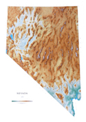 |
Raven Nevada Map
Although Nevada is known for being the home of
Las Vegas, it also has grassy valleys, rugged, snow-covered
mountains, alkalai flats, and open sandy deserts. The beautiful
glacial Lake Tahoe lies on the California border, and over 150
mountain ranges dominate the rest of the state. Elevations are
represented by color, and this, in combination with our relief
shading technique, gives the map a 3-dimensional look.
Raven Nevada Map Dimensions: 43" x 61" (approx.)
Raven Nevada Map Scale: 1:500,000 or 1" equals about 8 miles |
|
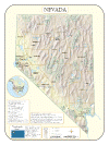 |
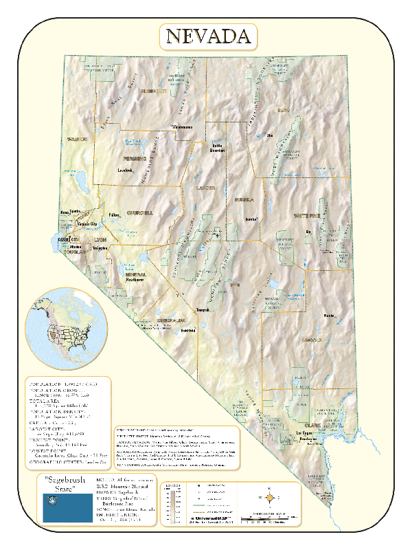
NEVADA SHADED RELIEF MAP
The Nevada Shaded Relief Wall Map by Universal Map measures 36 W x 48 H and is a full-color, laminated, shaded relief, topographical wall map. Statistical information on this map includes historical, anecdotal, and geographical. There is also an inset map of North America locating Nevada. Other data found with the map are an elevation table, state capital, major cities, counties, state and county boundaries. There is also a scale showing distances in miles and kilometers. Identifies county boundaries. Shows state flag. Lists state motto, bird, flower, and tree, plus total area, population and origin of name. Its heavy laminated surface can be used with waterbased pens. |
Click Price to Add to Cart | | Laminated |
$31.95 |
|
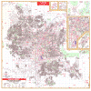 |
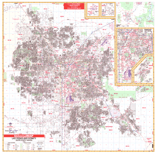
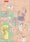
LAS VEGAS WALL MAP
2009 1st edition
The Las Vegas, NV Wall Map by Universal Map features complete street detail with
the following boundaries: North including N. Las Vegas, Sunrise Manor, Nellis
Air Force Base, one mile North Floyd Lamb State Park; South to Enterprise and
one mile south of Henderson Executive Airport; East to East Las Vegas and
Henderson; West to Spring Valley, and western Las Vegas city limits two miles
west of Las Vegas Beltway. Inset maps illustrate Boulder City, Downtown Las
Vegas, Overton, Indian Springs, and the Lake Mead Recreation Area. Points of
interest highlight all streets and highways, government buildings, airports,
hospitals, cemeteries, post offices, block numbers, mileage circles, fire and
police stations, educational facilities, zip codes and boundaries, city limits
and annexations, golf courses and country clubs, railroads, longitude and
latitude lines, section/township/range lines, shopping centers, and recreational
parks. Framing rails are available on top and bottom for easy wall mounting;
protected by a markable laminate surface. 76" x 66" | |
 |
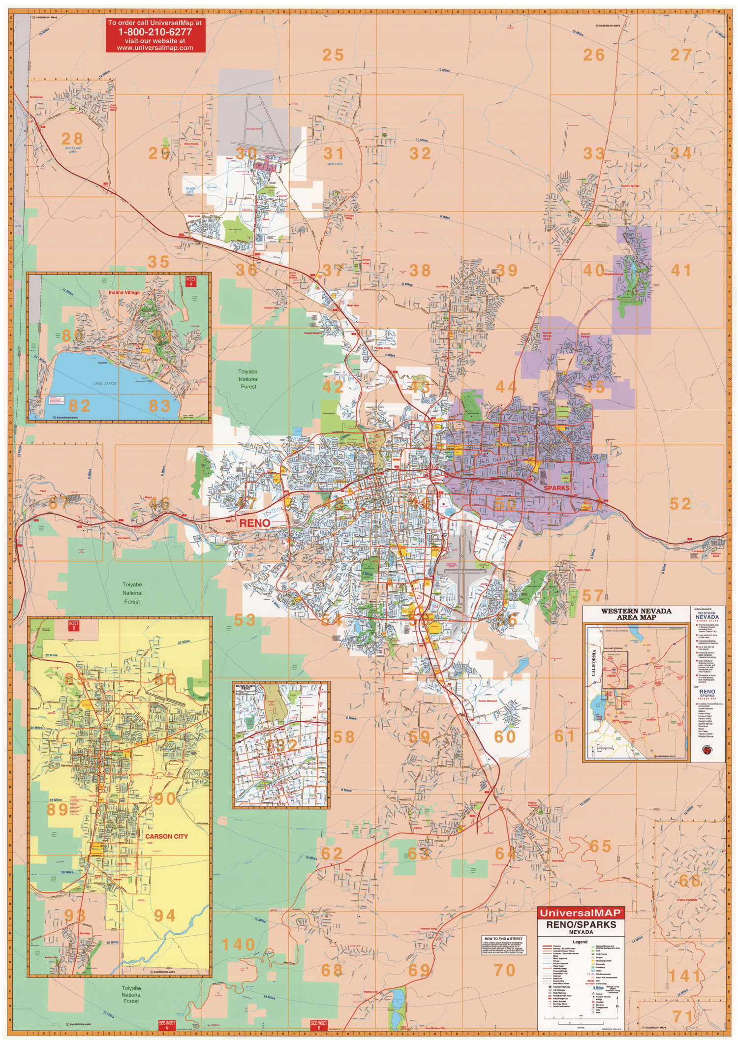
RENO WALL MAP
2007 3rd edition The Reno, NV Wall Map illustrates all of Reno in complete street detail with the boundaries as follows: North to include Cold Spring Valley and Reno-Stead Airport; South to Washoe City at Little Washoe Lake; East to Rainbow Bend and Lockwood at Exit 22 of I-80; West to Verdi at Exit 1 of I-80. The map insets include Incline Village, Carson City (Includes Sunridge and Indian Hills) Downtown Reno, and a Western Nevada Area Map. There is also an overlay grid that is compatible with Sagebrush Street Guide Map Book with both pages and grids. The special features and data contained on this map are as follows: all streets, government codes, airports, golf courses and country clubs, railroads, all highways, shopping centers, post offices, cemeteries, points of interest, mileage circles, educational institutions, hospitals, fire and police stations, recreational parks, city limits and annexations, and water features. Measuring 54 x 77, it is protected with a laminate finish which is both markable and washable. The map has been indexed in a separate book.
Framing rails are available on top and bottom for easy wall mounting.
54" x 77" | |
|