|
Wall Maps
- State, County & Cities - Ohio
GeoMart
is rapidly expanding its on-line selection of wall maps. If you
don't find what you are looking for here, please give us a call at
800-248-6277. One of our customer service representative will be
happy to assist you in finding the right map for you.
Most Maps Usually Ship within 48 hours.
Laminated maps with the option of hanging
rails usually ship in 5 days
 |
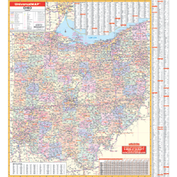
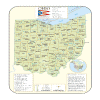
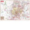
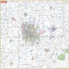
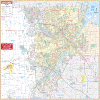
OHIO WALL MAP
2006 3rd edition The Ohio Wall Map by Universal Map includes all state highways, all federal highways, major airports, cities, towns, state universities, wildlife areas, military installations, points of interest, major waterways, county names and boundaries, and state parks. Map Insets highlight the Downtown areas of Cincinnati and Cleveland. Special features for this map are a mileage chart between major cities and Listings of Ohio State Parks. Measuring 46 x 64, the map is protected with laminate that is both markable and washable. The map distance scale measures 1 = 11 miles.
Framing rails are available on top and bottom for easy wall mounting. | |
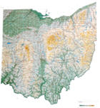 |
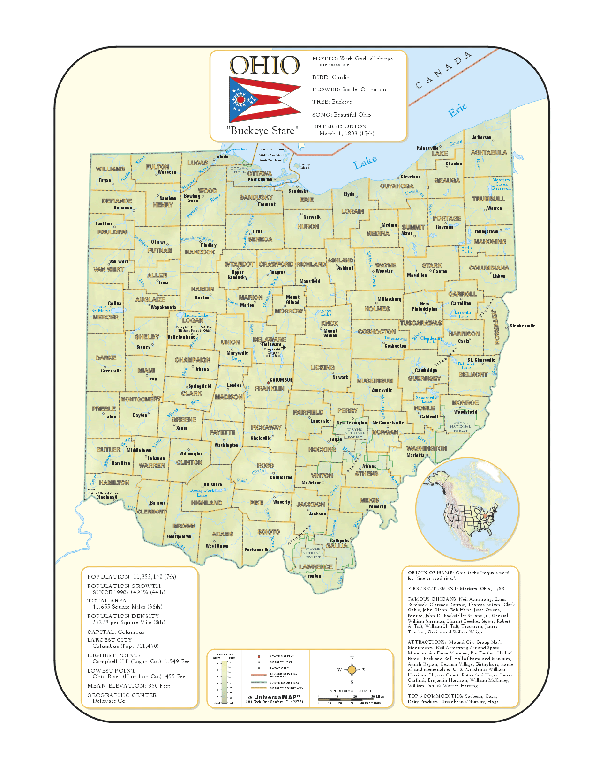
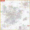
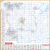
Raven Ohio Map
The northern portion of Ohio shares 312 miles of
shoreline with Lake Erie. The land then becomes part of the Till
Plains, the beginning of the corn belt and one of the most
fertile farming regions in the nation. The southern border is
the historic Ohio River. Elevations are represented by color,
and this, in combination with our relief shading technique,
gives the map a 3-dimensional look.
Raven Ohio Map Dimensions: 38" x 42" (approx.)
Raven Ohio Map Scale: 1:500,000 or 1" equals about 8 miles. |
|
 |
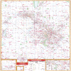
OHIO SHADED RELIEF MAP
The Ohio Shaded Relief Wall Map by Universal Map measures 36 W x 48 H is a full-color, topographical wall map. Statistical information on this map includes historical, anecdotal, and geographical. There is also an elevation scale measured in meters and feet and a distance scale measured in miles and kilometers. Identifies county boundaries. Shows state flag. Lists state motto, bird, flower, and tree, plus total area, population and origin of name. Its heavy laminated surface can be used with waterbased pens. |
Click Price to Add to Cart |
| Laminated |
$31.95 |
|
 |
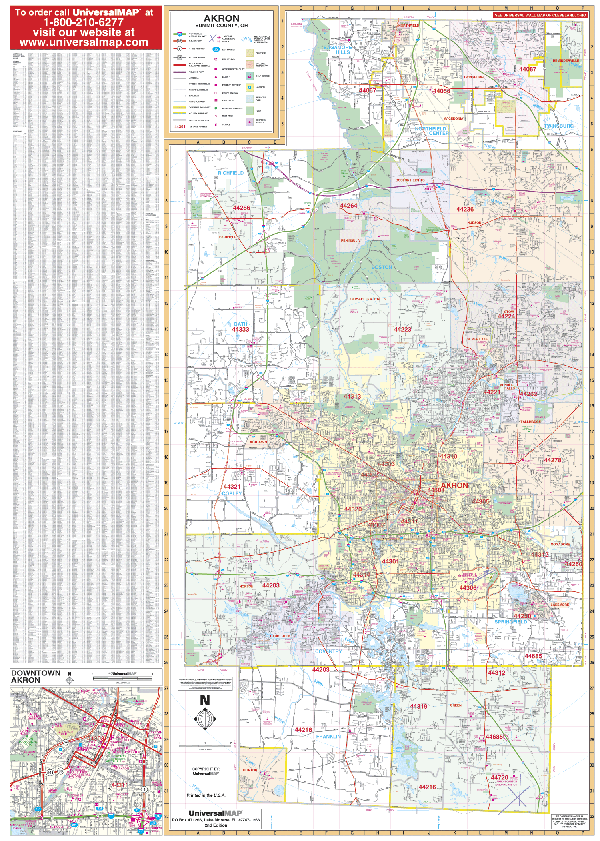
AKRON WALL MAP
2007
3rd edition The Akron, OH Wall Map by Universal Map shows all of Summit County, OH plus extensive point of interest information. Protected by a markable, laminate surface.
Framing rails are available on top and bottom for easy wall mounting. 54" x 60" | |
 |
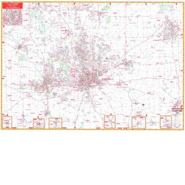
CANTON WALL MAP
2001 1st edition The Canton, OH Wall Map by Universal Map provides up-to-date cartography in complete street detail with over 500 new streets and changes. The area of coverage ranges North to the Portage/Stark County line including all of Green's city limits; South to the cities of Malvern, Brewster, and Navarre; East to the Columbiana/Stark County line and the city of Alliance; and West to the Wayne/Stark County line. Insets for this map are of Wilmot, Beach City, Bolivar, East Sparta, Magnolia, Waynesburg, and downtown Canton. Also included are all streets and highways, government buildings, airports, golf courses and country clubs, railroads, longitude and latitude lines, zip codes and zip code boundaries, shopping centers, recreational parks, mileage circles, cemeteries, educational facilities, hospitals, post offices, city limits and annexations, fire and police stations, and miscellaneous points of interest. Measuring 70 W x 54 H, it is protected by a laminate surface which is both markable and washable. Also, the streets on this map are indexed in a separate book.
Framing rails are available on top and bottom for easy wall mounting. | |
 |
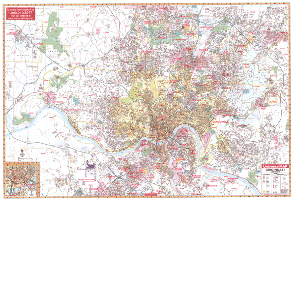
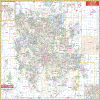
CINCINNATI WALL MAP
2006
3rd edition The Cincinnati, OH Wall Map by Universal Map features complete street detail with coverage ranging North to the Hamilton/Butler line; South to include I-275 Loop and the Cincinnati/Northern Kentucky International Airport; East to Include I-275 Loop at Exit 57 and Exit 59 at Milford; and West to the Indiana state line. Also include is a detailed inset map of Downtown Cincinnati, plus hospitals, airports, schools, parks, shopping centers, cemeteries, zip codes and boundaries, golf and country clubs, post offices, government buildings, mileage circles, zip codes and boundaries, city limits and annexations, township names and boundaries, water features, fire and police stations, highways and exits, and local points of interest. Protected by a laminated markable surface, the map measures 73 W x 52 H. Street indexing has been provided in a separate book.
Framing rails are available on top and bottom for easy wall mounting. | |
 |
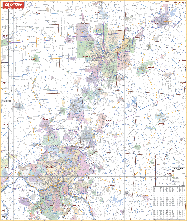
CINCINNATI/DAYTON VICINITY OHIO WALL MAP
2005
1st edition The Cincinnati and Dayton, OH Vicinity Wall Map by Universal Map measures 54” x 64.” Provides up-to-date cartography. Includes all of the counties of Butler, Clermont, Greene, Hamilton, Montomery, Preble, and portions of Brown, Clark, Clinton, Darke, Highland, and Miami Counties. Printed in color with a markable/washable laminated surface with
Framing rails are available on top and bottom. Excellent source for routing or planning. | |
 |
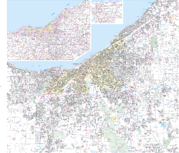
CLEVELAND WALL MAP
2007 4th edition The Cleveland and Cuyahoga County, OH Wall Map by Universal Map features complete street detail with the boundaries as follows: North to Lake Erie; East to State Rd 306 including Willoughby; South to Rt. 80, showing 80 and 480 interchange; and West to Avon Lake in Lorain County and also Richfield. Inset maps included are Downtown Cleveland, which shows Rock and Roll Hall of Fame, Gund Arena and Jacob's Field; and a seven-county Northeast Ohio Area Map. Special features include educational institutions, hospitals, government buildings, golf and country clubs, fire and police stations, water features, post offices, shopping centers, airports, cemeteries, recreational parks, points of interest, city limits and annexations, zip codes and boundaries, railroads, and mileage Circles.
Framing rails are available on top and bottom for easy wall mounting; measures 49 W x 54 H. | |
 |
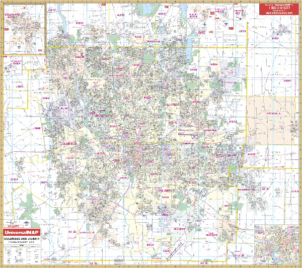
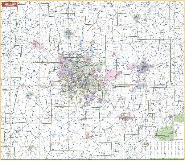
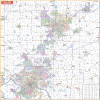
COLUMBUS WALL MAP
2008 7th edition The Columbus/Franklin County, OH Wall Map by Universal Map measures 58 x 54 and offers complete street detail. Covers all of Franklin Co. with the following boundaries: North to include the cities of Dublin, Westerville, Shawnee Hills, and Powell; South to the Franklin Co. line; East to include the cities of Pataskala and Johnstown; West to the Franklin Co. line. This full-color map provides up-to-date cartography with new streets and changes, and is protected by with a markable/washable-laminated surface.
Framing rails are available on top and bottom for easy wall mounting. | |
 |
COLUMBUS/VICINITY OHIO WALL MAP
2006
2nd edition The Columbus, OH Vicinity Wall Map by Universal Map includes Franklin County and portions of 8 other counties. Measuring 62” x 54”, it also features full-color, up-to-date cartography and a comprehensive index. It is protected by a laminated surface.
Framing rails are available on top and bottom. Excellent source for routing or planning. Boundaries range: North: includes Cardington, Fredericktown, Gann; South: includes Washington, Clarksburg, Kingston, and Adelphi; East: includes Gration, Nellie, Frazeyburg, New Lexington; West: Includes Mechanicsburg, Milledgeville, South Charleston.
Framing rails are available on top and bottom for easy wall mounting. | |
 |
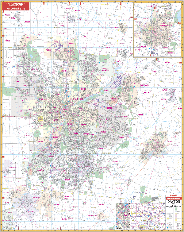
DAYTON WALL MAP 3RD EDITION
2009
4th edition The Dayton, OH and adjacent areas Wall Map by Universal Map measures 54 x 69 inches. Offers up-to-date cartography with new streets and changes along with complete street detail. Printed in color with a markable and washable surface. Area of coverage ranges: N: to West Milton, Tipp City, and New Carlisle; S: to Waynesville, Corwin, and Franklin; E: to Yellow Springs and Xenia; W: to Germantown and Sycamore State Park. Insets include Springfield, a vicinity map, and Downtown Dayton.
Framing rails are available on top and bottom for easy wall mounting. | |
 |
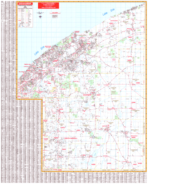
LAKE COUNTY/GEAUGA COUNTY WALL MAP
2001 1st edition The Lake and Geauga Counties, OH Wall Map by Universal Map contains up-to-date cartography with complete street detail. This full-color map has a markable laminated surface. Measuring 4 1/2' x 5'2, it includes a complete index. The area of coverage ranges North to Lake Erie; South to the Geauga-Portage County line; East to the Lake-Geauga County Line boundary with Ashtabula and Trumble County Lines; and West to the Cuyahoga County Line. Other details provided on this map feature all streets, post offices, hospitals, railroads, mileage circles, municipal township names and boundaries, airports, cemeteries, shopping centers, water features, recreational parks, government buildings, fire and police stations, educational facilities, golf courses and country clubs, zip codes and boundaries.
Framing rails are available on top and bottom for easy wall mounting. | |
 |
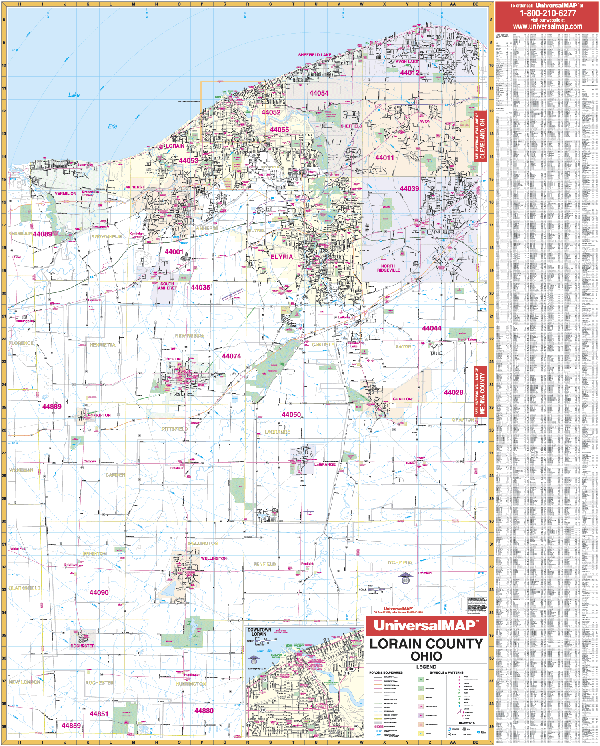
LORAIN COUNTY WALL MAP
2005
2nd edition The Lorain County, OH Wall Map by Universal Map measures 42 W x 54 H provides up-to-date cartography with many new streets and updates. The full-color map is protected with a markable laminate surface.
Framing rails are available on top and bottom. | |
 |
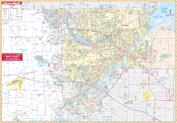
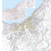
TOLEDO WALL MAP
2007
2nd edition The Toledo, OH Wall Map by Universal Map has added approximately 375 new streets and changes. Its boundaries include
North to the Michigan state line; South to Perrysburg; East to Oregon and Millbury; and West to the Toledo Express Airports. Points of interest include government buildings, airports, golf courses and country clubs, railroads, longitude and latitude lines, zip codes and zip code boundaries, shopping centers, recreational parks, mileage circles, cemeteries, educational facilities, hospitals, post offices, city limits and annexations, fire and police stations, plus a complete index. This wall map measures 62 W x 54 H and is protected by a laminate surface which is both markable and washable.
Framing rails are available on top and bottom for easy wall mounting. | |
 |
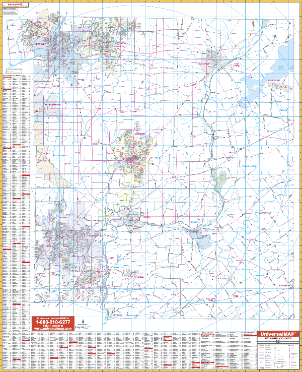
WARREN WALL MAP
2008
2nd edition The Warren County, OH Wall Map by Universal Map shows complete street detail with boundaries as follows: North to the Montgomery-Green County line including the towns of Carlisle, Franklin, and Springboro; South to the Clermont County line including the towns of Landen, Mainesville, and Loveland; East to the Clinton County line including the town of Harveysburg, and West to the Bulter County line. Other data includes
all streets and highways, government buildings, airports, golf courses and country clubs, railroads, longitude and latitude lines, zip codes and zip code boundaries, shopping centers, recreational parks, mileage circles, cemeteries, educational facilities, hospitals, post offices, city limits and annexations, fire and police stations, and miscellaneous points of interest, plus a complete index. This wall map measures 54 W x 68 H and is protected by a laminate surface which is both markable and washable.
Framing rails are available on top and bottom for easy wall mounting. | |
 |
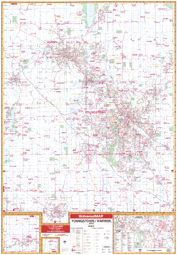
YOUNGSTOWN WALL MAP
2006
2nd edition The Youngstown/Warren, OH Wall Map by Universal Map includes complete coverage of Trumbull and Mahoning Counties and has added approximately 600 new streets and changes. The area of coverage includes all of Youngstown/Warren, Ohio in complete street detail with the following boundaries: North to Cortland, Bradley-Brownlee Road; South to the Columbiana County line; East to the Pennsylvania State line; and West to Portage/Geauga County lines. The map also includes an downtown Youngstown inset map. Other highlights include government buildings, zip codes and boundaries, airports, golf courses and country clubs, railroads, city limits and annexations, post offices, shopping centers, cemeteries, educational facilities, fire and police stations, hospitals, recreational parks, water features, and points of interest. The map measures 54 W X 77 H and is protected with a laminate finish which is both markable and washable.
Framing rails are available on top and bottom for easy wall mounting; indexed in book form. | |
'
|