|
Wall Maps
- State, County & Cities - Pennsylvania
GeoMart
is rapidly expanding its on-line selection of wall maps. If you
don't find what you are looking for here, please give us a call at
800-248-6277. One of our customer service representative will be
happy to assist you in finding the right map for you.
Most Maps Usually Ship within 48 hours.
Laminated maps with the option of hanging
rails usually ship in 5 days
 |
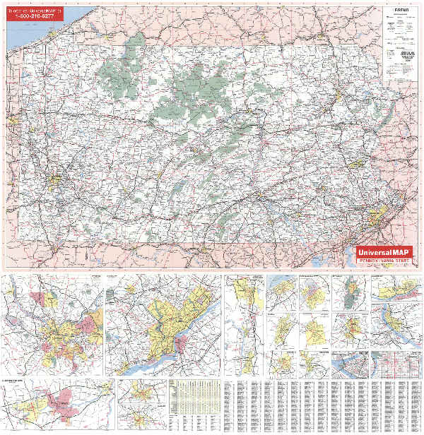
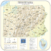
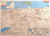
PENNSYLVANIA WALL MAP
2005 2nd edition The Pennsylvania Wall Map by Universal Map measures 57 W x 54 H and includes the following: all state highways, all federal highways, major airports, cities, towns, state universities, wildlife areas, military installations, various points of interest, major waterways, state parks, county names and boundaries. Inset maps of major cities in more detail include: Pittsburgh, Philadelphia, Scranton, Gettysburg, Williamsport, Harrisburg, Hazelton, Johnstown, New Castle, York, Lancaster, Allentown, Easton, Wilkes-Barre, Erie, Reading, Altoona, and Bethlehem. There is a special Inset of Pennsylvania State College and a Mileage Chart between major cities. The map is protected with a non-glare matte finish lamination which is both markable and washable. Executive wood-grain rails are mounted top and bottom to complete this quality product. In addition, for your convenience, the map is indexed on the face of the map.
Framing rails are available on top and bottom for easy wall mounting. | |
 |
Raven Pennsylvania & New Jersey Map
Our map of these two states together
presents the Delaware River plain in context. Elevations are
represented by color, and this, in combination with our relief
shading technique, gives the map a 3-dimensional look.
Raven Pennsylvania & New Jersey Map Dimensions: 36" x 54"
(approx.)
Raven Pennsylvania & New Jersey Map Scale: 1:500,000 or 1"
equals about 8 miles |
|
 |
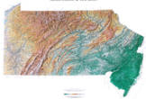
PENNSYLVANIA SHADED RELIEF MAP
The Pennsylvania Shaded Relief Wall Map by Universal Map is a full-color, topographical wall map. Statistical information on this map includes historical, anecdotal, and geographical. There is also an elevation scale measured in meters and feet and a distance scale measured in miles and kilometers. Identifies county boundaries. Shows state flag. Lists state motto, bird, flower, and tree, plus total area, population and origin of name. Its heavy laminated surface can be used with waterbased pens.
48" x 36" |
Click Price to Add to Cart | | Laminated |
$31.95 |
|
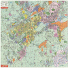 |
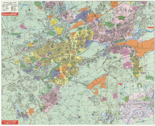
ALLENTOWN WALL MAP
2004 2nd edition The Allentown/Bethlehem, PA Wall Map by Universal Map has added approximately 600 new streets and changes. Boundaries range North to and including the city of Coplay; South to includes all of the cities of Macungie and Coopersburg; East to and including the city of Hellertown; West to Interchange #33 in Upper Macungie Township. Insets illustrate Easton and Wilson. Other points of interest are government buildings, zip codes, airports, golf courses and country clubs, railroads, all highways, shopping centers, post offices, cemeteries, points of interest, educational institutions, hospitals, fire and police stations, recreational parks, city limits and annexations, and water features. This wall map measures 46x54 and is protected with a non-glare matte finish lamination which is both markable and washable. Also, the map has been indexed in book form.
Framing rails are available on top and bottom for easy wall mounting. | |
 |
ERIE WALL MAP
2003
2nd edition The 2nd edition of the Erie, PA Wall Map by Universal Map measures 64” x 46” and is complete street detail at a scale of 1” = 46.” Insets include: Albion, Corry, Edinboro, Fairview, Girard, Northeast Lake City, Union, Waterford, and Erie County. Protected by a markable laminate finish. Area of coverage ranges: North: to Lake Erie, including Presque Isle State Park; South: includes the I-90 and I-79 interchange, and Popps Mobile Home Park; East: to Harbor Creek and SR 531 and Depot Rd; West: includes Manchester Beach and Orchard Hills.
Framing rails are available on top and bottom for easy wall mounting. | |
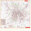 |
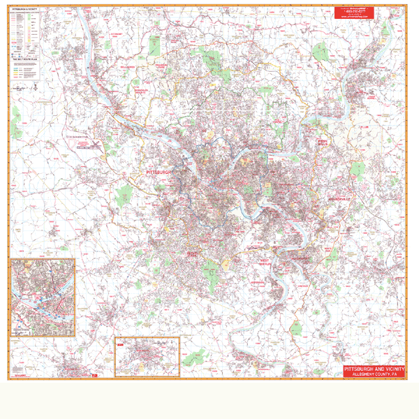
PITTSBURGH WALL MAP
2007 1st edition
The Allegheny County, Pennsylvania Wall Map by
Universal Map features complete street detail at a scale of 1" = 2,600 feet.
Up-to-date cartography with new streets and changes. Boundaries are as follows:
North: to Allegheny Co. line including the city of Conway in Beaver County;
South: to Allegheny County line to include Monongahela; East: to the county line
including cities of Manor and Lower Burrell; West: to the Allegheny County line
including the city of Midway. Insets include Downtown Pitttsburgh, a Downtown
Washington and East Washington in Washington County. Details, special features,
and data are as follows: all streets and highways, government buildings,
airports, golf courses and country clubs, railroads, zip codes/boundaries,
longitude and latitude lines, subdivision names, shopping centers, recreational
parks, mileage circles, cemeteries, educational facilities, hospitals, post
offices, city limits and annexations, water features, fire and police stations,
and miscellaneous points of interest. Measurements range from 77" W to 72" H.
Protected with a laminate finish, the map is both markable and washable. Indexed
in a separate book. Framing rails are included on top and bottom for easy wall
mounting. Framing rails are available on top and bottom for easy wall mounting. | |
 |
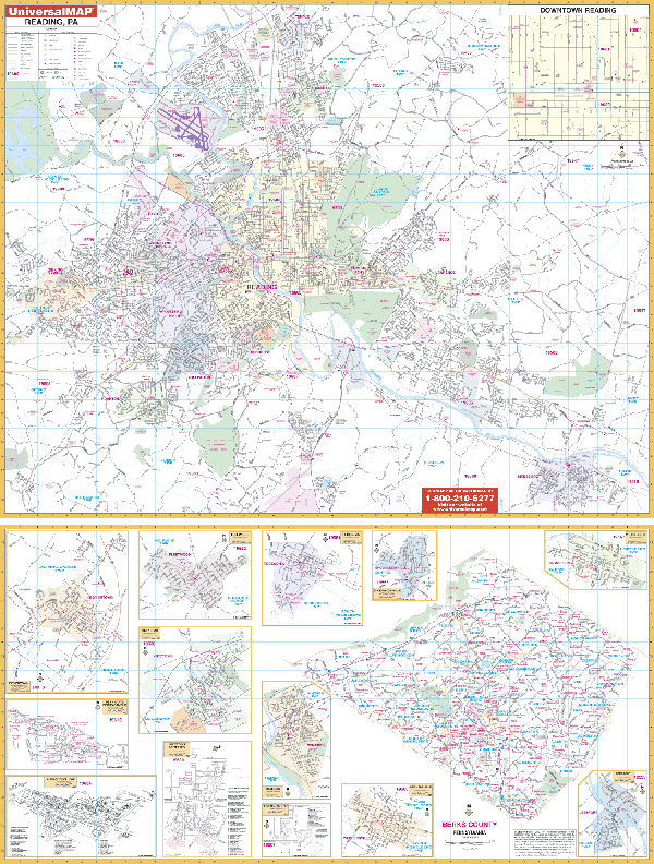
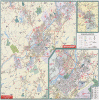
READING WALL MAP
2001 1st edition The Reading/Berks County, PA Wall Map by Universal Map measures 52 x 73 and provides up-to-date cartography with new streets and changes. The area of coverage includes North to the city of Temple; South to Green Hills and Birdsboro; East to the Daniel Boone Homestead, Amity Township; and West to Sinking Spring, S. Heidelburg Township. Map insets include Boyerstown, Penn State (Berks Campus) Albright College, Kutztown & Kutztown University, Robesonia, Hamburg, Alvernia College, Shoemakersville, Wernersville, Womelsdorf, Leesport, and Fleetwood. Also pinpointed are post offices, hospitals, water features, recreational parks, mileage circles, city limits and annexations, cemeteries, shopping centers, block numbers, golf courses and country clubs, zip codes and zip code boundaries, airports and railroads, government buildings, fire and police stations, educational facilities, longitude and latitude lines, section/township/range lines, and other points of interest.
Framing rails are available on top and bottom for easy wall mounting. | |
 |
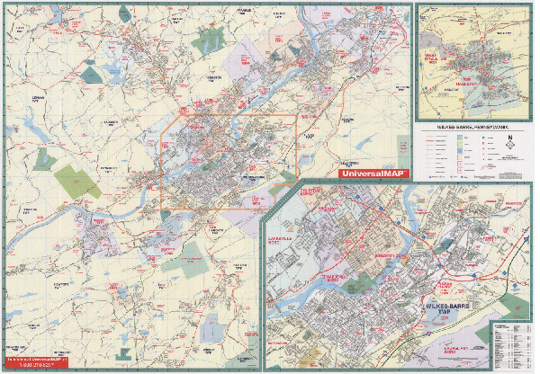
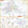
SCRANTON/WILKES BARRE WALL MAP
2003 1st edition The Wilkes-Barre, PA Wall Map by Universal Map measures 46 x 64 and has added approximately 600 new streets and changes. Boundaries range North to include Harveys Lake, Old Forge, and Avoca; South to include Crestwood Industrial Park and Alberdeen Golf and Country Club, just South of exit 43 on I-81; East to the Wilkes-Barre Scranton Airport at Exit 50 on I-81; West to includes Harveys Lake and The Glen Lyon Area. Insets include Hazelton and West Hazelton. Data features educational institutions, government buildings, shopping centers, hospitals, zip codes, post offices, fire and police stations, airports, cemeteries, recreational parks, golf and country clubs, points of interest, city limits and annexations, railroads, and water features.
Framing rails are available on top and bottom for easy wall mounting. | |
|