|
Wall Maps
- State, County & Cities - South Carolina
GeoMart
is rapidly expanding its on-line selection of wall maps. If you
don't find what you are looking for here, please give us a call at
800-248-6277. One of our customer service representative will be
happy to assist you in finding the right map for you.
Most Maps Usually Ship within 48 hours.
Laminated maps with the option of hanging
rails usually ship in 5 days
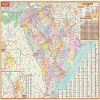 |
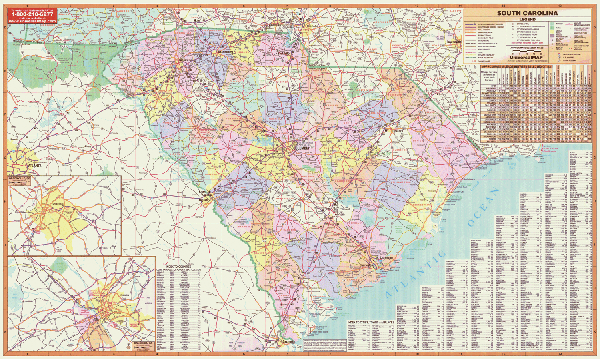
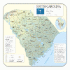
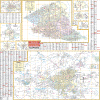
SOUTH CAROLINA WALL MAP
2008 4th edition The South Carolina Wall Map by Universal Map includes insets of Columbia and Greenville, color-coded counties, a mileage chart between major cities, a laminated surface that is both markable and washable, and indexing on the face of the map. This map measures 5' 7 W x 4' H. Details and features supplied by the map include interchange exit numbers, primary and secondary roads, major highways, state and federal highways, major waterways, major airports, state universities, state parks, wildlife areas, military installations, population classifications, and assorted points of interest.
Framing rails are available on top and bottom for easy wall mounting. | |
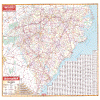 |
NORTH CAROLINA/SOUTH CAROLINA WALL MAP
2008
4th edition The North Carolina and South Carolina Wall Map by Universal Map measures 42 W x 56 H and includes all state highways, all federal highways, cities, major waterways, major airports, state parks, towns, state universities, wildlife areas, military installations, points of interest, and mileage charts, plus a comprehensive index. The map is protected with a laminate surface, which is both markable and washable.
Framing rails are available on top and bottom for easy wall mounting. | |
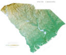 |
Raven South Carolina Map
The Low Country of South Carolina,
with its many rivers and swamps, also boasts a forested area
know as the Pine Barrens. The Up Country to the northwest
consists of rolling hills and the Blue Ridge Mountains.
Sassafras Mountain, at 3,554", is the highest point in the
state. Elevations are represented by color, and this, in
combination with our relief shading technique, gives the map a
3-dimensional look.
Raven South Carolina Dap Dimensions: 35" x 41" (approx.)
Raven South Carolina Map Scale: 1:500,000 or 1" equals about 8
miles |
|
 |
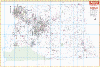
SOUTH CAROLINA SHADED RELIEF MAP
The South Carolina Shaded Relief Wall Map by Universal Map is a full-color, topographical wall map. Statistical information on this map includes historical, anecdotal, and geographical. There is also an elevation scale measured in meters and feet and a distance scale measured in miles and kilometers. Identifies county boundaries. Shows state flag. Lists state motto, bird, flower, and tree, plus total area, population and origin of name. Its heavy laminated surface can be used with waterbased pens.
45" x 36" |
Click Price to Add to Cart | | Laminated |
$31.95 |
|
 |
AIKEN WALL MAP
2007 3rd edition The Aiken County, SC Wall Map by Universal Map measures 66” x 55”, with up-to-date cartography and complete street detail. Area of coverage: North: to the Edgefield County line; South: to the Barnwell County line; East: to the Orangeburg/Lexington County line; West: to the Georgia State line. Protected by a markable and washable surface, it is indexed on the face of the map. Includes framing rails on top and bottom for easy wall mounting. | |
 |
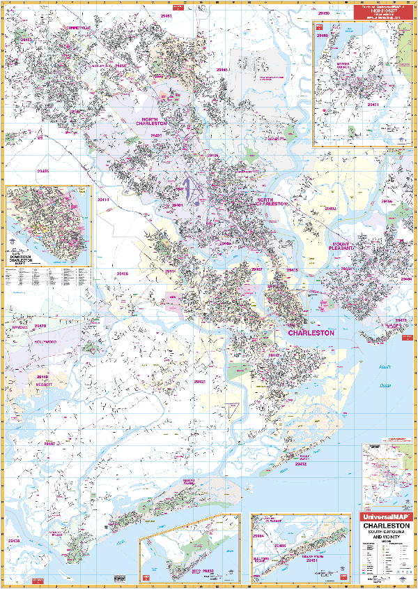
CHARLESTON WALL MAP
2008 5th edition The
4th edition of the Charleston, SC Wall Map by Universal Map measures 54 W x 77 H and provides indexing in a separate book. The map is laminated making it both markable and washable. The area of coverage ranges North to include Goose Creek and Summerville; South to include Seabrook Island; East to include Mount Pleasant and Sullivan's Island; West to portions of Ravenei and Meggett. Insets feature Monck's Corner, Edisto Beach, Isle of Palms, and Downtown Charleston showing historical points of interest. Also pinpoints government buildings, airports, golf courses and country clubs, railroads, zip codes and zip code boundaries, shopping centers, water features, recreational parks, cemeteries, educational facilities, hospitals, post offices, city limits and annexations, fire and police stations, mileage circles, and miscellaneous points of interest.
Framing rails are available on top and bottom for easy wall mounting. | |
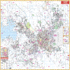 |
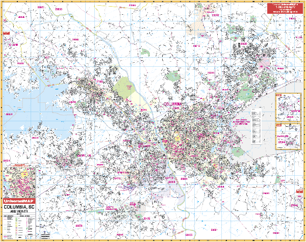
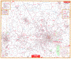
COLUMBIA WALL MAP
2009 5th edition The
Columbia, SC Wall Map by Universal Map includes up-to-date cartography with over 650 new streets. Protected with a markable laminated surface, the map's area of coverage runs: North to the city of Blythewood; South to include the cities of South Congaree and Pine Ridge; East to McEntire Air national Guard Base; West to the city of Chapin and 7 miles of Lake Murray. Map Insets are of the cities of Chapin and Eastover plus downtown Columbia. Also pinpoints post offices, hospitals, railroads, mileage circles, airports, cemeteries, shopping centers, water features, recreational parks, governmental buildings, fire and police stations, educational facilities, golf courses and country clubs, mileage circles, zip codes and boundaries, and points of interest. Measures 64 W x 54 H.
Framing rails are available on top and bottom for easy wall mounting. Includes a separate street index. | |
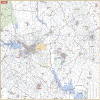 |
COLUMBIA/VICINITY WALL MAP
2005 1st edition The Columbia, SC Vicinity Wall Map by Universal Map has portions of 18 counties. Measures 63” x 54” and contains up-to-date cartography. Covers: 45 miles n. of Seattle to the Snohomish/Skagit Co line; 50 miles s. of Seattle to Olympia in Thurston Co., 40 miles s. of Elk Plain; 30 miles E. of Seattle to N. Bend & Gold Bar in Snohomish Co.; 40 miles w. of Seattle to Skokomish in Mason Co. Printed in color with a markable and washable laminated surface with cities indexed on the face of the map.
Framing rails are available on top and bottom. Excellent source for routing or planning.
64" x 54" | |
 |
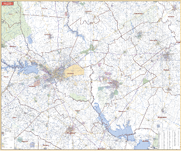
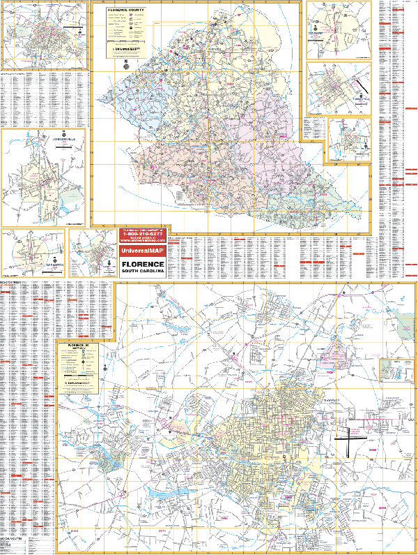
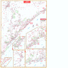
FLORENCE WALL MAP
2006 1st edition The Florence/Florence County, SC Wall Map by Universal Map has added approximately 600 new streets and changes. The upper half of the map is the entire county, and the lower half is the city of Florence with insets of Pamplico, Scranton, Johnsonville, Lake City, Coward, Olanta, and Timmonsville. Also pinpoints government buildings, airports, golf courses and country clubs, railroads, longitude and latitude lines, zip codes and zip code boundaries, shopping centers, recreational parks, mileage circles, cemeteries, educational facilities, hospitals, post offices, city limits and annexations, fire and police stations, and miscellaneous points of interest, plus a complete index. This wall map measures 48 W x 72 H and is protected by a laminate surface which is both markable and washable.
Framing rails are available on top and bottom for easy wall mounting. | |
 |
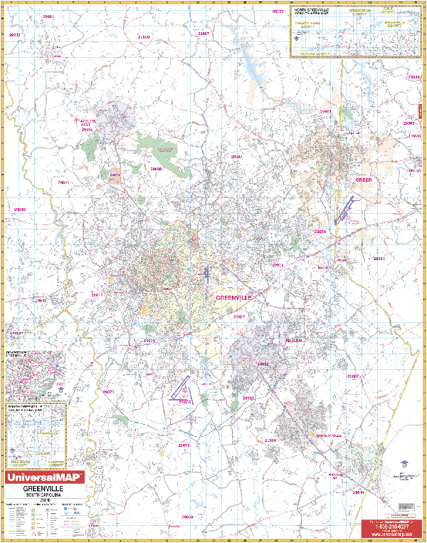
GREENVILLE WALL MAP
2008 7th edition The Greenville, SC Wall Map by Universal Map provides a laminated surface that is both markable and washable. Measuring 54 W x 70 H, it is indexed in a separate book. Coverage ranges North to include Slater Mills and Marietta; South to include Fountain Inn and Pelzer; East to include the BMW Plant and the Greenville-Spartanburg Regional Airport; West to the Pickens County line. Downtown Greenville, southern Greenville, and northern Greenville County have been added to the map as insets. Residential streets have been added to the county inset as a new feature. Other details include airports, all streets and highways, post offices, hospitals, railroads, mileage circles, fire district lines, airports, cemeteries, shopping centers, water features, recreational parks, longitude and latitude lines, government buildings, fire and police stations, educational facilities, golf courses, country clubs, zip codes and boundaries, city limits, and annexations.
Framing rails are available on top and bottom for easy wall mounting. | |
 |
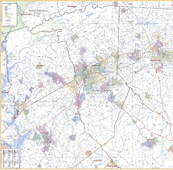
GREENVILLE/SPARTANBURG SOUTH CAROLINA/VICINITY WALL MAP
2007 3rd edition The Greenville and Spartanburg, SC Vicinity Wall Map measures 54” x 64.” Contains up-to-date cartography at a scale of 1” = 1.1 miles. Boundaries: North to include Tryon in NC and Landrum in Spartanburg County; South to include Ware Schoals in Greenwood County, Clinto in Laurens County; East to include Pacalet in Spartanburg County; West to include Utica in Oconee County. Printed in color with a markable and washable laminated surface with cities indexed on the map’s face.
Framing rails are available on top and bottom. | |
 |
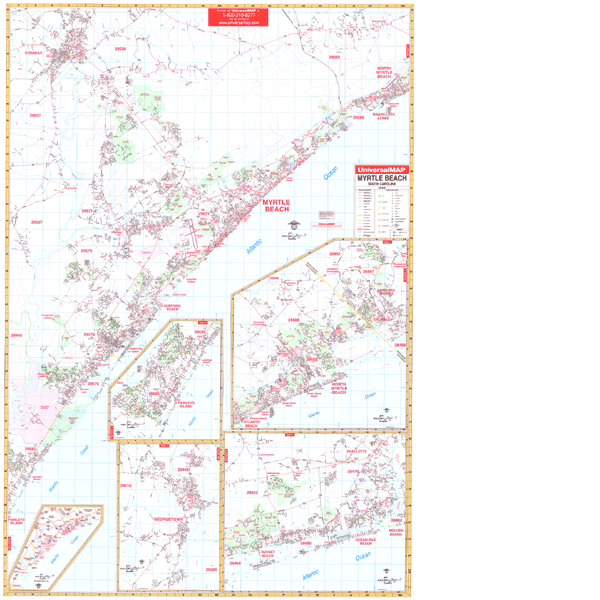
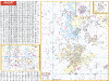
MYRTLE BEACH WALL MAP
2008 5th edition The Myrtle Beach, SC Wall Map by Universal Map features up-to-date cartography in complete street detail with over 350 new streets and changes. Its protective laminate surface can be used with water based pens. Street indexing appears in a separate book. Measuring 4'6 W x 6' 2 H, coverage ranges North to Conway, SC and Calabash and Brunswick Plantation, NC; South to the community of Litchfield Beach on the main map; Pawley's Island and Pawley's Plantation Golf and Country Club; East to Atlantic Beach, SC and the city of Shallotte, NC; West to Conway, SC and Brookgreen Gardens. Insets include Gerogetown, SC; Vicinity map; continuing coverage from the main map of the Pawley's Island area, North Myrtle Beach, and NC beaches to Holden Beach. Also pinpoints airports, all streets and highways, government buildings, cemeteries, hospitals, railroads, post offices, longitude and latitude lines, shopping centers, water features, recreational parks, mileage circles, fire and police stations, educational facilities, golf courses and country clubs, zip codes, and boundaries.
Framing rails are available on top and bottom for easy wall mounting. | |
 |
ROCK HILL WALL MAP
2009 2nd edition
The Rock Hill, York County, SC Wall Map by Universal Map measures 69” x 55” and
is in complete street detail at a scale of 1” = 2,166 feet. Covers all of Rock
Hill with the following boundaries: North: to the state line; South to exit 73
off I-77; East: to Pineville and 2 miles east of Fort Mill; West: 4 miles west
of the Rock Hill city limits. Insets: Clover and York, and York County. Provides
up-to-date cartography with new streets and changes. Protected by a markable
laminate surface. Framing rails are available on top and bottom for easy wall mounting. | |
 |
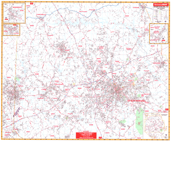
SPARTANBURG WALL MAP
2008 1st edition The Spartanburg, SC Wall Map by Universal Map has added approximately 600 new streets and changes. Boundaries range North to include Campobello and Chesnee; South to the intersection of I-26 and US Hwy 221; East to include Cowpens; West to include Greer. The insets include Landrum, Pacolet, Pacolet Mills, Central Pacolet, and Woodruff. Also pinpoints government buildings, airports, golf courses and country clubs, water features, railroads, longitude and latitude lines, zip codes and boundaries, shopping centers, recreational parks, mileage circles, cemeteries, educational facilities, hospitals, post offices, city limits and annexations, fire and police stations, and miscellaneous points of interest. Measuring 62 W x 54 H, the map is protected by a laminate surface which is both markable and washable. Also includes separate index book.
Framing rails are available on top and bottom for easy wall mounting. | |
|