|
Wall Maps
- State, County & Cities
GeoMart
is rapidly expanding its on-line selection of wall maps. If you
don't find what you are looking for here, please give us a call at
800-248-6277. One of our customer service representative will be
happy to assist you in finding the right map for you.
Most Maps Usually Ship within 48 hours.
Laminated maps with the option of hanging
rails usually ship in 5 days
 |
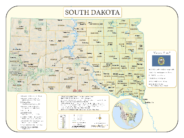
Raven South Dakota Map
The Missouri River, running through the middle of
this beautiful state, separates the western hills and canyons
from the fertile eastern farm country. The Black Hills, home of
Mt. Rushmore and Crazy Horse Memorial, are located in the
southwestern part of South Dakota. Elevations are represented by
color, and this, in combination with our relief shading
technique, gives the map a 3-dimensional look.
Raven South Dakota Map
Dimensions: 37" x 56" (approx.)
Raven South Dakota Map Scale: 1:500,000 or 1" equals about 8
miles |
|
 |
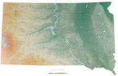
SOUTH DAKOTA SHADED RELIEF MAP
The South Dakota Shaded Relief Wall Map by Universal Map is a full-color, topographical wall map measuring 48 by 36. Statistical information on this map includes historical, anecdotal, and geographical. There is also an elevation scale measured in meters and feet and a distance scale measured in miles and kilometers. Identifies county boundaries. Shows state flag. Lists state motto, bird, flower, and tree, plus total area, population and origin of name. Its heavy laminated surface can be used with waterbased pens. |
Click Price to Add to Cart | | Laminated |
$31.95 |
|
|