|
Wall Maps
- State, County & Cities - Tennessee
GeoMart
is rapidly expanding its on-line selection of wall maps. If you
don't find what you are looking for here, please give us a call at
800-248-6277. One of our customer service representative will be
happy to assist you in finding the right map for you.
Most Maps Usually Ship within 48 hours.
Laminated maps with the option of hanging
rails usually ship in 5 days
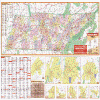 |
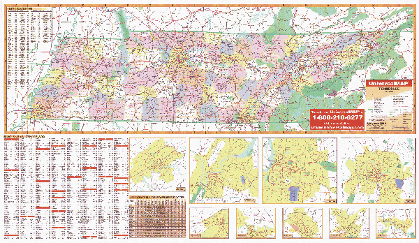
TENNESSEE WALL MAP
2003
2nd edition The Tennessee Wall Map by Universal Map includes major waterways, major airports, state parks, universities, wildlife areas, military installations, and points of interest. Insets include the following Bristol, Chattanooga, Clarksville, Kingsport, Knoxville, Jackson, Memphis, and Nashville. Special features for this map include color coded counties, and major cities mileage chart. This wall map measures 42H x 70W and is protected with a laminate finish, which is both markable and washable. In addition, for your convenience, cities are indexed on the face of the map.
Framing rails are available on top and bottom for easy wall mounting. | |
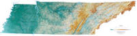 |
Raven Tennessee Map
Tennessee extends from the Bottoms along the Mississippi River,
through the rich farming country of the Nashville Basin, the
Cumberland Plateau and The Great Valley, all the way to the
beautiful Great Smoky Mountains in the east. From Lookout
Mountain on the Plateau, you can see seven states. Elevations
are represented by color, and this, in combination with our
relief shading technique, gives the map a 3-dimensional look.
Raven Tennessee Map Dimensions:
21" x 65" (approx.)
Raven Tennessee Map Scale: 1:500,000 or 1" equals about 8 miles. |
|
 |
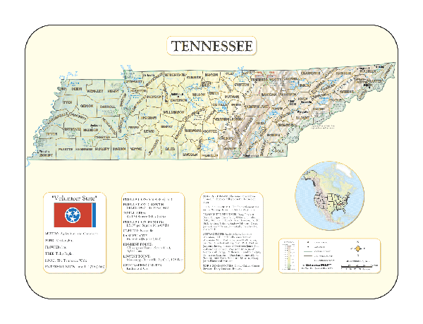
TENNESSEE SHADED RELIEF MAP
The Tennessee Shaded Relief Wall Map by Universal Map is a full-color, topographical wall map. Statistical information on this map includes historical, anecdotal, and geographical. There is also an elevation scale measured in meters and feet and a distance scale measured in miles and kilometers. Identifies county boundaries. Shows state flag. Lists state motto, bird, flower, and tree, plus total area, population and origin of name. Its heavy laminated surface can be used with waterbased pens.
48" x 36" |
Click Price to Add to Cart | | Laminated |
$31.95 |
|
 |
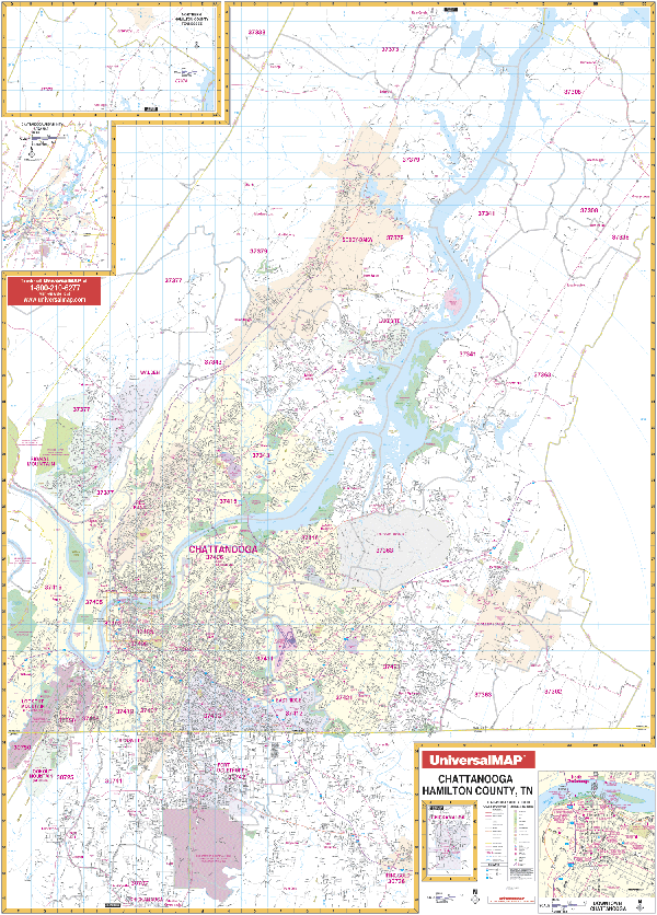
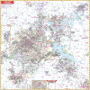
CHATTANOOGA WALL MAP
2008 5th edition
The 4th edition of the Chattanooga and Hamilton County, TN Wall Map by Universal
Map features up-to-date cartography in complete street detail. Includes a
markable, washable, and laminated surface. Measures 54” x 77” with indexing in a
separate book. Coverage: North to Soddy Daisy and the Hamilton Co. line; South
to Rossville, Ft. Oglethorpe, Chattanooga Natl. Park, and portions of Ringgold
in GA; East to Collegedale and the Bradley County line; West to Hamilton Co.
line, signal, and Lookout Mts. Framing rails are available on top and bottom for easy wall mounting. | |
 |
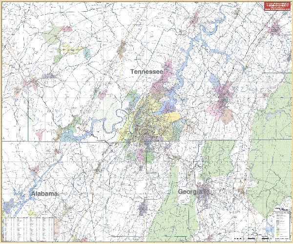
CHATTANOOGA/VICINITY TENNESSEE WALL MAP
2003 1st edition The Chattanooga, TN Vicinity Wall Map by Universal Map measures 64” x 54”, provides up-to-date full color cartography, and is protected with a markable/washable laminated surface. Includes Bradley, Grundy, Hamilton, Marion, Sequatchie, Co’s - parts of Coffee, Bledsoe, Franklin, Meigs, McMinn, Polk and Rhea Counties in TN; and in GA, includes Dade, Catoosa, Whitfield, Walker Co’s - parts of DeKalb, Jackson, Murray, and Gilmen Counties.
Framing rails are available on top and bottom. Excellent source for routing or planning. | |
 |
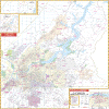
CLARKSVILLE/MONTGOMERY COUNTY WALL MAP
2009 3rd edition The Clarksville and Montgomery County, TN Wall Map by Universal Map measures 5' 8 W x 4' 4 H and is protected with a durable lamination, allowing the map to be easily marked on and wiped off. Street indexing appears on the face of the map. Insets are of downtown Clarksville and Fort Campbell Military Reservation. Also pinpoints government buildings, airports, golf courses and country clubs, railroads, longitude and latitude lines, zip codes and zip code boundaries, shopping centers, recreational parks, mileage circles, cemeteries, educational facilities, hospitals, post offices, city limits and annexations, fire and police stations, and miscellaneous points of interest.
Framing rails are available on top and bottom for easy wall mounting. | |
 |
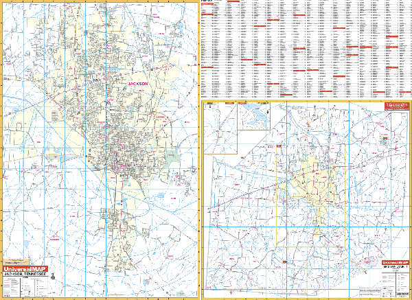
JACKSON WALL MAP
2001 1st edition The Jackson, TN Wall Map by Universal Map measures 64 x 46 and provides up-to-date cartography in complete street detail. Also pinpoints government buildings, airports, golf courses and country clubs, railroads, longitude and latitude lines, zip codes and zip code boundaries, shopping centers, recreational parks, mileage circles, cemeteries, educational facilities, hospitals, post offices, city limits and annexations, fire and police stations, and miscellaneous points of interest. There are two sections to the map. Section One ranges North to the Jackson city limit and Ashport Rd.; South to Mt. Pinson and Gobelett Rd.; East to Rose Hill and East Union; and West to the Western Jackson city limit: Section two contains Madison County and an inset of Medon and Springport.
Framing rails are available on top and bottom for easy wall mounting. Protected by a markable laminate finish. | |
 |
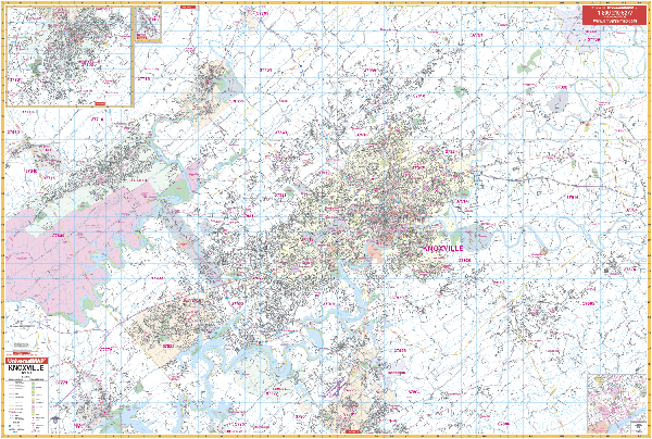
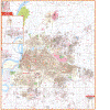
KNOXVILLE WALL MAP
2008 4th edition This Knoxville & Knox County, TN Wall Map by Universal Map measures 77 W x 54 H and provides complete street detail. The map is protected by a markable and washable laminated surface. Streets are indexed in a separate book. The area of coverage includes all of Knox County with the following boundaries: North to the Union County line, Exit 122 of I-75, city of Blaine; South to Lenoir City and Alcoa; East 1 mile east of Knox County line; and West to the city of Oliver Springs. Insets include downtown Knoxville, Maryville, and Lake City. The special features and data contained on this map are as follows: all streets and highways, government buildings, airports, golf courses and country clubs, railroads, longitude and latitude lines, zip codes and zip code boundaries, shopping centers, recreational parks, mileage circles, cemeteries, educational facilities, hospitals, post offices, city limits and annexations, fire and police stations, section/township/range lines, longitude and latitude lines, and miscellaneous points of interest.
Framing rails are available on top and bottom for easy wall mounting. | |
 |
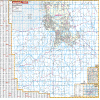
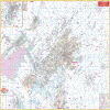
MEMPHIS/SHELBY WALL MAP
2009 3rd edition The Memphis and Shelby County, TN Wall Map by Universal Map measures 60 W x 69 H and is protected by a markable and washable laminated surface. The map provides complete street detail and up-to-date cartography with new streets and changes. Streets are indexed in a separate book. Insets are of Downtown Memphis and West Memphis and Marion, Arkansas. Also pinpoints government buildings, airports, golf courses and country clubs, railroads, longitude and latitude lines, block numbers, shopping centers, recreation parks, mileage circles, cemeteries, educational facilities, hospitals, post offices, city limits and annexations, township names, water features, fire and police stations, fire district lines, zip codes and boundaries, and assorted points of interest.
Framing rails are available on top and bottom for easy wall mounting. | |
 |
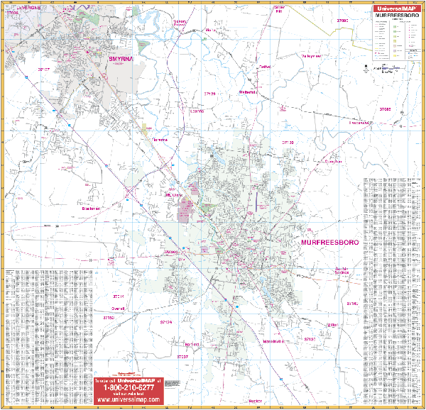
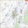
MURFREESBORO WALL MAP
2004
2nd edition The Murfreesboro, TN Wall Map by Universal Map illustrates complete street detail with the boundaries as follows: North to Smyrna Airport; South To Rucker Road; East to State Highway 266 and Highway 96 (Cainsville Road); and West to State Highway 102 (Almaville Road). Also pinpoints government buildings, airports, golf courses and country clubs, railroads, longitude and latitude lines, zip codes and zip code boundaries, shopping centers, recreational parks, mileage circles, cemeteries, educational facilities, hospitals, post offices, city limits and annexations, fire and police stations, and miscellaneous points of interest, plus a complete index. Measuring 54 W x 52 H, the map is protected by a laminate surface which is both markable and washable.
Framing rails are available on top and bottom for easy wall mounting. | |
 |
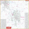
NASHVILLE WALL MAP
2009 7th edition The Nashville/Davidson County, TN Wall Map by Universal Map offers up-to-date cartography with over 1,050 new streets and changes. Protected by a laminated surface which is markable and washable, it measures 41/2'W x 5'9W. The map's area of coverage ranges North to include Goodlettsville, Hendersonville, Gallatin, Ridgetop, and Millersville; South to 1 mile south of Franklin, and a portion of Murfreesboro; East to include Mt. Juliet, LaVergne, Smyma, Lebanon, and State Hwy 840; and West to include 1-40 and the US 70 Interchange. There is an inset map of Downtown Nashville. Also pinpoints post offices, hospitals, railroads, mileage circles, city limits and annexations, airports, cemeteries, shopping centers, water features, recreational parks, government buildings, fire and police stations, educational facilities, golf courses and country clubs, zip codes and boundaries, and points of interest.
Framing rails are available on top and bottom for easy wall mounting. Street indexing is included in a separate book. | |
|