|
Wall Maps
- State, County & Cities - Texas
GeoMart
is rapidly expanding its on-line selection of wall maps. If you
don't find what you are looking for here, please give us a call at
800-248-6277. One of our customer service representative will be
happy to assist you in finding the right map for you.
Most Maps Usually Ship within 48 hours.
Laminated maps with the option of hanging
rails usually ship in 5 days
 |
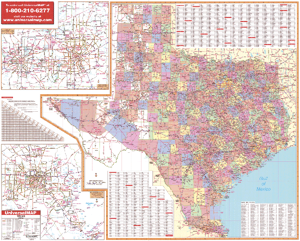
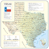
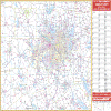
TEXAS WALL MAP
2007
4th edition The Texas Wall Map by Universal Map measures 66 W x 54 H at a scale of 1” = 15 miles. Details include state/federal highways, major waterways, state universities, military installations, major airports, wildlife areas, cities, state parks, county names, time zones, and pts of interest. Insets: Dallas/Ft. Worth and Houston to Galveston. Includes color coded counties, a mileage chart between major cities, and a laminated surface making the map both markable and washable. | |
 |
Raven Texas Map
The Lone Star State may be known for bluebonnets, pecans, and
armadillos, but the scope of its geographic variety is
stunningly apparent on this map of Texas. The Great Plains and
the southern part of the Rocky Mountains spread through the
Panhandle, and in the south, the Gulf Coast Plain runs into the
Gulf of Mexico. Elevations are represented by color, and this,
in combination with our relief shading technique, gives the map
a 3-dimensional look.
Raven Texas Map Dimensions: 46" x
50" (approx.)
Raven Texas Map Scale: 1:1.1 million or 1" equals about 16
miles. |
|
 |
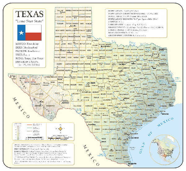
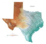
TEXAS SHADED RELIEF MAP
The Texas Shaded Relief Wall Map by Universal Map is a full-color, topographical wall map. Statistical information on this map includes historical, anecdotal, and geographical. There is also an elevation scale measured in meters and feet and a distance scale measured in miles and kilometers. Identifies county boundaries. Shows state flag. Lists state motto, bird, flower, and tree, plus total area, population and origin of name. Its heavy laminated surface can be used with waterbased pens.
39" x 36" |
Click Price to Add to Cart | | Laminated |
$31.95 |
|
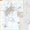 |
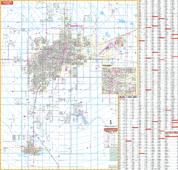
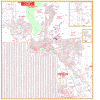
AMARILLO WALL MAP
2009
2nd edition The Amarillo, TX Wall Map by Universal Map provides complete street detail along with up-to-date cartography with new streets and changes. This map measures 54 x 54 and is protected with a markable and washable laminated surface. Streets are indexed on the face of the map. Coverage ranges North 2 miles north of the Amarillo city limits; South to the city of Canyon; East to the Amarillo International Airport and Amarillo Technical Center; and West 4 miles west of Amarillo city limits and including Arnote Rd. There is an inset of Downtown Amarillo. Also includes government buildings, airports, golf courses and country clubs, railroads, longitude and latitude lines, zip codes and zip code boundaries, shopping centers, recreational parks, mileage circles, cemeteries, educational facilities, hospitals, post offices, city limits and annexations, fire and police stations, and miscellaneous points of interest.
Framing rails are available on top and bottom for easy wall mounting. | |
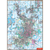 |
AUSTIN WALL MAP
2007 4th edition The Austin, TX Wall Map By Universal Map measures 54 W x 77 H and has added approximately 1,900 new streets and changes. Boundaries range North to include Leander and Round Rock; South to include San Leanna and Austin; East to includes Manor, Pflugeville, and Walter E. Long Park and Lake; and West to Lakeway and Jonestown. Also included is an inset map of Georgetown. Other features are educational institutions, hospitals, governmental buildings, golf and country clubs, zip codes and boundaries, post offices, fire and police stations, shopping centers, airports, cemeteries, recreational parks, points of interest, city limits and annexations, water features, railroads, mileage circles, block numbers. Protected with a markable laminated finish.
Framing rails are available on top and bottom for easy wall mounting. The street index appears in a separate book. | |
 |
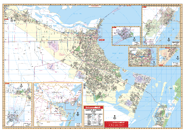
CORPUS CHRISTI WALL MAP
2006 4th edition The Corpus Christi, TX Wall Map by Universal Map is protected with a durable, markable laminate finish. Measuring 65 W x 50 H, this map offers up-to-date cartography in complete street detail, and includes a separate index book. Also illustrates Calallen, Robstown, Portland, Port Aransas, Ingleside, and Aransas Pass. Boundaries range North to include Nueces Bay; South to the Kleberg-Nueces County line; East to include Mustang Island State Park; West to include the cities of Calallen and Robstown. Insets are as follows: Portland, Port Aransas, Ingleside, Aransas pass, and Downtown Corpus Christi. Other data features government buildings, airports, golf courses and country clubs, railroads, zip codes and zip code boundaries, shopping centers, water features, recreational parks, cemeteries, educational facilities, hospitals, post offices, city limits and annexations, longitude and latitude lines, fire and police stations, and miscellaneous points of interest.
Framing rails are available on top and bottom for easy wall mounting. | |
 |
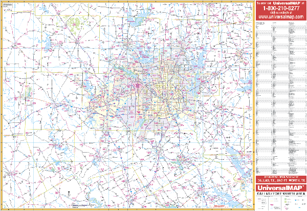
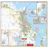
DALLAS/FORT WORTH WALL MAP
2006
The Dallas/Fort Worth, TX Wall Map by Universal Map ranges North to Ray Roberts Lake State Recreation Area, including Sunset, Howe, and Whitewright; South to Navarro Mills Lake Recreation Area, including Hillsboro and Corsicana; East to Purtis Creek State Recreation Area, including Trinidad and Greenville; and West to Lake Mineral Wells State Park, including Stephenville, Mineral Wells and Jacksboro. Also
features mileage circles, national forests, longitude and latitude, wildlife hunting areas, recreation areas, water features, zip code numbers, airports, and military installations, plus a complete index. Protected with a markable laminate finish, the oversized reference measures 5' 4" x 3' 10".
Framing rails are available on top and bottom for easy wall mounting. | |
 |
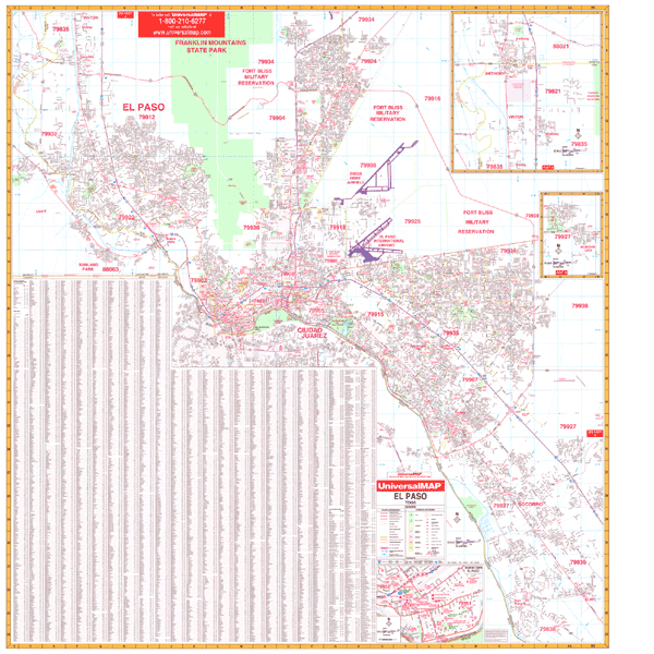
EL PASO WALL MAP
2008 5th edition The
5th edition of the El Paso, TX Wall Map by Universal Map features up-to-date cartography, complete street detail at a scale of 1” = 2,818 ft. Includes new streets, a laminated surface, and indexing. Coverage: North to include Anthony plus the unincorporated area of Anthony in New Mexico; South to include Clint and also the major portion of Ciudad Jaurez, Mexico; East to include Horizon City; West to the El Paso County line, Sunland Park in New Mex. Measures 59 x 62.
Framing rails are available. Protected by a markable laminate finish. | |
 |
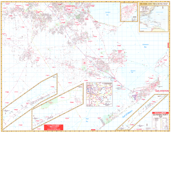
GALVESTON WALL MAP
2007
2nd edition The Galveston, TX Wall Map by Universal Map has added approximately 1100 new streets and changes. Boundaries range North to include the Lyndon B. Johnson Space Center and Pearland; South to include West Bay; East to the Gulf of Mexico including the entire beach side from Sea Isle to Galveston and Crystal Beach High Island; and West to include all of Alvin and a portion of Manuel in Brazoria County. A hurricane tracking chart has been included as an inset. Also features government buildings, airports, golf courses and country clubs, railroads, longitude and latitude lines, zip codes and zip code boundaries, shopping centers, recreational parks, mileage circles, cemeteries, educational facilities, hospitals, post offices, city limits and annexations, fire and police stations, and miscellaneous points of interest. This wall map measures 66 W x 54 H and is protected by a laminate surface which is both markable and washable. This wall map has been indexed in a separate book.
Framing rails are available on top and bottom for easy wall mounting. | |
 |
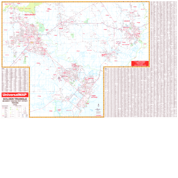
GOLDEN TRIANGLE WALL MAP
2000
2nd edition The Golden Triangle, TX Wall Map by Universal Map measures 77 x 54 and includes the cities and towns of Beaumont, Bridge City, Groves, Nederland, Orange, Pinehurst, Port Neches, Rose City, Port Arthur, Vidor and West Orange. This map has added approximately 500 new streets and changes. Boundaries range North to include Pine Forest; South to include Port Arthur; East to include Orange; and West to include Beaumont. Also features educational facilities, government buildings, shopping centers, hospitals airports, recreational parks, post offices, golf and country clubs, points of interest, city limits and annexations railroads, mileage circles, water features, longitude and latitude lines, cemeteries, fire and police stations, zip code and boundaries. In addition, for your convenience, the map is indexed on the face of the map. The map is protected with a laminate finish, which is both markable and washable.
Framing rails are available on top and bottom for easy wall mounting. | |
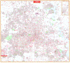 |
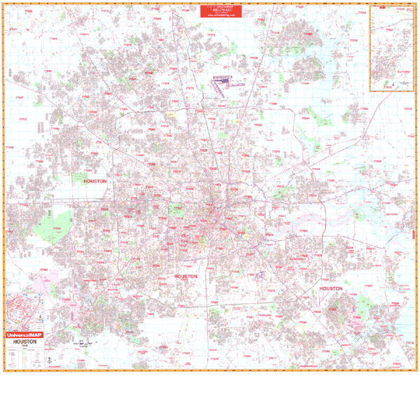
HOUSTON WALL MAP
2008 6th edition
The 3rd edition of the Houston, TX Wall Map by Universal Map measures 77 W x 71
H and provides complete street detail with new streets and changes. Laminated
surface is markable/washable. Street indexing for this wall map appears in a
separate book. Framing rails are available on top and bottom for easy wall
mounting | |
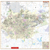 |
SAN ANTONIO WALL MAP
2008 4th edition The San Antonio, TX Wall Map by Universal Map measures 60 W x 73 H. The map has been protected with a markable and washable laminated surface. Streets are indexed in a separate book. Boundaries range North to the Comal/Bexar County lines, Fair Oaks Ranch; South to include Somerset and Elmendorf; East to include Cibolo; and West to San Antonio city limits including Loop 1604. There is an inset map of downtown San Antonio. Other data features government buildings, airports, golf courses and country clubs, railroads, water features, zip codes and boundaries, shopping centers, recreational parks, mileage circles, cemeteries, educational facilities, hospitals, post offices, city limits and annexations, fire and police stations, and miscellaneous points of interest.
Framing rails are available on top and bottom for easy wall mounting. | |
|