|
Wall Maps
- State, County & Cities - Utah
GeoMart
is rapidly expanding its on-line selection of wall maps. If you
don't find what you are looking for here, please give us a call at
800-248-6277. One of our customer service representative will be
happy to assist you in finding the right map for you.
Most Maps Usually Ship within 48 hours.
Laminated maps with the option of hanging
rails usually ship in 5 days
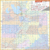 |
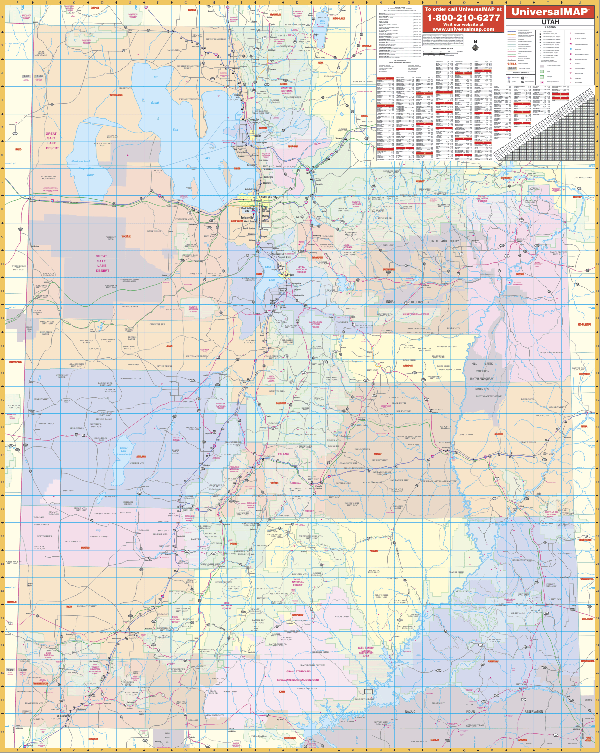
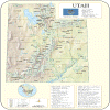
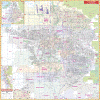
UTAH WALL MAP
2006
3rd edition The Utah Wall Map by Universal Map measures 54 W x 68 H and includes color coded counties, a laminated surface that is both markable and washable, and indexing on the face of the map. Details found with the map include all state highways, major waterways, state universities, military installations, all federal highways, major airports, national parks and forests, cities, towns, state parks, wildlife areas, and assorted points of interest.
Framing rails are available on top and bottom for easy wall mounting. | |
 |
Raven Utah Map From
lofty, snow-covered mountains to exquisite rock formations and
dramatically colored canyons, Utah is a beautiful state. The
Uinta Range in the northeast is the only Rocky Mountain range
that runs east west. The Beehive State is also know for the
Great Salt Lake, the Bonneville Salt Flats, Bryce Canyon, the
Wasatch Range, Zion Canyon, the Colorado River, and Lake Powell.
Elevations are represented by color, and this, in combination
with our relief shading technique, gives the map a 3-dimensional
look.
Raven Utah Map Dimensions: 41" x 50" (approx.)
Raven Utah Map Scale: 1:500,00 or 1" equals about 8 miles |
|
 |
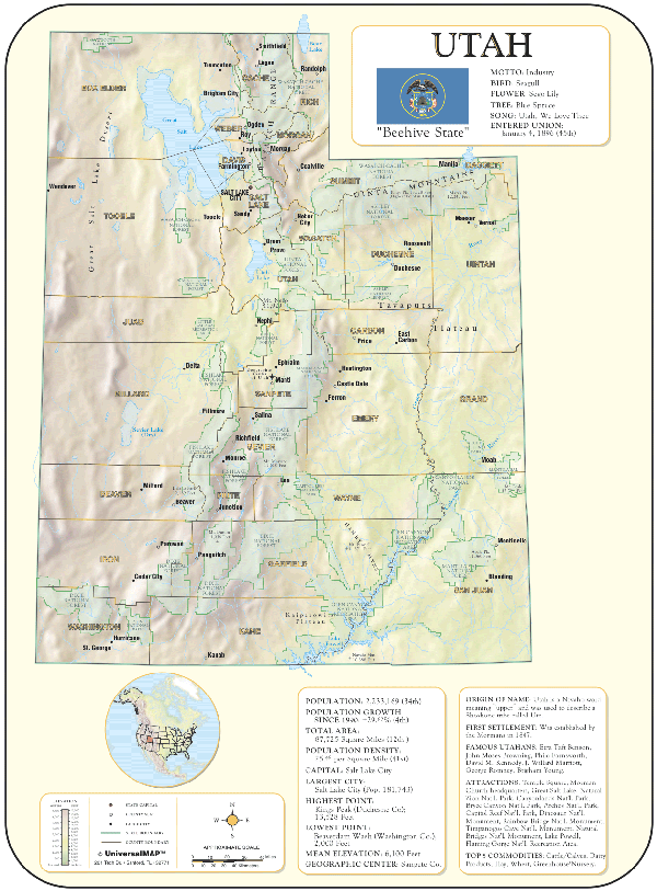
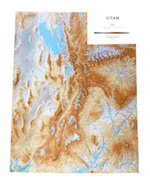
UTAH SHADED RELIEF MAP
The Utah Shaded Relief Wall Map by Universal Map is a full-color, topographical wall map. Statistical information on this map includes historical, anecdotal, and geographical. There is also an elevation scale measured in meters and feet and a distance scale measured in miles and kilometers. Identifies county boundaries. Shows state flag. Lists state motto, bird, flower, and tree, plus total area, population and origin of name. Its heavy laminated surface can be used with waterbased pens.
36" x 48" |
Click Price to Add to Cart | | Laminated |
$31.95 |
|
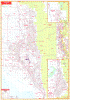 |
OGDEN WALL MAP
2001 1st edition The Ogden, Davis/Weber Counties, UT Wall Map by Universal Map measures 54 x 77 and provides complete street detail. Special features include post offices, hospitals, railroads, mileage circles, time zones, airports, cemeteries, shopping centers, water features, recreational parks, longitude and latitude lines, government buildings, fire and police stations, educational facilities, golf courses and country clubs, zip codes and boundaries, city limits, and annexations. Boundaries range North to Box Elder/Davis County line; South to Farmington; East to Wasatch-Cache National Forest; and West to West Point. Insets for this map are Brigham City, Bountiful/N. Salt Lake City area extending from Farmington south-almost to the Salt Lake County line; and a vicinity map.
Framing rails are available on top and bottom for easy wall mounting. Protected by a markable laminate surface. | |
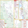 |
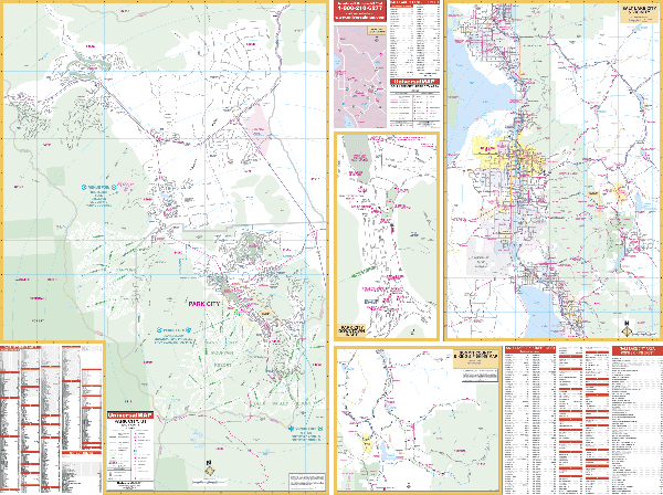
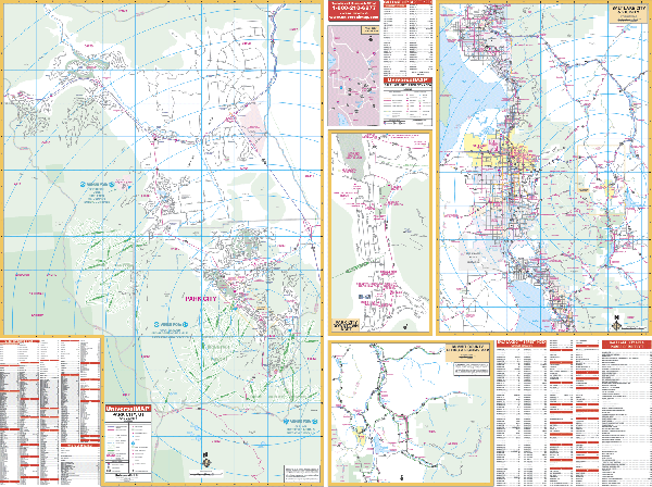
PARK CITY WALL MAP
2002 1st edition Measuring 64 W x 50 H, the Park City, UT Wall Map by Universal Map provides complete street detail and has up-to-date cartography with new streets and changes. It protected by a laminated surface which is both markable and washable. Coverage ranges North to the Summit-Morgan County lines; South 2 miles south of the Summit-Wasatch County lines; East to the easternmost boundary of Park City; and West to the Summit-Salt Lake County lines. Insets map feature a Park City locator map; Downtown Park City; Summit County Biking and Fishing map; and Salt Lake and vicinity. Other data highlights government buildings, airports, golf courses and country clubs, railroads, zip codes and zip code boundaries, shopping centers, water features, recreational parks, cemeteries, educational facilities, hospitals, post offices, mileage circles, city limits and annexations, section/township/range lines, fire and police stations, and miscellaneous points of interest, plus a complete index. Olympic venues are marked on this map as a special feature.
Framing rails are available on top and bottom for easy wall mounting. | |
 |
PROVO WALL MAP
2001 1st edition The Provo, UT Wall Map from Universal Map features complete street detail. Measuring 49 x 77, its laminated surface is markable with water based pens. This color map offers up-to-date cartography with new streets and changes. Special features include all streets, post offices, hospitals, railroads, mileage circles, time zones, airports, cemeteries, shopping centers, water features, recreational parks, longitude and latitude lines, government buildings, fire and police stations, educational facilities, golf courses and country clubs, zip codes and zip code boundaries, city limits, and annexations. Coverage ranges North to include Alpine; South to include Salem, Elk Ridge, Woodland Hills, and Payson; East to Uinta National Forest; and West to Utah Lake, Clinton, and Camp Williams.
Framing rails are available on top and bottom for easy wall mounting. | |
 |
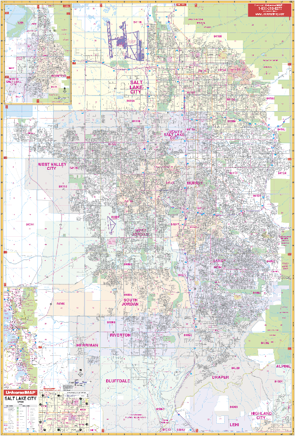
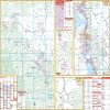
SALT LAKE CITY WALL MAP
2006
4th edition
The 4th edition of the Salt Lake City, UT Wall Map by Universal Map features
complete street detail. Measuring 54 x 78, it is laminated making the map markable and washable. Coverage: No: to the Salt Lake/Davis Co. line; So: to
Camp Williams, SR 92; East: to Wasatch-Cache National Forest; West: to the
community of Magna. Insets: Centerville/Bountiful/North Salt Lake City area;
vicinity map; and a downtown Salt Lake City map. This color map offers
up-to-date cartography with new streets and changes. Framing rails are available on top and bottom for easy wall mounting. | |
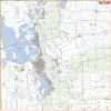 |
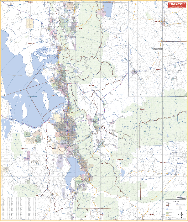
SALT LAKE CITY/VICINITY WALL MAP
2005 1st edition The Salt Lake City, UT Vicinity Wall Map includes portions of 15 counties measures 54” x 64.” Contains up-to-date cartography. Boundaries: No: 50 miles N of Elgin in Lancaster Co and Jefferson in Chesterfield Co; So: 50 miles S to include Orangeburg; East: 80 miles E to include Florence & Bennettsville; West: 30 miles W of Columbia to include all of Batesburg & part of Newberry. Printed in color with a markable and washable laminated surface. Cities are indexed on the face of the map. Published by Universal Map.
Framing rails are available on top and bottom. Excellent source for routing or planning. | |
|