|
Wall Maps
- State, County & Cities - Wisconsin
GeoMart
is rapidly expanding its on-line selection of wall maps. If you
don't find what you are looking for here, please give us a call at
800-248-6277. One of our customer service representative will be
happy to assist you in finding the right map for you.
Most Maps Usually Ship within 48 hours.
Laminated maps with the option of hanging
rails usually ship in 5 days
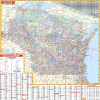 |
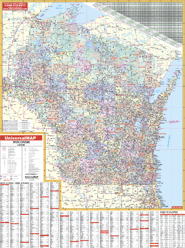
Wisconsin State Map
2005
2nd edition
The Wisconsin Wall Map by Universal Map includes
laminated surface that can be used with water based pens. Measuring 4' 2" W x 5'
6" H, this map has been indexed on its face. Details include all state and
federal highways, major waterways, rest areas, state universities, military
installations, a mileage chart between selected cities, airports and hospitals,
state and national parks, cities and towns along with their populations,
wildlife areas, and other miscellaneous points of interest. Counties have been
color coded to make identification easier. Framing rails are available on top and bottom for easy wall mounting.
| |
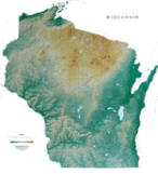 |
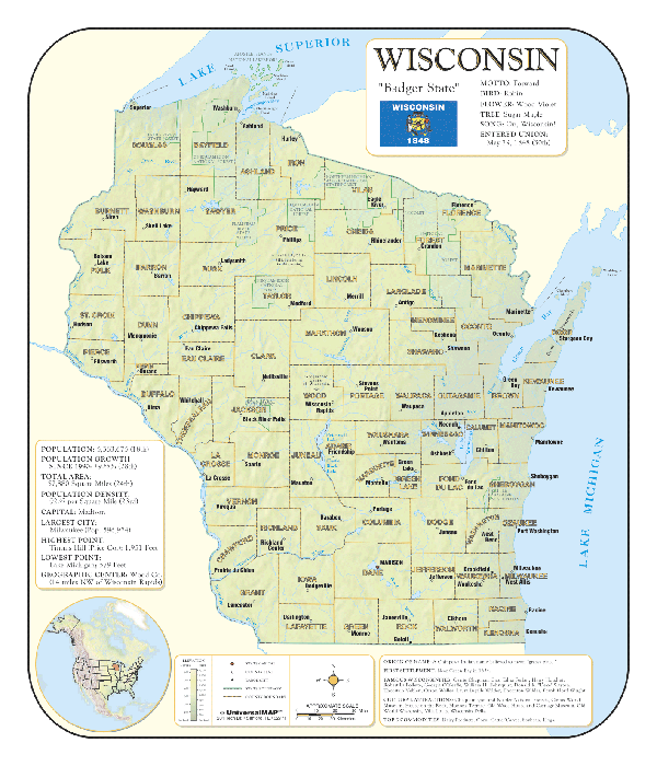
Raven Wisconsin Map
From Lake Superior in the north, past the limestone and
sandstone bluffs along the Mississippi River, to Lake Geneva,
most of the state of Wisconsin was carved by glaciers thousands
of years ago. Elevations are represented by color, and this, in
combination with our relief shading technique, gives the map a
3-dimensional look.
Raven Wisconsin Map Dimensions:
43" x 47" (approx.)
Raven Wisconsin Map Scale: 1:500,000 or 1" equals about 8 miles. |
|
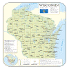 |
WISCONSIN SHADED RELIEF MAP
The Wisconsin Shaded Relief Wall Map by Universal Map is a full-color, topographical wall map. Statistical information on this map includes historical, anecdotal, and geographical. There is also an elevation scale measured in meters and feet and a distance scale measured in miles and kilometers. Identifies county boundaries. Shows state flag. Lists state motto, bird, flower, and tree, plus total area, population and origin of name. Its heavy laminated surface can be used with waterbased pens.
36" x 42" |
Click Price to Add to Cart | | Laminated |
$31.95 |
|
 |
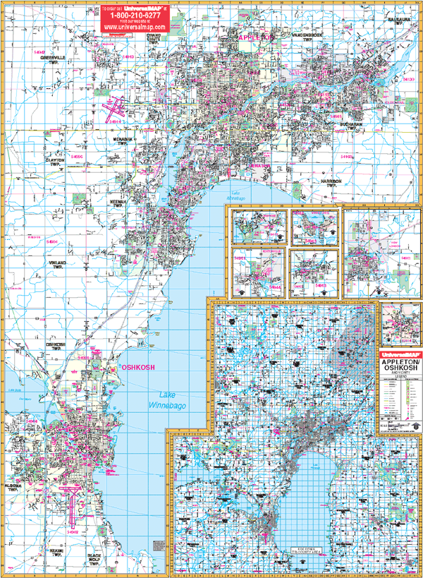
FOX CITIES WALL MAP
2003
2nd edition The Fox Cities, Appleton, and Oshkosh, WI Wall Map by Universal Map measures 54” x 75” and has added new streets and changes. This commercial wall map will show all of Appleton/Wisconsin in complete street detail at a scale of 1” = 2,060 feet. Boundaries: No: Includes CR JJ with Appleton and Kaukauna; So: includes Wittman Regional Airport and the interchange at US 41 and SR 26 and Far Vu Golf Course; East: All of Kaukauna; West: includes the westerly city limits of Oshkosh . Protected by a markable laminate finish.
Framing rails are available on top and bottom for easy wall mounting. | |
 |
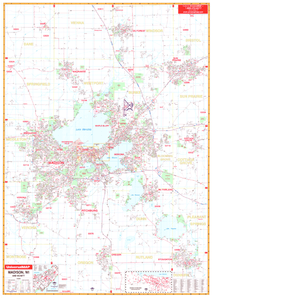
MADISON WALL MAP
2009 3rd edition The Madison, WI Wall Map by Universal Map includes adjacent areas and offers up-to-date cartography with new streets and changes. Measuring 54 x 77, this colorful map provides complete street detail. This map has been laminated making it markable and washable. The map's area of coverage ranges North to include Dane and DeForest; South to include Oregon and Stoughton; East to include Sun Prairie and Cottage Grove; and West to include Middleton and Verona. There are inset maps of Downtown Madison and the University of Wisconsin. Also illustrates educational facilities, government buildings, shopping centers, hospitals, airports, recreational parks, post offices, golf and country clubs, points of interest, city limits and annexations, railroads, mileage circles, water features, cemeteries, fire and police stations, zip code and boundaries. The map is indexed in a separate book.
Framing rails are available on top and bottom for easy wall mounting. | |
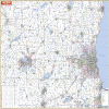 |
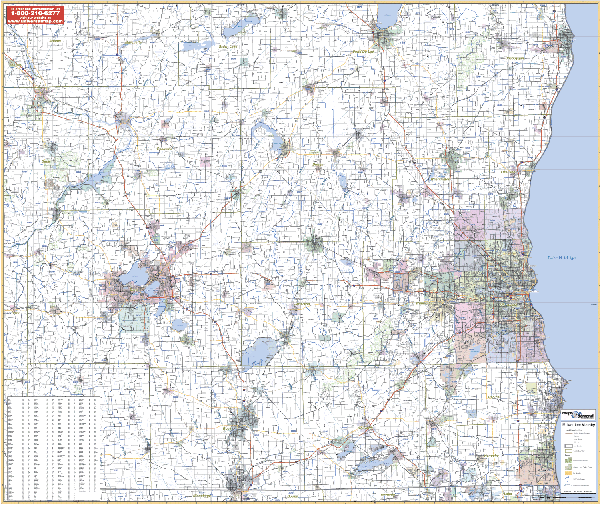
MILWAUKEE/VICINITY WALL MAP
2003 1st edition The Milwaukee, WI Vicinity Wall Map measures 64” x 54” and provides up-to-date cartography. Includes all of the counties of Butler, Clermont, Greene, Hamilton,
Montgomery, Preble, and portions of Brown, Clark, Clinton, Darke, Highland, and Miami Counties. Printed in color with a markable/washable-laminated surface. Cities are indexed on the face of the map.
Framing rails are available on top and bottom. Excellent source for routing or planning. | |
 |
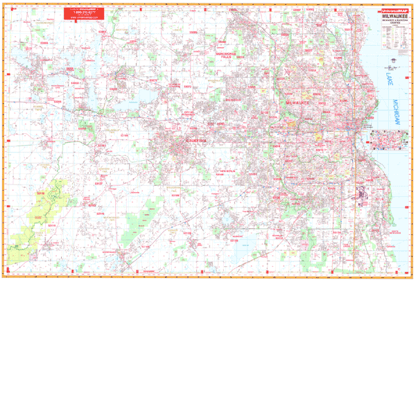
MILWAUKEE/WAUKESHA COUNTY WALL MAP
2009 4th edition Up-to-date cartography in complete street detail with new streets and changes grace the 3rd edition of the Milwaukee and Waukesha County, WI Wall Map. Includes all of the Greater Milwaukee area with the boundaries as follows: North to the Washington/Ozaukee Co. lines; South to the Walworth/Racine Co. lines; East to Lake Michigan; West to the Jefferson Co. line. Includes inset map of Downtown Milwaukee. Measures 77 W x 54, color and a laminated, markable, and washable surface.
Framing rails are available on top and bottom for easy wall mounting. | |
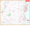 |
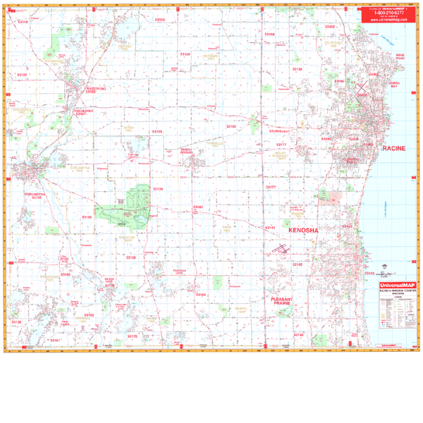
RACINE/KENOSHA WALL MAP
2000 1st edition The Racine and Kenosha County, WI Wall Map by Universal Map measures 62” x 54” and has up-to-date cartography. Street indexing appears in a separate book. Contains hanging rails mounted top and bottom. Area of coverage ranges: North: Racine County line; South: Wisconsin-Illinois state lines; East: Lake Michigan; West: Kenosha-Rachine-Walworth County lines. Provides complete street detail. Protected by laminated surface that is both markable and washable; includes framing rails on top and bottom for easy wall mounting. | |
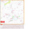 |
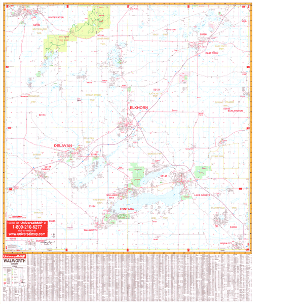
WALWORTH WALL MAP
2000 1st edition The Walworth, WI Wall Map by Universal Map offers up-to-date cartography in complete street detail. This map has been printed in color on a laminated surface that is markable and washable. Street indexing appears on the face of the map. Measuring 4 1/2' W x 3'4 H, coverage ranges North to the Jefferson-Waukesha County line; South to the State line; East to the Racine-Kenosha County line; and West to the Rock County line. Details found on this map include all streets, post offices, hospitals, railroads, mileage circles, airports, cemeteries, shopping centers, water features, recreational parks, government buildings, fire and police stations, educational facilities, golf courses and country clubs, zip codes, and zip code boundaries.
Framing rails are available on top and bottom for easy wall mounting. | |
|