|
Wall Maps
- State, County & Cities - West Virginia
GeoMart
is rapidly expanding its on-line selection of wall maps. If you
don't find what you are looking for here, please give us a call at
800-248-6277. One of our customer service representative will be
happy to assist you in finding the right map for you.
Most Maps Usually Ship within 48 hours.
Laminated maps with the option of hanging
rails usually ship in 5 days
 |
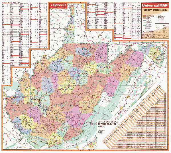
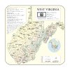
WEST VIRGINIA WALL MAP
2004
2nd edition The West Virginia Wall Map by Universal Map measures 54 W x 50 H and features color-coded counties, a mileage chart between major cities, a durably laminated surface that is both markable and washable, and indexing on the face of the map. Details found on this map include all state and federal highways, major waterways, state universities, military installations, major airports, wildlife areas, points of interest, cities and towns, state parks, county names, exit numbers, and indexing of cities, towns, places, counties, and county seats.
Framing rails are available on top and bottom for easy wall mounting. | |
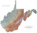 |
Raven West Virginia Map
Some of the most rugged land in the
country is in the Mountain State. The Allegheny and Blue Ridge
Mountain Ranges run from the northeast to the southwest, and the
Appalachian Plateau, with its flat-topped highlands and rounded
hills, covers the rest of the state of West Virginia. Elevations
are represented by color, and this, in combination with our
relief shading technique, gives the map a 3-dimensional look.
Raven West Virginia Map
Dimensions: 36" x 40" (approx.)
Raven West Virginia Map Scale: 1:500,000 or 1" equals about 8
miles. |
|
 |
WEST VIRGINIA SHADED RELIEF MAP
2000 1st edition The West Virginia Shaded Relief Wall Map by Universal Map is a full-color, topographical wall map. Statistical information on this map includes historical, anecdotal, and geographical. There is also an elevation scale measured in meters and feet and a distance scale measured in miles and kilometers. Identifies county boundaries. Shows state flag. Lists state motto, bird, flower, and tree, plus total area, population and origin of name. Its heavy laminated surface can be used with waterbased pens.
40" x 36" |
Click Price to Add to Cart | | Laminated |
$31.95 |
|
 |
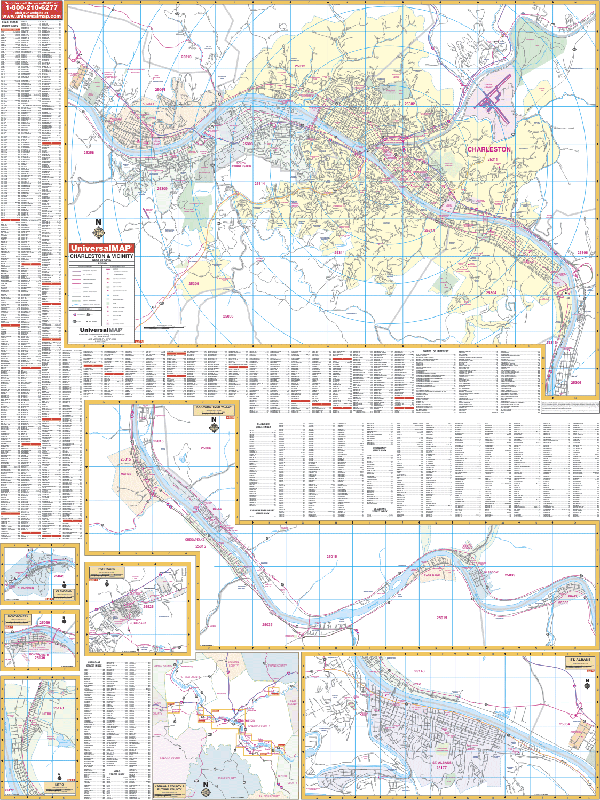
CHARLESTON WALL MAP
2009 3rd edition The Charleston, WV Wall Map by Universal Map measures 54 W x 72 H, and provides complete street detail with up-to-date cartography. Protected by a markable laminated surface, coverage ranges North to the northernmost point of Charleston; South to Rand; East to Port Amherst; West to WV State College. Insets include Clendenin, Montgomery, Nitro, Hurricane, St. Albans, Kanawha, Putnam County, and Kanawha River Valley. Also includes government buildings, airports, golf courses and country clubs, railroads, longitude and latitude lines, block numbers, shopping centers, recreation parks, mileage circles, cemeteries, educational facilities, hospitals, post offices, city limits and annexations, block numbers, longitude and latitude lines, township names, water features, fire and police stations, fire district lines, zip codes and boundaries, and assorted points of interest, plus a complete index.
Framing rails are available on top and bottom for easy wall mounting. | |
 |
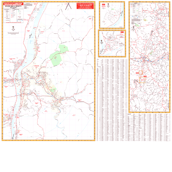
WHEELING WALL MAP
2000 1st edition The Wheeling, WV Wall Map by Universal Map measures 62 W x 52 H features up-to-date cartography with new streets and changes. The durably laminated map is both markable and washable. Coverage ranges North to include Tiltonsville, OH and Wheeling/Ohio County Airport; South to include McMechen, WV; East to include Triadelphia, WV; and West to include Brookside, Bellaire, and Martins Ferry. The map also has insets of Shadyside, Ohio and Moundsville, West Virginia. A special feature is an area map covering from Steubenville and Weirton and south to the Wetzell, WV county line. Other data
includes government buildings, airports, golf courses and country clubs, railroads, zip codes and zip code boundaries, shopping centers, water features, recreational parks, cemeteries, educational facilities, hospitals, post offices, city limits and annexations, mileage circles, fire and police stations, and miscellaneous points of interest, plus a complete index.
Framing rails are available on top and bottom for easy wall mounting. | |
|