|
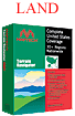
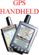
Handheld GPS
Software
Maptech handheld
technology-the marriage of GPS and PDAs-the best of both.
Until now, standard GPS
receivers have displayed primitive maps that lack
meaningful contour details. Maptech lets you combine
GPS with handheld PDAs powerful enough to display the
detail you deserve in full color.
Both
Pocket
Navigator and
Outdoor Navigator are perfect for work or
play; but they work in different ways:
 Pocket
Navigator
works with
Terrain Navigator and
Terrain Navigator Pro
CD-ROMs-think of it as a companion to your PC. Pocket
Navigator
works with
Terrain Navigator and
Terrain Navigator Pro
CD-ROMs-think of it as a companion to your PC.
|