Featured Products

See some of our other fine products

Click on image for more information

Search our Site

Build you own USGS topographic map

The Perfect Gift


Gift Certificates


Tell a friend

about GeoMart:

Acceptance Mark

Pre-Approved Purchase Orders

GeoMart

516 Villanova Court

Ft Collins, CO 80525

800-248-6277

800-321-6277 Fax

Maptech Software - Pocket Navigator

Maptech Terrain Navigator and Terrain Navigator Pro Digital USGS topographic Maps

Maptech Marine Navigator, Digital Chart Kits, Offshore Navigator and 3D Contour Digital NOAA Nautical Charts

Maptech VFR/IFR AeroPack Digital Aeronautical Charts, AeroSims, and Terminal Sims

Maptech Hand HeldGPS Solutions for Topographic, Nautical and Aeronautical Charts.


POCKET NAVIGATOR

"No One Does Digital Maps Better Than Maptech" Outdoor Life

Maptech Pocket Navigator displaying a nautical chart.

Maptech Pocket Navigator Marks and Routes in Pocket Navigator

Maptech Pocket Navigator Splash Resistant Product Case available  See more here

Pocket Navigator works hand in hand with the rest of the Maptech line and lets you download USGS topo maps onto a full color, touch screen Pocket PC.  It's a good companion to terrain Navigator that lets you transfer marks and routes between your desktop and handheld before and after going into the field.


Here's what you need:

  • Pocket Navigator Software

  • Terrain Navigator or Terrain Navigator PRO map CDs for USGS topo maps

  • Pocket PC Handheld

  • GPS Receiver

Here's what you get:

  • Full color USGS topo maps

  • Quick panning and zooming with your finger or stylus

  • Advanced Multipoint "Go To" GPS Navigation

  • GPS Data Windows display key navigation information

  • Share Marks and Routes between your PC and Pocket PC

 
Maptech Pocket Navigator displaying a nautical chart. Pocket Navigator

Maptech Retail $49.95

Discontinued


System Requirements
Features

Designed For Use With:

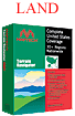
  • Maptech Digital Topo Maps.
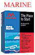
  • Maptech Digital Nautical Charts and NavPhotos.
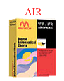
  • Maptech Digital Aeronautical Charts.
  • Each of the Above Sold Separately.

Real Time Tracking

  • Compatible with NMEA 0183 GPS.
  • "Goto" navigation window.

Overlays

  • Routes.
  • Tracks
  • Import Routes and Marks from Maptech Terrain Navigator, Chart Navigator, and Offshore Navigator PC desktop applications.
 
System Requirements
System Requirements

Pocket PC Requirements

  • Pocket PC Requirements
    Pocket PC running Pocket PC/Windows Mobile Operating System: Version 2003 Second Edition, or later

  • 4 Mb of free memory

  • ActiveSync 4.2 (or higher)

  • Additional storage for topo maps and nautical charts (approx. 2-5 Mb each)

  • Additional storage for aeronautical charts (approx. 20 Mb each)

Note: Pocket Navigator does NOT work with Palm OS (Palm, Handspring Sony) or older Windows CE (CE, CE2, CE3) devices.

GPS Requirements

  • NMEA 0183 GPS necessary for Pocket Navigator to display maps and charts.

  • Note: GPS is optional and not necessary for Pocket Navigator to display maps and charts.

Desktop/Laptop PC Requirements
  • Windows XP or Vista
  • ActiveSync 4.2 (or higher) - comes with Pocket PCs.
  • Pentium Processor
  • 32 MB RAM
  • 8 MB free disk space for installation.
  • Mouse or drawing equivalent.
  • CD-ROM Drive