Featured Products

See some of our other fine products

Click on image for more information

Search our Site

Build you own USGS topographic map

The Perfect Gift


Gift Certificates


Tell a friend

about GeoMart:

Acceptance Mark

Pre-Approved Purchase Orders

GeoMart

516 Villanova Court

Ft Collins, CO 80525

800-248-6277

800-321-6277 Fax

Maptech Software - Terrain Navigator Pro

Maptech Terrain Navigator and Terrain Navigator Pro Digital USGS topographic Maps

Maptech Marine Navigator, Digital Chart Kits, Offshore Navigator and 3D Contour Digital NOAA Nautical Charts

Maptech VFR/IFR AeroPack Digital Aeronautical Charts, AeroSims, and Terminal Sims

Maptech Hand HeldGPS Solutions for Topographic, Nautical and Aeronautical Charts.


TERRAIN NAVIGATOR PRO

"No One Does Digital Maps Better Than Maptech" Outdoor Life

Maptech Terrain Professional - 2-D and 3-D Topo Maps and Aerial Photos

Maptech Terrain Professional - 3-D Aerial Photo

Maptech Terrain Professional - 3-D Topo Map and Elevation Profile

Maptech Terrain Professional - GIS and CAD Ready

Brand new for 2003, Terrain Navigator Pro is Maptech's our full-featured software for the professional user.  It includes digital USGS topographic maps on CD, access to aerial photos via Maptech's internet site, and a full array of tools to help you do your job in the office and in the field.
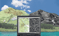
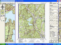
 

USGS Topographic Maps on CD

Maptech scans genuine USGS topos-all-58,000 plus-to produce the highest quality map images possible.  No other company has made the commitment to provide you with such clear maps.  Maps are available in state collections on CD.  Each CD contains two scales-1:24/25,000 (7.5 minute series) and 1:100,000.
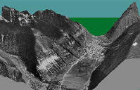
 

New-Aerial Photos via Maptech's Website

(1 meter resolution Digital Orthophoto Quarter Quads)

Use aerial photos the same way you use maps, including printing and adding notes.  Terrain Navigator Pro includes a 1 year subscription to download aerial photos from Maptech's website.  You can save downloaded photos to your hard drive, and they're your to keep.  If you need to download more photos in the future, the second year subscription is only $99.95 per state.
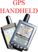
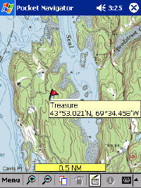
 

Tools for the Job - Advanced user-friendly software is included

  • Find Locations quickly by address and geographic landmarks

  • Add marks and labels

  • View and print in 2D and 3D

  • GPS Ready

  • GIS/CAD Ready

  • More features here

Compatible with popular GPS units (click for list) or


Connect with a USB GPS unit for Real Time tracking on your computer

USB GPS $135.95!  buy now

see more information

Download a fully-operational demo of Terrain Navigator Pro!

 
Maptech Terrain Professional - States Terrain Navigator Pro

Maptech Retail $399.95 per state

Our Price: $389 95

You Save $10.00


Click here to

View States and Purchase

 
System Requirements
Features

See full list of features for the Terrain Navigator Pro here.

 
System Requirements
System Requirements
  • Windows XP or Vista
  • DVD-ROM drive
  • 800x600 Display
  • 16/24/32-bit video card (HiColor/True Color)
  • OpenGL Video Accelerator recommended for optimum 3D performance
  • Internet connection (high-speed recommended) to access aerial photos and updated topographic maps