|
Delaware / New
Jersey (top) |
|
Click on Price to Add to Cart |
|
Bay & Coastal |
|
|
Delaware Bay, DE
Pro Series
Waterproof From C & D Canal to Atlantic Ocean,
Atlantic City to Ocean City. 1 Minute Lat/ Long
Grid System on Bay Side, 2 Minute Lat/Long Grid
System on Ocean Side. Loran C Over Lay, Courses,
Navigational Aids and More!! |
GM80400PS |
$9.95 |
| |
|
|
|
Delaware Bay, DE
Laminated
Same coverage as
above. Comes with its own
chart tube. |
GM80400L |
$18.95 |
|
|
Pennsylvania (top) |
|
Click on Price to Add to Cart |
|
Bay & Coastal |
|
|
Raystown Lake, PA
PRO SERIES
Waterproof, Grid for
GPS, Underwater structure, Water depth contours,
Facilites.
|
GM71100PS |
$8.95 |
|
Raystown Lake, PA
Underwater
structure, Water depth contours, Facilities.
|
GM71100 |
$4.95 |
|
|
Virginia (Tidal Rivers
|
Lakes & Reservoirs |
Bay & Coastal)
(top) |
|
Tidal Rivers |
|
Click on Price to Add to Cart |
|
Back Bay /North
Landing River Pro Series
Covers from
Sandbridge to Coinjock, LAT/LONG Grid for GPS,
Local Names of waterways and fishing grounds,
shows ramps, marinas, and much more!!
|
GM11400PS |
$9.95 |
|
Chickahominy River
From the Lake to the
James River and a lot of detail in between!!
Includes a 30 second grid for GPS, ramps, marinas,
aid to navigation, local names of waterways and
much more!
|
GM11600 |
$4.95 |
|
Chickahominy River
PRO SERIES
Waterproof, From the
Lake to the James River and a lot of detail in
between!! Includes a 30 second grid for GPS, ramps,
marinas, aid to navigation, local names of
waterways and much more!
|
GM11600PS |
$9.95 |
|
Chickahominy
River Laminated
Comes with its own
chart tube |
GM11600L |
$18.95 |
|
James River From
Richmond to Newport News
Includes; 1 min Grid
for GPS, ramps, marinas, navigational aids,
local area names, and more!
|
GM10307 |
$4.95 |
|
James River
Laminated
Same as map above,
laminated. Comes with its own
chart tube
|
GM10307L |
$20.95 |
|
Upper James River
Pro Series Waterproof
Covers from
Scottsville to Richmond. Approximately 81
miles or river. Includes: Lat/Long Grid for GPS, ramps, marinas,
navigational aids, local area names, and more!
|
GM17300PS |
$8.95 |
|
Tidal James River
Pro Series Waterproof
Covers from Richmond
to the Chickahominy River Enlarged scale
1:30,000 from Richmond to Jordan Point, 1:40,000
scale from Jordan Point to the Chickahominy
River also includes the Appomattox River up to
Petersburg. Grid for GPS, ramps, marinas,
navigational aids, local area names, and more!
|
GM16200PS |
$9.95 |
|
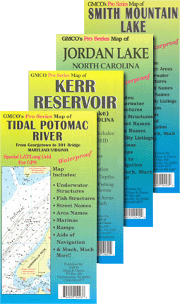
Tidal Potomac
River PRO SERIES
(From Georgetown to
The 301 Bridge)
Large Scale,
Waterproof, LAT/LONG Grid for GPS, Facilities
listing, Local Area Names, Aids to Navigation
and MUCH MORE!!
|
GM15096PS |
$9.95 |
|
Occoquan Reservoir PRO SERIES
WATERPROOF Includes; Marinas,
underwater structures, street names, area names
and much more!
|
GM11000PS |
$9.95 |
|
Potomac River
From Washington D.C. to the Chesapeake Bay with
enlargement of the Wilson Bridge Area.
Includes Special GPS
Grid, Local names, navigational aids, ramps and
More!!
|
GM10304 |
$5.95 |
|
Potomac River
Laminated Comes with
its own chart tube. |
GM10304L |
$20.95 |
|
Rappahannock
River
NEW Enlarged Scale
from Fredericksburg to Tappahannock
Includes Local
names, navigational aids, ramps, GPS Grid and
More!!
|
GM10305 |
$4.95 |
|
Rappahannock
River PRO SERIES
Waterproof, Enlarged
Scale from Fredericksburg to Tappahannock
Includes Local names, navigational aids, ramps,
GPS Grid and More!!
|
GM10305PS |
$7.95 |
|
Rappahannock
River Laminated Out
of Stock
Comes with its own
chart tube
|
GM10305L |
$14.95 |
|
York River From
West Point to the Chesapeake Bay.
Includes the
Mattaponi River, Pamunkey River have been
enlarged to a 1:40,000 Scale With Launching
sites Added. Lat./Long. Grid for GPS,
Navigational Aids, Local Names of waterways &
fishing areas
|
GM10306 |
$4.95 |
|
York River
Laminated
Same map coverage as above.
Laminated
|
GM10306L |
$20.95 |
| |
|
Click on Price
to Add to Cart |
|
VA Lakes &
Reservoirs
(top) |
|
|
Claytor Lake PRO SERIES
WATERPROOF Includes; 30 sec Lat/Long grid for
GPS, Marinas, underwater structures, street
names, area names and much more!
|
GM18400PS |
$8.95 |
|
Kerr Reservoir (Buggs
Island Lake) Chartbook
Complete Fishing &
Recreational guide to Kerr Reservoir 26 pages of
easy-to-use charts, facilities listing, local
names, LAT/LONG Grid for GPS and more!!
|
GM10600 |
$12.95 |
|
Kerr Reservoir
PRO Series
Sheet Map Waterproof
with GPS Grid Includes: Marinas, underwater
structures, street names, area names and much
more! Covers the lake on ONE sheet map!!!
|
GM10620PS |
$10.95 |
|
Lake Anna GPS
Grid
Includes Marinas,
ramps, underwater structures, street names, area
names, Striper fishing information and much
more!
|
GM10900 |
$4.95 |
|
Lake Anna
Laminated
Comes with its own
chart tube.
|
GM10900L |
$18.95 |
|
Lake Anna PRO
SERIES
Waterproof, With
Special Lat/Long Grid for GPS, Includes;
Marinas, underwater structures, street names,
area names, Striper fishing information and much
more!
|
GM10900PS |
$9.95 |
|
Lake Chesdin
Special GPS Grid
Includes Marinas,
underwater structures, local area names and
more!!
|
GM15196 |
$3.95 |
|
Lake Chesdin PRO
SERIES
Waterproof, Special
GPS Grid, underwater structure, local area names
and MUCH MORE!!
|
GM15196PS |
$6.95 |
|
Chickahominy River
From the Lake to the
James River and a lot of detail in between!!
Includes a 30 second grid for GPS, ramps, marinas,
aid to navigation, local names of waterways and
much more!
|
GM11600 |
$4.95 |
|
Chickahominy River
PRO SERIES
Waterproof, From the
Lake to the James River and a lot of detail in
between!! Includes a 30 second grid for GPS, ramps,
marinas, aid to navigation, local names of
waterways and much more!
|
GM11600PS |
$9.95 |
|
Chickahominy
River Laminated
Comes with its own
chart tube |
GM11600L |
$18.95 |
|
Lake Gaston
Includes 30 sec
Lat/Long Grid for GPS, Marinas, underwater
structures, street names, area names and much
more!
|
GM10500 |
$4.95 |
|
Lake Gaston
Laminated
Comes with its own
chart tube.
|
GM10500L |
$16.95 |
|
Lake Gaston PRO
SERIES
Waterproof, Special
GPS Grid, Includes; Marinas, underwater
structure, area names, street names and MORE!
|
GM10500PS |
$9.95 |
|
Occoquan
Reservoir Pro Series
Waterproof, Includes Marinas,
underwater structures, street names, area names
and much more!
|
GM11000PS |
$9.95
|
|
Smith Mountain
Lake PRO SERIES
Waterproof, LAT/LONG
Grid for GPS, Underwater Structures, Water Depth
Contours, Facilities Listing, street names and
More!
|
GM10400PS |
$9.95 |
|
Smith Mountain
Lake
Includes Special GPS
Grid, Underwater structure, Water depth
contours, Facilities listing, marinas, street
names and MORE!
|
GM10400 |
$5.95 |
|
Smith Mountain
Lake Laminated
Comes with its own
chart tube.
|
GM10400L |
$18.95 |
| |
|
Click on Price to Add to Cart |
|
VA Bay & Coastal
(top) |
|
|
Back Bay /North
Landing River Pro Series
Covers from
Sandbridge to Coinjock, LAT/LONG Grid for GPS,
Local Names of waterways and fishing grounds,
shows ramps, marinas, and much more!!
|
GM11400PS |
$9.95 |
|
Cape May to Cape
Hatteras Offshore Chart Pro Series
Rolled and comes with its own
chart tube Your guide to the canyons, from
Wilmington Canyon to Cape Hatteras, updated and
now with a 1-minute lat/long grid for GPS.
Covers up to 75-85 nautical miles Offshore
|
GM13800PS |
$14.95 |
|
Chesapeake Bay
Chartbook Laminated
Covers the entire
Chesapeake Bay and its tidal tributaries
Includes: 1 Minute Grid System for GPS, Facility
Listing, Local area names, and Much, Much
More!!
|
GM14000 |
$59.95 |
|
Chesapeake Bay
Map
Complete view of
the entire Chesapeake Bay Region. Full Color.
Covers from Havre de Grace MD to Virginia Beach
VA and from Richmond VA to Atlantic Ocean See the whole
Chesapeake Region including
the entire Eastern Shore Includes the
entire Eastern Shore.
|
GM13400 |
$9.95 |
|
Chesapeake Bay
Map Laminated
Same map as above Laminated
|
GM13400L |
$34.95 |
|
Chesapeake Bay
Map Rolled
Same map as GM13400 above.
Rolled never folded. Perfect for framing.
|
GM13400R |
$20.95 |
|
Chincoteaque-Assateaque Map
A complete map that
covers both land and water at this jewel of the
Eastern Shore!! Great for the fisherman or just
the person looking to enjoy the Chincoteague
Area
|
GM10301 |
$2.95 |
|
Southern
Chesapeake Bay From Smith Pt. to Virginia Beach
Includes 1Min.
Lat./Long. Grid for GPS, Navigational Aids,
Local Names of waterways & fishing areas, wrecks
& artificial reefs and MORE!!
|
GM13700 |
$12.95 |
|
Southern
Chesapeake Bay Rolled Waterproof
Comes with its own
chart tube.
|
GM13700L |
$16.95 |
|
Currituck Sound PRO SERIES
Waterproof Large Scale 1" = 2,000Feet From Rt.
I-85 Bridge to Brant Island New GPS grid
|
GM40205PS |
$9.95 |
|
Virginia Barrier
Islands PRO SERIES
WATERPROOF From
Chincoteague to Cape Charles Includes: Local
names of waterways and landmarks, LAT/LONG Grid
for GPS aids to navigation, ramps, marinas and
more!
|
GM10308PS |
$9.95 |
|
|
Maryland
(Tidal Rivers
|
Bay & Coastal)
(top) |
|
Click on Price to Add to Cart |
|
Tidal Rivers |
|
|
Tidal Potomac
River PRO SERIES
(From Georgetown to
The 301 Bridge)
Large Scale,
Waterproof, LAT/LONG Grid for GPS, Facilities
listing, Local Area Names, Aids to Navigation
and MUCH MORE!!
|
GM15096PS |
$9.95 |
|
Potomac River
From Washington D.C. to the Chesapeake Bay with
enlargement of the Wilson Bridge Area.
Includes Special GPS
Grid, Local names, navigational aids, ramps and
More!!
|
GM10304 |
$5.95 |
|
Potomac River
Laminated Comes with
its own chart tube. |
GM10304L |
$20.95 |
|
Upper Potomac River
PRO SERIES
From Dam 4 to Great
Falls
Large Scale,
Waterproof, Special LAT/LONG Grid for GPS,
Facilities listing, Local Area Names, Aids to
Navigation and MUCH MORE!! |
GM25099PS |
$8.95 |
| |
|
Click on Price to Add to Cart |
|
Maryland Bay &
Coastal(top) |
|
|
Cape May to Cape
Hatteras Offshore Chart Pro Series
Rolled and comes with its own
chart tube Your guide to the canyons, from
Wilmington Canyon to Cape Hatteras, updated and
now with a 1-minute lat/long grid for GPS.
Covers up to 75-85 nautical miles Offshore
|
GM13800PS |
$14.95 |
|
Chesapeake Bay
Chartbook Laminated
Covers the entire
Chesapeake Bay and its tidal tributaries
Includes: 1 Minute Grid System for GPS, Facility
Listing, Local area names, and Much, Much
More!!
|
GM14000 |
$59.95 |
|
Chesapeake Bay
Map
Complete view of
the entire Chesapeake Bay Region. Full Color.
Covers from Havre de Grace MD to Virginia Beach
VA and from Richmond VA to Atlantic Ocean See the whole
Chesapeake Region including
the entire Eastern Shore Includes the
entire Eastern Shore.
|
GM13400 |
$9.95 |
|
Chesapeake Bay
Map Laminated
Same map as above Laminated
|
GM13400L |
$34.95 |
|
Chesapeake Bay
Map Rolled
Same map as GM13400 above.
Rolled never folded. Perfect for framing.
|
GM13400R |
$20.95 |
|
Chesapeake Bay
Regional
A great glove
compartment map. Same map as 13400 only small
size 24”x36”
|
GM13401 |
$3.50 |
|
Central Chesapeake
Bay
From Calvert Cliff
to Smith Point, Piney Point to Crisfield.
Includes: Loran C,
1-Minute Lat/Long Grid System for GPS,
Navigational Aids, Local Names and More!!
|
GM23200 |
$9.95 |
|
Central
Chesapeake Bay Laminated
Same map as above. Laminated Comes with its own
chart tube.
|
GM23200L |
$16.95 |
|
Northern Chesapeake
Bay
From Havre de Grace,
Chesapeake City to Little Choptank River.
Includes: 1-Minute
Lat/Long Grid System for GPS, Navigational Aids,
Local Names and More!!
|
GM23100 |
$9.95 |
|
Northern
Chesapeake Bay Laminated
Comes with its own
chart tube.
|
GM23100L |
$16.95 |
|
Ocean City
Complete Recreation
map for land or water with a special offshore
chart. Includes Marinas, ramps, water
depths, aids to navigation and much more!
|
GM20301 |
$4.95 |
|
Ocean City Laminated
Same map as above. Laminated Comes with its own
chart tube.
|
GM20301L |
$10.95 |
| |
|
|
|
North Carolina
(Lakes &
Reservoirs |
NC/SC Bay &
Coastal)
(top) |
|
Lakes &
Reservoirs |
|
Click on Price to Add to Cart |
|
Kerr Reservoir (Buggs
Island Lake) Chartbook
Complete Fishing &
Recreational guide to Kerr Reservoir 26 pages of
easy-to-use charts, facilities listing, local
names, LAT/LONG Grid for GPS and more!!
|
GM10600 |
$12.95 |
|
Kerr Reservoir
PRO Series
Sheet Map Waterproof
with GPS Grid Includes: Marinas, underwater
structures, street names, area names and much
more! Covers the lake on ONE sheet map!!!
|
GM10620PS |
$10.95 |
|
Falls Lake NC
Underwater
structure, Water depth contours, Facilities.
listing, Grid for GPS.
|
GM40600 |
$4.50 |
|
Falls Lake NC Pro
Series
Waterproof, With
Lat/Long Grid for GPS, Underwater structure,
Water depth contours, Facilities Listing and
more!
|
GM40600PS |
$7.95 |
|
Lake Gaston
Includes 30 sec
Lat/Long Grid for GPS, Marinas, underwater
structures, street names, area names and much
more!
|
GM10500 |
$4.95 |
|
Lake Gaston
Laminated
Same map as above. Laminated Comes with its own
chart tube.
|
GM10500L |
$16.95 |
|
Lake Gaston PRO
SERIES
Waterproof, Special
GPS Grid, Includes; Marinas, underwater
structure, area names, street names and MORE!
|
GM10500PS |
$9.95 |
|
Jordan Lake
Underwater
structure, Water depth contours, Facilities.
listing, Grid for GPS.
|
GM40400 |
$4.95 |
|
Jordan Lake
Laminated
Same map as GM40400 above. Laminated Comes with its own
chart tube.
|
GM40400L |
$18.95 |
|
Jordan Lake PRO
SERIES
Waterproof With
Lat/Long Grid for GPS, Underwater structure,
Water depth contours, Facilities Listing and
more!
|
GM40400PS |
$9.95 |
|
|
|
|
|
|
|
|
| |
|
Click on Price to Add to Cart |
|
NC/SC Bay &
Coastal
(top) |
|
|
Cape May to Cape
Hatteras Offshore Chart Pro Series
Rolled and comes with its own
chart tube Your guide to the canyons, from
Wilmington Canyon to Cape Hatteras, updated and
now with a 1-minute lat/long grid for GPS.
Covers up to 75-85 nautical miles Offshore
|
GM13800PS |
$14.95 |
|
Albemarle Sound
Laminated
Includes: Covers
from the Chowan River to the Rte 158 Bridge.
Includes: Navigational Aids, water depths
wrecks, marina, Lat./Long. Grid for GPS, local
names, artificial reefs, fishing areas with
species and seasons and much more! Laminated
Comes with its own chart tube.
Out
of Stock
|
GM40206L |
$14.95 |
|
Albemarle Sound Pro
Series
Waterproof! Includes: Covers
from the Chowan River to the Rte 158 Bridge.
Includes: Navigational Aids, water depths
wrecks, marina, Lat./Long. Grid for GPS, local
names, artificial reefs, fishing areas with
species and seasons and much more!
|
GM40206PS |
$9.95 |
|
Cape Lookout Covers
from Core Banks to New Topsail Inlet
Includes;
Navigational Aids, wrecks & artificial reefs,
fishing piers, 1 minute Lat/Long Grid for GPS.
|
GM40202 |
$4.95 |
|
Cape Lookout
Laminated
Same map as above. Laminated Comes with its own
chart tube.
|
GM40202L |
$16.95 |
|
Cape Lookout Pro
Series
Waterproof! Covers
from Core Banks to New Topsail Inlet.
Enlargement of Morehead. Includes; Navigational
Aids, water depths wrecks, marina, Lat./Long.
Grid for GPS, local names, artificial reefs,
fishing areas with species and seasons and much
more!
|
GM40202PS |
$8.95 |
|
Currituck Sound PRO SERIES
Waterproof! Large Scale 1" = 2,000Feet From Rt.
I-85 Bridge to Brant Island New GPS grid
Currently Out
of Stock
|
GM40205PS |
$9.95 |
|
North Carolina
Chartbook WATERPROOF
Most complete guide
of all tidal waters in North Carolina. Includes:
Navigational Aids, Marinas, Wrecks & Artificial
Reefs, Facilities Listing and Much, Much,
MORE!!
|
GM40200 |
$44.95 |