|
Fishing Maps
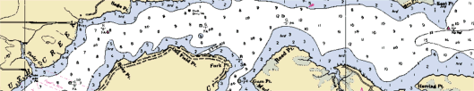
Captain Segull's Nautical Charts
Sometimes referred to as grease charts, these
fishing charts are waterproof and in full color. Charts
highlight: Latitude and Longitude (GPS), Loran Lines, contour
lines, fishing holes with local names, coordinates of buoys,
inlets, wrecks, reefs and shore services such as fuel docks,
ramps, pump-out stations and restaurants. See more
here.
GMCO
Whether you are a beginning boater, an
experienced cruiser, recreational fisherman, or a top tournament
angler, GMCO maps are designed to provide the important
information you need while on the water. See more
here.
Sportsman's Connection Lake Maps
Sportsman's Connection is the Midwest's
leading publisher of regional fishing map guide books and lake
map software. Sportsman's Connection offers high quality contour
lake maps with detailed fishing information for over 4,000 lakes
in Illinois, Indiana, Iowa, Michigan, Minnesota, Missouri, Ohio
and Wisconsin with more states on the way!
The unique book and CD-ROM formats give you more lake maps for
your money, allowing coverage of many smaller lakes that
aren't readily available as individual maps - helping you
discover great new fishing spots and get away from the crowds.
See more
here.
Kingfisher
Lake, Intracoastal Waterway and River Maps
Kingfisher Maps, Inc.
has been producing quality maps since 1970. Their
popular contour lake maps, intracoastal waterway, and
river maps are noted for quality and reliability.
States covered: Alabama - Arizona -
Florida - Georgia - Kentucky - North Carolina - Oklahoma - South
Carolina - Tennessee - Texas - Virginia. See more
here.
|