Atterbury F & W
Area
Barr
Bass (St. Joseph)
Bass (Starke)
Beaver Creek
Bischoff
Bowen
Brookville
Bruce
Brush Creek
Cagles Mill
Cecil M. Harden
Cedar
Celina
Clark State Forest
Clear
Cook
Crosley
Deam
Dixon
Dogwood
Eagle
Eagle Creek
Feller |
Ferdinand
Fish, Lower
Fish, Upper
Flat
Fletcher
Flint
Franke
Freeman
Geist
Gilbert
Glenn Flint
Greene-Sullivan SF
Greenwood
Griffy
Hahn
Harden Reservoir
Hardy
Hartz
Hillenbrand F & W Area
Hog
Holem
Hovey
Hudson
Huntingburg |
Huntington
Indian
J.C. Murphey
John Hay
Kickapoo
King
Kokomo
Koontz
Kreighbaum
Kunkel (Kunkle)
Lake 16
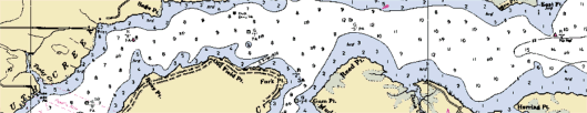
Lake Michigan
Lake of the Woods
Langenbaum
Lawrence
Lemon
Lenape
Lincoln
Long (Porter)
Long (Wabash)
Loomis
Lukens
Manitou
Mansfield
Maxinkuckee |
McColley
Middle Fork
Mill Pond
Minnehaha F & W Area
Mississinewa
Monroe
Morse
Mud, South
Myers
North Chain
Nyona
Ogle
Ohio River
Oser
Patoka
Pine, North & South
Prairie Creek
Pretty
Riddles
Rockville
Round
Saddle
Salamonie
Saugany |
Scales
Schlamm
Shafer
Shakamak
South Chain
Spring Valley
Starve Hollow
Stone
Strahl
Sullivan
Summit
Szmanda
Tipsaw
Town
Tucker
Turtle Creek
Twin
Versailles
Waveland
West Boggs Creek
Westwood Run
Whitewater
Willow Slough
Worster
Yellowwood |