|
|
Featured Products |
|

Click on image for more information |
|
Search our Site |
|
|
|
 |
|
|
|
|
|
|
|
GeoMart
516 Villanova Court
Ft Collins, CO 80525
800-248-6277
800-321-6277 Fax |
| |
|
Sportsman's Connection - East Tennessee
Sportsman's Connection Home |
Products |
Features |
Coming Soon
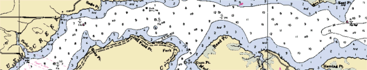
East Tennessee
East Tennessee is the home of some truly
unique fishing waters, including several TVA reservoirs
nestled in the mountains and some of the state's best
trout streams.
Features editorial by Jeff Samsel, Larry
Self and Vernon Summerlin.
Scroll down for a list of featured
lakes.
|
|
- Color contour lake maps
- Detailed lake information
- DNR stocking and survey data
- Local fishing information
- Area road maps
- Scroll down for lake list
| East Tennessee |
$22.75 |
 |
| Usually ships within 48
hours |
|
|
|
Lake maps and fishing
information are included for the following lakes:
| Lake Name |
Acres |
County |
| Boone Reservoir aka
Boone Lake |
4,520 |
Sullivan, Washington |
| Calderwood Reservoir |
536 |
Blount, Monroe |
| Campbell Cove Lake |
77 |
Polk |
| Cherokee, Lake |
30,300 |
Grainger, Hamblen,
Hawkins, Jefferson |
| Chilhowee Lake |
1,747 |
Blount |
| Cove Lake |
210 |
Campbell |
| Davy Crockett aka
Nolichucky Reservoir |
|
Greene |
| Douglas Lake aka
Douglas Reservoir |
30,600 |
Cocke, Hamblin,
Jefferson, Lock, Sevier |
| Fort Loudoun Lake |
14,600 |
Blount, Knox, Loudon |
| Fort Patrick Henry
Lake |
893 |
Sullivan |
| Holston Lake, South |
6,336 |
Sullivan |
| Indian Boundary Lake |
96 |
Monroe |
| Indian Mountain State
Park Lakes |
21 |
Campbell |
| Melton Hill Lake |
5,720 |
Anderson, Kent, Knox,
Loudon, Roane |
| Norris Lake |
34,200 |
Anderson, Campbell,
Claiborne. Grainger, Union |
| Parksville aka Lake
Ocoee |
1,930 |
Bradley, Polk |
| Tellico Reservoir aka
Tellico Lake |
16,056 |
Blount, Loudon,
Monroe |
| Watauga Lake |
6,430 |
Carter, Johnson |
| Wilbur Lake |
72 |
Carter |
Stream maps, fishing
information, and TN Rivers Assessment Project survey
data is included for many streams in the following
watersheds:
| Watershed |
| Clear Fork of the
Cumberland Watershed |
| Clinch River (Upper)
Watershed |
| Clinch River
Watershed |
| Conasauga River
Watershed |
| Fort Loudoun Lake
Watershed |
| French Broad River
(Lower) Watershed |
| French Broad River
Watershed |
| Hiwassee River
Watershed |
| Holston River (North
Fork) Watershed |
| Holston River (South
Fork) Watershed |
| Holston River
Watershed |
| Little Tennessee
River Watershed |
| Nolichucky River
Watershed |
| Ocoee River Watershed |
| Pigeon River
Watershed |
| Powell River
Watershed |
| Watauga River
Watershed |
|
|
|
|
|
|